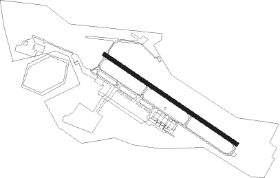
Mönchengladbach - Moenchengladbach
Airport details
| Country | Germany |
| State | North Rhine-Westphalia |
| Region | ED |
| Airspace | Langen Ctr |
| Municipality | Mönchengladbach |
| Elevation | 125ft (38m) |
| Timezone | GMT +1 |
| Coordinates | 51.23035, 6.50449 |
| Magnetic var | |
| Type | land |
| Available since | X-Plane v10.40 |
| ICAO code | EDLN |
| IATA code | MGL |
| FAA code | n/a |
Communication
| Moenchengladbach ATIS | 109.800 |
| Moenchengladbach Moenchengladbach ground | 121.925 |
| Moenchengladbach Tower | 120.450 |
| Moenchengladbach Moenchengladbach tower | 118.125 |
| Moenchengladbach Langen radar | 128.500 |
Approach frequencies
| ILS-cat-I | RW13 | 108.95 | 18.00mi |
| ILS-cat-I | RW31 | 110.55 | 18.00mi |
| 3.5° GS | RW13 | 108.95 | 18.00mi |
| 3° GS | RW31 | 110.55 | 18.00mi |
Nearby Points of Interest:
Ueddinger Straße 230–234
-Dammer Straße 51
-Ueddinger Straße 196
-Dünner Straße 273
-Priorhaus Neuwerk
-Rathaus Neuwerk
-Donker Straße 180
-Raderbroich 2
-Honschaftskapelle Dünn
-Loosenweg 193
-Raderbroich 59d
-Engelblecker Straße 137
-Wegestock Heerstraße 2
-Neusser Straße 346
-Wegestock Heerstraße 1
-Wegestock Neusser Straße
-Wegekreuz Hansastraße
-Am Waldfriedhof 20
-Hansastraße 1
-Hansastraße 3
-Bockersend 152
-Wegestock Herrenshoffer Straße
-Hansastraße 5
-Beethovenstraße 21
-Bockersend 96
Nearby beacons
| code | identifier | dist | bearing | frequency |
|---|---|---|---|---|
| MHD | DME | 0.5 | 290° | 112.50 |
| MHV | MOENCHENGLADBACH VOR | 0.6 | 296° | 109.80 |
| DY | DUESSELDORF NDB | 5.6 | 88° | 284 |
| LMA | LIMA NDB | 9.3 | 322° | 311 |
| DUS | DUESSELDORF VOR/DME | 9.8 | 78° | 115.15 |
| LI | DUESSELDORF NDB | 16.1 | 73° | 417 |
| GIX | GEILENKIRCHEN TACAN | 23.6 | 240° | 108.10 |
| WNN | DME | 24.5 | 157° | 109.85 |
| NVO | NOERVENICH VORTAC | 24.9 | 162° | 116.20 |
| LAA | NIEDERRHEIN NDB | 25.5 | 318° | 352 |
| MAS | MAASTRICHT VOR/DME | 25.7 | 245° | 108.60 |
| BAM | BARMEN VOR/DME | 25.9 | 82° | 114 |
| NID | DME | 26 | 316° | 115.50 |
| NW | MAASTRICHT NDB | 26.7 | 251° | 373 |
| LJ | COLOGNE-BONN NDB | 27.8 | 119° | 365 |
| BOT | BOTTROP NDB | 28.8 | 56° | 406 |
| WYP | WIPPER VOR | 31.1 | 103° | 109.60 |
| KBO | COLOGNE-BONN VOR/DME | 32.8 | 120° | 112.15 |
| LW | COLOGNE-BONN NDB | 34.5 | 114° | 300 |
| LV | COLOGNE-BONN NDB | 37.7 | 120° | 327 |
| VKL | VOLKEL TACAN | 39.2 | 298° | 108.30 |
| ONL | LIEGE NDB | 48.1 | 241° | 290 |
| LNO | OLNO VOR/DME | 49 | 231° | 112.80 |
| SLV | SPA NDB | 50.4 | 218° | 386 |
| SPI | SPRIMONT VOR/DME | 54.4 | 231° | 113.10 |
| DLN | DEELEN TACAN | 54.9 | 323° | 112.20 |
| RKN | DME | 55 | 16° | 116.80 |
Departure and arrival routes
| Transition altitude | 5000ft |
| SID end points | distance | outbound heading | |
|---|---|---|---|
| RW13 | |||
| SONE5A | 49mi | 18° | |
| NUDG4A | 74mi | 85° | |
| KUMI3A | 64mi | 104° | |
| NVO2Z | 25mi | 162° | |
| MODR9M | 20mi | 243° | |
| ROMI2M | 20mi | 269° | |
| ABOD4A | 17mi | 352° | |
| RW31 | |||
| SONE3N | 49mi | 18° | |
| NUDG5N | 74mi | 85° | |
| KUMI4N | 64mi | 104° | |
| NVO1N | 25mi | 162° | |
| MODR8N | 20mi | 243° | |
| ROMI9N | 20mi | 269° | |
| ABOD2N | 17mi | 352° | |
| STAR starting points | distance | inbound heading | |
|---|---|---|---|
| ALL | |||
| GESB3J | 12.2 | 47° | |
| VEBA2J | 14.8 | 146° | |
| NVO1J | 24.9 | 342° | |
Instrument approach procedures
| runway | airway (heading) | route (dist, bearing) |
|---|---|---|
| RW13 | MHV (116°) | MHV 2000ft LN401 (10mi, 323°) 2000ft LN400 (4mi, 232°) 2000ft |
| RNAV | LN400 2000ft SUVIG (4mi, 117°) 2000ft EDLN (5mi, 117°) 164ft LN409 (4mi, 117°) (3093mi, 187°) 1500ft MHV (3095mi, 7°) 2000ft | |
| RW31 | MHV (116°) | MHV 2000ft LN601 (11mi, 135°) 2000ft LN600 (4mi, 52°) 2000ft |
| RNAV | LN600 2000ft GREKA (4mi, 297°) 2000ft EDLN (6mi, 297°) 164ft LN609 (5mi, 297°) (3097mi, 187°) 1500ft MHV (3095mi, 7°) 2000ft |
Holding patterns
| STAR name | hold at | type | turn | heading* | altitude | leg | speed limit |
|---|---|---|---|---|---|---|---|
| GESB3J | GESBI | VHF | right | 319 (139)° | > 3000ft | 1.0min timed | ICAO rules |
| GESB3J | MHV | NDB | left | 179 (359)° | > 2000ft | 1.0min timed | ICAO rules |
| LMA3J | LMA | FIX | right | 59 (239)° | 4000ft - 14000ft | 1.0min timed | ICAO rules |
| LMA3J | MHV | NDB | left | 179 (359)° | > 2000ft | 1.0min timed | ICAO rules |
| NVO1J | GESBI | VHF | right | 319 (139)° | > 3000ft | 1.0min timed | ICAO rules |
| NVO1J | MHV | NDB | left | 179 (359)° | > 2000ft | 1.0min timed | ICAO rules |
| VEBA2J | LMA | FIX | right | 59 (239)° | 4000ft - 14000ft | 1.0min timed | ICAO rules |
| VEBA2J | MHV | NDB | left | 179 (359)° | > 2000ft | 1.0min timed | ICAO rules |
| *) magnetic outbound (inbound) holding course | |||||||
Disclaimer
The information on this website is not for real aviation. Use this data with the X-Plane flight simulator only! Data taken with kind consent from X-Plane 12 source code and data files. Content is subject to change without notice.