Augsburg
Airport details
| Country | Germany |
| State | Bavaria |
| Region | ED |
| Airspace | Munich Ctr |
| Municipality | Affing |
| Elevation | 1515ft (462m) |
| Timezone | GMT +1 |
| Coordinates | 48.42516, 10.93176 |
| Magnetic var | |
| Type | land |
| Available since | X-Plane v10.32 |
| ICAO code | EDMA |
| IATA code | AGB |
| FAA code | n/a |
Communication
| Augsburg Augsburg ATIS | 119.665 |
| Augsburg Augsburg Tower | 124.980 |
| Augsburg Departure Langen | 128.255 |
Approach frequencies
| ILS-cat-I | RW25 | 108.5 | 18.00mi |
| 3.5° GS | RW25 | 108.5 | 18.00mi |
Nearby Points of Interest:
St. Maria
-Burgstall Mühlhausen
-Schaufelrad Friedberg (Bayern)
-Schlossgut Iglhof
-Alter Ostfriedhof (Augsburg)
-Bildstock
-Nordfriedhof (Augsburg)
-Hohes Meer (Augsburg)
-Justizvollzugsanstalt Augsburg
-Category:Kloster St. Georg (Augsburg)
-Brunnen am Bourges-Platz
-Pavillon
-Ehemaliger Domherrenhof
-Frauentorstraße 2
-Burgstall Haunswies
-Peutingerhaus
-Fürstbischöfliche Residenz (Augsburg)
-Burggrafenturm
-Stadtmetzg Augsburg
-Leonhardskapelle
-Neuer Bau
-Holi
-Oberpostdirektion
-Alte Silberschmiede
-Stadttheater Augsburg
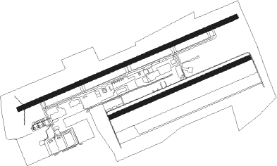
Runway info
Runway 07 / 25  | ||
| length | 1590m (5217ft) | |
| bearing | 77° / 257° | |
| width | 30m (98ft) | |
| surface | asphalt | |
| displ threshold | 142m (466ft) / 172m (564ft) | |
| Runway 07R / 25L | ||
| length | 1011m (3317ft) | |
| bearing | 77° / 257° | |
| width | 30m (98ft) | |
| surface | grass | |
Nearby beacons
| code | identifier | dist | bearing | frequency |
|---|---|---|---|---|
| AGB | AUGSBURG NDB | 0 | 123° | 318 |
| AUG | DME | 0.2 | 90° | 115.90 |
| WLD | WALDA VOR/DME | 12.1 | 52° | 112.80 |
| LCH | LECHFELD TACAN | 14.3 | 197° | 108.80 |
| MAH | MAISACH VOR/DME | 18 | 113° | 115.20 |
| NEU | NEUBURG TACAN | 20.5 | 44° | 108.90 |
| OBI | OBERPFAFFENHOFEN NDB | 25 | 134° | 429 |
| MIQ | MIKE NDB | 27.8 | 78° | 426 |
| MSE | MUNICH NDB | 29.2 | 97° | 358 |
| MNE | MUNICH NDB | 29.9 | 95° | 369 |
| IGL | INGOLSTADT TACAN | 30.8 | 65° | 111.40 |
| IGL | INGOLSTADT NDB | 33.9 | 66° | 345 |
| DMS | DME | 34.1 | 96° | 115 |
| DMN | DME | 34.5 | 94° | 116 |
| ALG | ALLGAEU (MEMMINGEN) NDB | 37.1 | 237° | 341 |
| OTT | OTTERSBERG VOR/DME | 38.2 | 105° | 112.30 |
| ALD | (MEMMINGEN/ALLGAU) DME | 38.3 | 238° | 117.20 |
| MSW | MUNICH NDB | 39 | 94° | 400 |
| MNW | MUNICH NDB | 39.2 | 93° | 338 |
| KPT | KEMPTEN VOR/DME | 47 | 221° | 108.40 |
| DKB | DINKELSBUEHL VORTAC | 51 | 316° | 117.80 |
| ANS | ANSBACH NDB | 54.3 | 341° | 452 |
| HFX | HOHENFELS NDB | 60.1 | 49° | 286 |
| NDD | DME-ILS | 69.6 | 315° | 108.70 |
| NSN | NIEDERSTETTEN NDB | 69.6 | 315° | 311 |
Departure and arrival routes
| Transition altitude | 5000ft |
| SID end points | distance | outbound heading | |
|---|---|---|---|
| RW07 | |||
| MIQ5F | 28mi | 78° | |
| MAH6F | 18mi | 113° | |
| KPT9F | 47mi | 221° | |
| RIDA7F | 11mi | 322° | |
| RW25 | |||
| MIQ6G | 28mi | 78° | |
| MAH7G | 18mi | 113° | |
| KPT9G | 47mi | 221° | |
| RIDA6G | 11mi | 322° | |
| STAR starting points | distance | inbound heading | |
|---|---|---|---|
| ALL | |||
| ANDE2A | 36.1 | 323° | |
| DISU4A | 34.4 | 343° | |
| MERS4A | 26.9 | 346° | |
Instrument approach procedures
| runway | airway (heading) | route (dist, bearing) |
|---|---|---|
| RW07 | MAH (293°) | MAH 4000ft MA001 (14mi, 324°) 4000ft MA010 (8mi, 293°) 4000ft MA011 (14mi, 257°) 4000ft MA012 (6mi, 153°) 4000ft |
| RW07 | WLD (232°) | WLD 4000ft MA010 (6mi, 257°) 4000ft MA011 (14mi, 257°) 4000ft MA012 (6mi, 153°) 4000ft |
| RNAV | MA012 4000ft ABUSI (3mi, 77°) 3500ft EDMA (6mi, 77°) 1560ft MA013 (7mi, 77°) 3500ft WLD (7mi, 15°) 4000ft | |
| RW25 | MAH (293°) | MAH 4000ft MA001 (14mi, 324°) 3500ft |
| RW25 | WLD (232°) | WLD 4000ft MA001 (6mi, 166°) 3500ft |
| RNAV | MA001 3500ft BUREG (4mi, 258°) 3500ft EDMA (6mi, 257°) 1565ft MA002 (2mi, 257°) MA004 (6mi, 334°) MA005 (7mi, 77°) 3500ft WLD (6mi, 77°) 4000ft |
Holding patterns
| STAR name | hold at | type | turn | heading* | altitude | leg | speed limit |
|---|---|---|---|---|---|---|---|
| ANDE2A | MAH | NDB | right | 311 (131)° | > 5000ft | 1.0min timed | ICAO rules |
| DISU4A | MAH | NDB | right | 311 (131)° | > 5000ft | 1.0min timed | ICAO rules |
| MERS4A | MAH | NDB | right | 311 (131)° | > 5000ft | 1.0min timed | ICAO rules |
| *) magnetic outbound (inbound) holding course | |||||||
Disclaimer
The information on this website is not for real aviation. Use this data with the X-Plane flight simulator only! Data taken with kind consent from X-Plane 12 source code and data files. Content is subject to change without notice.