Deggendorf
Airport details
| Country | Germany |
| State | Bavaria |
| Region | ED |
| Airspace | Munich Ctr |
| Municipality | Stephansposching |
| Elevation | 1029ft (314m) |
| Timezone | GMT +1 |
| Coordinates | 48.83028, 12.87972 |
| Magnetic var | |
| Type | land |
| Available since | X-Plane v10.40 |
| ICAO code | EDMW |
| IATA code | n/a |
| FAA code | n/a |
Communication
| Deggendorf Deggendorf Info | 122.025 |
Nearby Points of Interest:
Bezirksklinikum Mainkofen
-Schöpfwerk Sulzbach
-St. Jakob (Plattling)
-Schöpfwerk Mariaposching
-Sankt Koloman (Lenzing)
-Ehemaliges Pflegerhaus
-Burg Degenberg
-Saint John the Baptist Church
-Schloss Ottmaring
-Wallfahrtskirche zum Kreuzberg
-Katholische Pfarrkirche Sankt Laurentius
-Pilgrimage Church of the Ascension
-Burg Bogen
-Ehemaliges Schloss, jetzt Pfarrhaus
-Au vorm Wald
-Rettenbach 12
-Schloss Hienhart
-Schloss Steinburg
-Osterbrünnl-Kapelle
-Osterhofen Abbey
-Schöpfwerk Alte Kinsach
-Hien-Sölde
-Sankt Josef (Mitterfels)
-St. Veit (Straubing)
-Synagogue (Straubing)
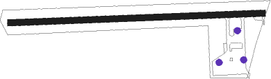
Runway info
| Runway 09 / 27 | ||
| length | 608m (1995ft) | |
| bearing | 92° / 272° | |
| width | 15m (49ft) | |
| surface | asphalt | |
| displ threshold | 0m (0ft) / 30m (98ft) | |
Nearby beacons
| code | identifier | dist | bearing | frequency |
|---|---|---|---|---|
| RDG | RODING VOR/DME | 18.7 | 301° | 114.70 |
| MNW | MUNICH NDB | 47.1 | 245° | 338 |
| MSW | MUNICH NDB | 48.2 | 244° | 400 |
| SBG | SALZBURG VOR/DME | 49.7 | 179° | 113.80 |
| SBG | SALZBURG NDB | 51.8 | 179° | 382 |
| GRF | GRAFENWOHR TACAN | 63.5 | 312° | 111.80 |
| GRW | GRAFENWOHR NDB | 63.6 | 313° | 405 |
Disclaimer
The information on this website is not for real aviation. Use this data with the X-Plane flight simulator only! Data taken with kind consent from X-Plane 12 source code and data files. Content is subject to change without notice.