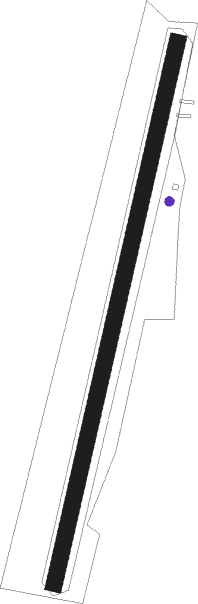
Berching
Airport details
| Country | Germany |
| State | Bavaria |
| Region | ED |
| Airspace | Munich Ctr |
| Municipality | Berching |
| Elevation | 1266ft (386m) |
| Timezone | GMT +1 |
| Coordinates | 49.13050, 11.44417 |
| Magnetic var | |
| Type | land |
| Available since | X-Plane v10.40 |
| ICAO code | EDNI |
| IATA code | n/a |
| FAA code | n/a |
Communication
Nearby Points of Interest:
Kloster Berching
-Burgstall Hohenbrunnen
-Schleusenwärterhaus Schleuse 25
-Burgstall Häferloch
-Gasthaus Zur Linde
-Burgstall Burggriesbach
-Schloss Wappersdorf
-Burg Wappersdorf
-Greißelbach railway station
-Pfarrhof
-Burgruine Hofberg
-Former Franciscan Monastery
-Rathaus Engen
-town hall
-Kaiserbeck House
-„Der Millipp“ inn
-Rathaus
-Kapelle St. Georg
-Am Kirchberg 4
-Pfarrhof, Pfarrhaus
-Burgstall Mallerstetten
-Ehemaliges Pfarrhaus
-Premerzhofener Quelle
-Rathaus Dietfurt an der Altmühl
Nearby beacons
| code | identifier | dist | bearing | frequency |
|---|---|---|---|---|
| HFX | HOHENFELS NDB | 17.1 | 78° | 286 |
| RTB | ROETHENBACH NDB | 22.4 | 331° | 415 |
| IGL | INGOLSTADT NDB | 24.8 | 153° | 345 |
| IGL | INGOLSTADT TACAN | 25.2 | 163° | 111.40 |
| NGD | DME | 26.4 | 316° | 113.10 |
| NEU | NEUBURG TACAN | 26.7 | 209° | 108.90 |
| NUB | NUERNBERG VOR/DME | 27.5 | 312° | 115.75 |
| ERL | ERLANGEN VOR/DME | 33.5 | 331° | 114.90 |
| ANS | ANSBACH NDB | 33.6 | 282° | 452 |
| MIQ | MIKE NDB | 34.1 | 165° | 426 |
| WLD | WALDA VOR/DME | 35.3 | 210° | 112.80 |
| GRF | GRAFENWOHR TACAN | 38.8 | 41° | 111.80 |
| GRW | GRAFENWOHR NDB | 39 | 41° | 405 |
| AUG | DME | 46.8 | 216° | 115.90 |
| AGB | AUGSBURG NDB | 46.9 | 216° | 318 |
| MNE | MUNICH NDB | 47.4 | 163° | 369 |
| DMN | DME | 47.9 | 155° | 116 |
| MSE | MUNICH NDB | 48.5 | 165° | 358 |
| MNW | MUNICH NDB | 49 | 148° | 338 |
| DMS | DME | 49.2 | 157° | 115 |
| MSW | MUNICH NDB | 50.1 | 149° | 400 |
| BAY | BAYREUTH VOR | 51.8 | 13° | 110.60 |
| MAH | MAISACH VOR/DME | 52.3 | 189° | 115.20 |
| OTT | OTTERSBERG VOR/DME | 58.9 | 159° | 112.30 |
| LCH | LECHFELD TACAN | 61 | 212° | 108.80 |
| OKG | CHEB VOR/DME | 67.4 | 46° | 115.70 |
Disclaimer
The information on this website is not for real aviation. Use this data with the X-Plane flight simulator only! Data taken with kind consent from X-Plane 12 source code and data files. Content is subject to change without notice.