Airports for X-Plane offers a convenient way to explore airports and their related communication information for the X-Plane flight simulator. It only uses data from the X-Plane flight simulator itself, and is therefore more reliable than the data that comes from real aviation websites. You can search for airports by using the ICAO code, or browse for airports per country and state. The information displayed is categorized by airport details, runway information, airport communication, approach frequencies (ILS and Glidepath details), details of nearby beacons, SIDs, STARs and approach procedures.

rail transport hangar concrete arriving government airspace non-towered airport consulate airfield traffic pattern flight capital flown stopover takeoff seaplane kennedy buildings embassy seaplanes frankfurt airport

Kirchdorf Am Inn - Kirchdorf/inn

Airport details

CountryGermany
StateBavaria
RegionED
AirspaceMunich Ctr
MunicipalityKirchdorf am Inn
Elevation1138ft (347m)
TimezoneGMT +1
Coordinates48.23850, 12.97683
Magnetic var
Typeland
Available sinceX-Plane v10.40
ICAO codeEDNK
IATA coden/a
FAA coden/a

Communication

Kirchdorf/Inn EDNK Info118.625
Nearby Points of Interest:
Local history museum Braunau with bell foundry
-
Adolf-Hitler-Geburtshaus
-
Badeanlage, Vorderbad, Braunau am Inn
-
Stadtplatz 1 (Braunau am Inn)
-
Gugg Culture House
-
Evangelische Pfarrkirche Braunau am Inn
-
Filialkirche hl. Valentin
-
Mariä Himmelfahrt
-
Saint George Church
-
Schlosskapelle Hagenau
-
Pfarrkirche St. Georgen an der Mattig
-
Rathaus Marktl
-
Schloss Bogenhofen
-
St. Oswald
-
Filialkirche Bogenhofen
-
Sankt Peter und Paul (Tann, Lower Bavaria)
-
Pfarrkirche Handenberg
-
Katholische Pfarrkirche hl. Ägidius, Gilgenberg am Weilhart
-
Pfarrkirche St. Georgen am Fillmannsbach
-
Studienkirche St. Josef
-
Tauffkirchenpalais
-
In den Grüben 121
-
Pfarrhaus
-
Baumeisterhaus
-
Wohnhaus, ehemalige Werkstatt der Bildhauer Johann Georg Lindt und Thomas Jorhan

Runway info

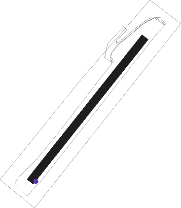
Runway 04 / 22
 length671m (2201ft)
 bearing55° / 235°
 width30m (98ft)
 surfacegrass

Airport layout - taxiway location 04


Taxiway locations

Nearby beacons

codeidentifierdistbearingfrequency
SBGSALZBURG VOR/DME14.5200°113.80
SBGSALZBURG NDB16.6197°382
SISALZBURG NDB25.2179°410
GSBDME26.5163°109.45
RDGRODING VOR/DME51.3331°114.70

Disclaimer

The information on this website is not for real aviation. Use this data with the X-Plane flight simulator only! Data taken with kind consent from X-Plane 12 source code and data files. Content is subject to change without notice.