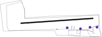
Donzdorf
Airport details
| Country | Germany |
| State | Baden-Württemberg |
| Region | ED |
| Airspace | Munich Ctr |
| Municipality | Donzdorf |
| Elevation | 2272ft (693m) |
| Timezone | GMT +1 |
| Coordinates | 48.67805, 9.84361 |
| Magnetic var | |
| Type | land |
| Available since | X-Plane v10.40 |
| ICAO code | EDPM |
| IATA code | n/a |
| FAA code | n/a |
Communication
| Donzdorf Donzdorf Info | 122.600 |
Nearby Points of Interest:
Siechenkapelle
-Alter Bau
-Altes Schulhaus Bargau
-Haltepunkt Schwäbisch Gmünd Süd
-Alte PH
-Kapitelshaus Schwäbisch Gmünd
-Rechbergsche Scheuer
-Stadtarchiv Schwäbisch Gmünd
-Rathaus Schwäbisch Gmünd
-Grät Schwäbisch Gmünd
-Göppingen City Library
-Spital zum hl. Geist Schwäbisch Gmünd
-Jugendarrestanstalt Göppingen
-Wallfahrtskirche Birenbach
-St. Nemesius
-Rehnenhofkapelle
-Neues Schloss Rechberghausen
-Altes Schloss Rechberghausen
-Kirche Lindach
-Oberes Schloss
-Jupitergigantensäule von Walheim
-Kloster Herbrechtingen
-Villa Arnold, Schorndorf
-Burgschloss Schorndorf
-Palmsche Apotheke
Nearby beacons
| code | identifier | dist | bearing | frequency |
|---|---|---|---|---|
| STG | STUTTGART VOR/DME | 23.3 | 272° | 116.85 |
| TGO | TANGO TACAN | 23.4 | 264° | 112.50 |
| LBU | LUBURG VOR/DME | 24.4 | 295° | 109.20 |
| SGD | DME | 24.5 | 271° | 115.45 |
| SHD | HALL DME | 26.4 | 352° | 108.05 |
| LUP | LAUPHEIM NDB | 27.7 | 172° | 407 |
| DKB | DINKELSBUEHL VORTAC | 31.9 | 40° | 117.80 |
| NDD | DME-ILS | 43.2 | 9° | 108.70 |
| NSN | NIEDERSTETTEN NDB | 43.3 | 10° | 311 |
| ALD | (MEMMINGEN/ALLGAU) DME | 44.1 | 151° | 117.20 |
| ALG | ALLGAEU (MEMMINGEN) NDB | 44.1 | 148° | 341 |
| ANS | ANSBACH NDB | 48.9 | 51° | 452 |
| ILM | ILLESHEIM NDB | 52.2 | 34° | 488 |
| KPT | KEMPTEN VOR/DME | 59.5 | 151° | 108.40 |
Disclaimer
The information on this website is not for real aviation. Use this data with the X-Plane flight simulator only! Data taken with kind consent from X-Plane 12 source code and data files. Content is subject to change without notice.