Airports for X-Plane offers a convenient way to explore airports and their related communication information for the X-Plane flight simulator. It only uses data from the X-Plane flight simulator itself, and is therefore more reliable than the data that comes from real aviation websites. You can search for airports by using the ICAO code, or browse for airports per country and state. The information displayed is categorized by airport details, runway information, airport communication, approach frequencies (ILS and Glidepath details), details of nearby beacons, SIDs, STARs and approach procedures.

city railway station asphalt metro airport airport apron ferry commuter heliport airliner runway airport authority rail transport airports jetliner airbase flown airfield flight attendant nearby

Waldkirchen - Sonnen

Airport details

CountryGermany
StateBavaria
RegionED
AirspaceMunich Ctr
MunicipalitySonnen
Elevation2672ft (814m)
TimezoneGMT +1
Coordinates48.68278, 13.69583
Magnetic var
Typeland
Available sinceX-Plane v10.40
ICAO codeEDPS
IATA coden/a
FAA coden/a

Communication

Sonnen Sonnen Info122.050
Nearby Points of Interest:
Rathaus
-
Bahnhof Waldkirchen
-
Cultural heritage D-2-7247-0029 in Büchlberg
-
St. Josef (Karlsbach)
-
Ensemble Marktplatz/Marktstraße
-
Kloster Thyrnau
-
Passau–Hauzenberg railway
-
Schloss Peilstein
-
Pfarrkirche St.Jakobus in Gottsdorf
-
Pfarrkirche Hinterschmiding
-
Pfarrkirche Vichtenstein
-
Expositurkirche Neustift im Mühlkreis
-
St.Wolfgang am Stein - Kirche
-
Saint Mary Magdalene parish church in Oepping
-
Kloster Niedernburg
-
Jesuitenkolleg Passau
-
Town hall of Passau
-
Engelszell Abbey
-
Bezirksgericht Aigen
-
Andreaskapelle
-
Sixtuskapelle
-
Alt-Daun-Hof
-
Lamberg-Kapelle
-
Trennbach Chapel
-
Filialkirche Stadl-Kicking

Runway info

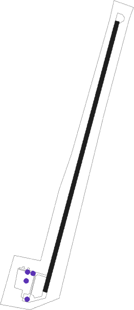
Runway 01 / 19
 length648m (2126ft)
 bearing28° / 208°
 width10m (33ft)
 surfaceasphalt
 displ threshold0m (0ft) / 150m (492ft)

Airport layout - parking location Ramp


Parking locations

Nearby beacons

codeidentifierdistbearingfrequency
FREDME22.9120°113.50
LNZLINZ VOR/DME31.6138°116.60
LNZLINZ NDB36.5125°327
SBGSALZBURG VOR/DME51.9230°113.80
SBGSALZBURG NDB53.5228°382
GSBDME57.6214°109.45
SISALZBURG NDB59.1219°410

Disclaimer

The information on this website is not for real aviation. Use this data with the X-Plane flight simulator only! Data taken with kind consent from X-Plane 12 source code and data files. Content is subject to change without notice.