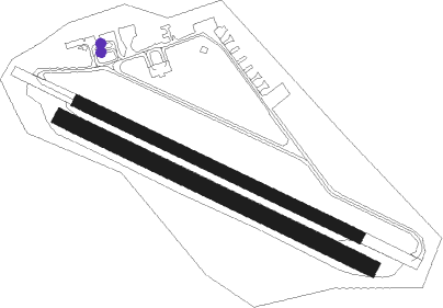
Coburg - Coburg - Brandensteinsebene
Airport details
| Country | Germany |
| State | Bavaria |
| Region | ED |
| Airspace | Munich Ctr |
| Municipality | Coburg |
| Elevation | 1484ft (452m) |
| Timezone | GMT +1 |
| Coordinates | 50.26328, 10.99505 |
| Magnetic var | |
| Type | land |
| Available since | X-Plane v10.40 |
| ICAO code | EDQC |
| IATA code | n/a |
| FAA code | n/a |
Communication
| Coburg - Brandensteinsebene Coburg ATIS | 120.100 |
| Coburg - Brandensteinsebene Coburg Info | 128.680 |
Nearby Points of Interest:
Pfarrkirche Unserer Lieben Frau
-Hofgarten Coburg
-Neudörfles
-Escora-Gebäude
-Jüdischer Friedhof (Coburg)
-Kyrill Palais
-Marstall Coburg
-Hahnmühle Coburg
-Steingasse 18
-St. Lukas
-Zeughaus
-Wohnhaus
-Bahnhofstraße 10/12
-Wohn- und Geschäftshaus
-Kaufhaus
-Hofapotheke Coburg
-Stadthaus Coburg
-Hindenburgstraße
-Villa
-Ketschengasse 1
-Rathaus
-Bahnhofstraße 17
-Markt 6

Nearby beacons
| code | identifier | dist | bearing | frequency |
|---|---|---|---|---|
| BAY | BAYREUTH VOR | 29.8 | 113° | 110.60 |
| ERL | ERLANGEN VOR/DME | 36.9 | 166° | 114.90 |
| ERF | ERFURT VOR/DME | 42.3 | 19° | 113.85 |
| EFD | DME | 43.2 | 357° | 112.05 |
| NUB | NUERNBERG VOR/DME | 45.6 | 177° | 115.75 |
| NGD | DME | 45.8 | 174° | 113.10 |
| RTB | ROETHENBACH NDB | 47.9 | 162° | 415 |
| GRF | GRAFENWOHR TACAN | 50 | 121° | 111.80 |
| GRW | GRAFENWOHR NDB | 50 | 121° | 405 |
| ILM | ILLESHEIM NDB | 53 | 217° | 488 |
| ANS | ANSBACH NDB | 59 | 201° | 452 |
Departure and arrival routes
| Transition altitude | 5000ft |
| SID end points | distance | outbound heading | |
|---|---|---|---|
| RW12 | |||
| LASG3E | 11mi | 67° | |
| LONL4E | 14mi | 129° | |
| RW30 | |||
| LASG1W | 11mi | 67° | |
| LONL3W | 14mi | 129° | |
Instrument approach procedures
| runway | airway (heading) | route (dist, bearing) |
|---|---|---|
| RW30 | LASGA (247°) | LASGA 6000ft QC020 (10mi, 134°) 6000ft QC021 (5mi, 222°) 5000ft |
| RW30 | LONLI (309°) | LONLI 5000ft QC021 (5mi, 42°) 5000ft |
| RNAV | QC021 5000ft KOPUG (5mi, 290°) 4000ft EDQC (8mi, 291°) 1493ft QC023 (5mi, 290°) (3072mi, 192°) 3000ft QC024 (3071mi, 12°) QC025 (7mi, 180°) LONLI (16mi, 102°) 5000ft |
Disclaimer
The information on this website is not for real aviation. Use this data with the X-Plane flight simulator only! Data taken with kind consent from X-Plane 12 source code and data files. Content is subject to change without notice.