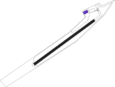
Simmern - Nannhausen
Airport details
| Country | Germany |
| State | Rhineland-Palatinate |
| Region | ED |
| Airspace | Langen Ctr |
| Municipality | Nannhausen |
| Elevation | 1223ft (373m) |
| Timezone | GMT +1 |
| Coordinates | 49.97000, 7.47850 |
| Magnetic var | |
| Type | land |
| Available since | X-Plane v10.32 |
| ICAO code | EDRN |
| IATA code | n/a |
| FAA code | n/a |
Communication
| Nannhausen Nannhausen Info | 130.600 |
Nearby beacons
| code | identifier | dist | bearing | frequency |
|---|---|---|---|---|
| HAN | HAHN NDB | 7.6 | 269° | 376 |
| FHH | DME | 8.5 | 263° | 117.35 |
| BUE | BUECHEL TACAN | 20.1 | 297° | 117.10 |
| SPA | SPANGDAHLEM TACAN | 30.1 | 271° | 109.50 |
| TAU | TAUNUS VOR/DME | 31.2 | 68° | 113.35 |
| RMS | RAMSTEIN TACAN | 32.4 | 169° | 113.40 |
| WIB | WIESBADEN TACAN | 32.4 | 85° | 114.10 |
| FW | FRANKFURT NDB | 36.7 | 88° | 382 |
| VFM | NAUHEIM VOR | 38.3 | 90° | 113.75 |
| ZWN | ZWEIBRUECKEN VOR/DME | 44.5 | 185° | 114.80 |
| SR | ENSHEIM (SAARBRUECKEN) NDB | 46.2 | 199° | 360 |
| SAD | DME | 47.6 | 206° | 116.75 |
| COL | COLA VOR/DME | 49 | 8° | 108.80 |
| SIL | SIEGERLAND NDB | 49.5 | 43° | 489 |
| SLD | DME | 49.8 | 39° | 108.05 |
| LV | COLOGNE-BONN NDB | 50.9 | 344° | 327 |
| KBO | COLOGNE-BONN VOR/DME | 55 | 340° | 112.15 |
| LW | COLOGNE-BONN NDB | 56.4 | 346° | 300 |
| LJ | COLOGNE-BONN NDB | 59.6 | 336° | 365 |
| NVO | NOERVENICH VORTAC | 60.5 | 315° | 116.20 |
| WNN | DME | 60.5 | 317° | 109.85 |
| GTQ | GROSTENQUIN VOR/DME | 66.1 | 218° | 111.25 |
Disclaimer
The information on this website is not for real aviation. Use this data with the X-Plane flight simulator only! Data taken with kind consent from X-Plane 12 source code and data files. Content is subject to change without notice.
