Wilhelmshaven - Wilhelmshaven Mariensiel
Airport details
| Country | Germany |
| State | Lower Saxony |
| Region | ED |
| Airspace | Bremen Ctr |
| Municipality | Sande |
| Elevation | 16ft (5m) |
| Timezone | GMT +1 |
| Coordinates | 53.50485, 8.05325 |
| Magnetic var | |
| Type | land |
| Available since | X-Plane v10.40 |
| ICAO code | EDWI |
| IATA code | WVN |
| FAA code | n/a |
Communication
| Wilhelmshaven Mariensiel Wilhelmshaven Info | 129.250 |
Nearby Points of Interest:
Lutherische Kirche
-Bavariahaus
-Strandhalle Wilhelmshaven
-St. Stephanuskirche
-Woltzetener Kirche
-St. Florian
-Holy Cross Church
-Altfunnixsieler Mühle
-Carolinensiel church
-Ostgroßefehner Kirche
-St. Marienkirche
-Mansinger Burgplatz
-Jüdischer Friedhof Esens
-Holtrop Church
-Hof Sibbern
-Hof Rall
-Andreaskirche
-Zollamt Rotersand
-Wohnhausgruppe Bürgermeister-Smidt-Straße 173–205
-Kaserne Roter Sand
-Seemannsamt
-Allgemeine Ortskrankenkasse Bremerhaven
-Haus des Handwerks
-Hafenamt
-Bürgermeister-Smidt-Straße 120
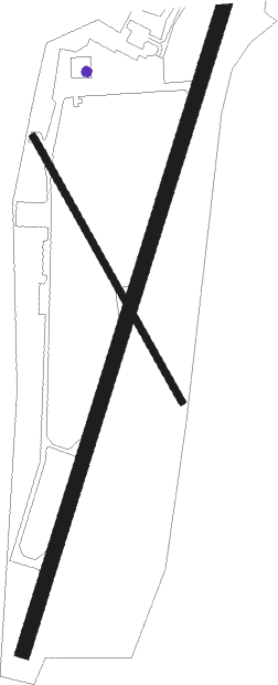
Runway info
Runway 02 / 20  | ||
| length | 1461m (4793ft) | |
| bearing | 34° / 214° | |
| width | 30m (99ft) | |
| surface | asphalt | |
| displ threshold | 225m (738ft) / 245m (804ft) | |
| Runway 16 / 34 | ||
| length | 631m (2070ft) | |
| bearing | 142° / 322° | |
| width | 15m (50ft) | |
| surface | asphalt | |
Nearby beacons
| code | identifier | dist | bearing | frequency |
|---|---|---|---|---|
| WTM | WITTMUNDHAFEN TACAN | 12 | 279° | 113.50 |
| NDO | NORDHOLZ TACAN | 26.6 | 66° | 117.10 |
| WSN | WESER NDB | 30.8 | 101° | 378 |
| NDO | NORDHOLZ NDB | 31.6 | 70° | 372 |
| BMN | BREMEN VOR/DME | 37.4 | 123° | 117.45 |
| BND | DME | 38 | 122° | 113.65 |
| DHE | HELGOLAND VOR/DME | 41.1 | 348° | 116.30 |
| HIG | BREMEN NDB | 41.1 | 118° | 318 |
| DP | DIEPHOLZ NDB | 56.7 | 156° | 325 |
Departure and arrival routes
| Transition altitude | 5000ft |
| SID end points | distance | outbound heading | |
|---|---|---|---|
| RW02 | |||
| DOTO1N | 13mi | 177° | |
| RW20 | |||
| DOTO1S | 13mi | 177° | |
Instrument approach procedures
| runway | airway (heading) | route (dist, bearing) |
|---|---|---|
| RW02 | DOTOB (357°) | DOTOB 4000ft D317D (4mi, 303°) 3000ft WI100 (2mi, 303°) 2000ft |
| RNAV | WI100 2000ft XETEL (3mi, 34°) 2000ft EDWI (7mi, 34°) 63ft WI105 (5mi, 35°) 420ft WI106 (2mi, 93°) WI107 (16mi, 158°) WI108 (1mi, 229°) DOTOB (6mi, 265°) 4000ft | |
| RW20 | DOTOB (357°) | DOTOB 4000ft WI200 (21mi, 26°) 3000ft WI205 (3mi, 284°) 2000ft |
| RNAV | WI205 2000ft NOSNO (3mi, 214°) 2000ft EDWI (6mi, 215°) 68ft WI210 (2mi, 213°) 420ft DOTOB (11mi, 170°) 4000ft |
Disclaimer
The information on this website is not for real aviation. Use this data with the X-Plane flight simulator only! Data taken with kind consent from X-Plane 12 source code and data files. Content is subject to change without notice.