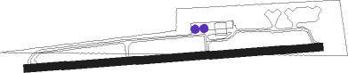
Osnabrück - Osnabrueck Atterheide
Airport details
| Country | Germany |
| State | Lower Saxony |
| Region | ED |
| Airspace | Bremen Ctr |
| Municipality | Osnabrück |
| Elevation | 287ft (87m) |
| Timezone | GMT +1 |
| Coordinates | 52.28633, 7.97333 |
| Magnetic var | |
| Type | land |
| Available since | X-Plane v10.40 |
| ICAO code | EDWO |
| IATA code | n/a |
| FAA code | n/a |
Communication
| Osnabrueck Atterheide Osnabrueck Info | 128.675 |
Nearby Points of Interest:
Liebfrauenkirche
-Stadthaus
-Jüdischer Friedhof
-Kloster Ohrbeck
-Jüdischer Friedhof (Lengerich)
-Tecklenburg
-Michaelsbrunnen
-Holter Kirche
-Weidenhof
-Amtsgericht Ibbenbüren
-Herold House
-Jüdischer Friedhof (Ibbenbüren)
-Church of the Nativity of the Virgin Mary
-Giersfeld
-Sankt Johannes der Täufer, Bohmte
-Schleuse Bergeshövede
-Heeker Klause
-Schloss Bruche
-Schloss Loburg
-Anna-Kapelle
-Heimathaus
-Kapelle zur schmerzhaften Mutter
-Donatusstatue
-Brinkjans Krüüs
-Kloster Rengering
Nearby beacons
| code | identifier | dist | bearing | frequency |
|---|---|---|---|---|
| MYN | MUENSTER/OSNABRUECK NDB | 9.9 | 234° | 371 |
| OSB | OSNABRUCK TACAN | 12.5 | 105° | 108.35 |
| OSN | OSNABRUECK VOR | 12.5 | 105° | 114.30 |
| MOD | DME | 13.7 | 243° | 114.05 |
| DP | DIEPHOLZ NDB | 25.4 | 58° | 325 |
| HMM | HAMM VOR/DME | 27.5 | 212° | 115.65 |
| PAD | PADERBORN-LIPPSTADT NDB | 46.8 | 135° | 354 |
| PAD | DME-ILS | 47.1 | 136° | 108.50 |
| DWI | DORTMUND-WICKEDE NDB | 47.3 | 204° | 357 |
| DOR | WICKEDE (DORTMUND) VOR/DME | 47.4 | 204° | 108.65 |
| BMN | BREMEN VOR/DME | 53.8 | 46° | 117.45 |
| BND | DME | 54.2 | 47° | 113.65 |
| BOT | BOTTROP NDB | 54.8 | 234° | 406 |
| HIG | BREMEN NDB | 57.1 | 51° | 318 |
| BAM | BARMEN VOR/DME | 64.7 | 220° | 114 |
Disclaimer
The information on this website is not for real aviation. Use this data with the X-Plane flight simulator only! Data taken with kind consent from X-Plane 12 source code and data files. Content is subject to change without notice.