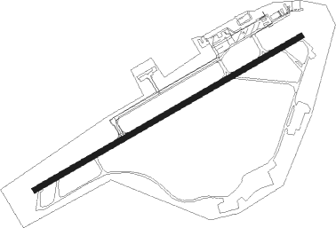
Tampere / Pirkkala - Tampere Pirkkala
Airport details
| Country | Finland |
| State | Western Finland |
| Region | EF |
| Airspace | Helsinki Ctr |
| Municipality | Pirkkala |
| Elevation | 390ft (119m) |
| Timezone | GMT +2 |
| Coordinates | 61.42144, 23.62761 |
| Magnetic var | |
| Type | land |
| Available since | X-Plane v10.40 |
| ICAO code | EFTP |
| IATA code | TMP |
| FAA code | n/a |
Communication
| Tampere Pirkkala ATIS | 133.550 |
| Tampere Pirkkala Tampere radar | 127.100 |
| Tampere Pirkkala PIRKKALA Tower | 118.700 |
| Tampere Pirkkala PIRKKALA Tower | 119.700 |
| Tampere Pirkkala PIRKKALA Approach | 119.700 |
| Tampere Pirkkala PIRKKALA Approach | 126.200 |
Approach frequencies
| ILS-cat-I | RW24 | 110.1 | 18.00mi |
| 3° GS | RW24 | 110.1 | 18.00mi |
Nearby Points of Interest:
Neulalähde
-Sääksjärvi railway station
-Pitkäniemi hospital
-Lepolan huvila
-Nokiankivi
-Hatanpää Manor
-Hatanpää Hospital
-Epilän Nahkatehdas
-Bishop's Residence
-Pyynikinlinna
-Haapasen huvila
-De Gamlas Hem
-OTK matchstick factory
-Santalahti Paper Mill
-Näsijärvi Cardboard Factory
-Haarla paper mill
-Marjatta Hospital
-Former Real Lyceum
-Tampere Workers' Hall
-Hjorthin talo
-Laukonkulma
-Valioasu Building
-Kymmenenmiehen talo
-Office building of the Evangelical Lutheran parishes
-Tuotanto House
Nearby beacons
| code | identifier | dist | bearing | frequency |
|---|---|---|---|---|
| PIR | PIRKKA (TAMPERE) VOR/DME | 1.5 | 257° | 116.20 |
| VTI | DME | 60.5 | 147° | 117 |
Departure and arrival routes
| Transition altitude | 5000ft |
| SID end points | distance | outbound heading | |
|---|---|---|---|
| RW06 | |||
| ARBE3F | 28mi | 77° | |
| NISV2F | 22mi | 125° | |
| UVEM2F | 21mi | 146° | |
| ENET2F | 21mi | 189° | |
| EVLI2F | 28mi | 236° | |
| NEBA2F | 29mi | 248° | |
| XORM2F | 29mi | 264° | |
| GEMK2F | 15mi | 319° | |
| RW24 | |||
| ARBE3E | 28mi | 77° | |
| NISV3E | 22mi | 125° | |
| UVEM3E | 21mi | 146° | |
| ENET3E | 21mi | 189° | |
| EVLI3E | 28mi | 236° | |
| NEBA3E | 29mi | 248° | |
| XORM3E | 29mi | 264° | |
| GEMK3E | 15mi | 319° | |
| STAR starting points | distance | inbound heading | |
|---|---|---|---|
| RW06 | |||
| EVLI2D | 27.6 | 56° | |
| NEBA2D | 29.3 | 68° | |
| XORM2D | 28.7 | 84° | |
| GEMK3D | 14.8 | 139° | |
| ARBE2D | 27.7 | 257° | |
| NISV2D | 21.5 | 305° | |
| UVEM2D | 20.7 | 326° | |
| RW24 | |||
| EVLI2C | 27.6 | 56° | |
| NEBA2C | 29.3 | 68° | |
| XORM2C | 28.7 | 84° | |
| GEMK3C | 14.8 | 139° | |
| ARBE2C | 27.7 | 257° | |
| NISV2C | 21.5 | 305° | |
| UVEM2C | 20.7 | 326° | |
Instrument approach procedures
| runway | airway (heading) | route (dist, bearing) |
|---|---|---|
| RW06 | ERTIN (61°) | ERTIN 2700ft OLNEG (5mi, 315°) 2700ft |
| RW06 | TEPDA (89°) | TEPDA 2700ft OLNEG (5mi, 135°) 2700ft |
| RNAV | OLNEG 2700ft RIRAR (5mi, 77°) 2000ft EFTP (6mi, 77°) 441ft LEDGU (10mi, 78°) 2700ft | |
| RW24 | ATBOK (239°) | ATBOK 2700ft LEDGU (5mi, 135°) 2700ft |
| RW24 | INRUL (271°) | INRUL 2700ft LEDGU (5mi, 315°) 2700ft |
| RNAV | LEDGU 2700ft GOMIB (5mi, 257°) 2000ft EFTP (5mi, 258°) 421ft OLNEG (11mi, 257°) 2700ft |
Holding patterns
| STAR name | hold at | type | turn | heading* | altitude | leg | speed limit |
|---|---|---|---|---|---|---|---|
| ARBE2C | LEDGU | VHF | right | 55 (235)° | > 2700ft | 1.0min timed | 230 |
| ARBE2D | OLNEG | VHF | left | 325 (145)° | > 2700ft | 1.0min timed | 230 |
| EVLI2C | LEDGU | VHF | right | 55 (235)° | > 2700ft | 1.0min timed | 230 |
| EVLI2D | OLNEG | VHF | left | 325 (145)° | > 2700ft | 1.0min timed | 230 |
| GEMK3C | LEDGU | VHF | right | 55 (235)° | > 2700ft | 1.0min timed | 230 |
| GEMK3D | OLNEG | VHF | left | 325 (145)° | > 2700ft | 1.0min timed | 230 |
| NEBA2C | LEDGU | VHF | right | 55 (235)° | > 2700ft | 1.0min timed | 230 |
| NEBA2D | OLNEG | VHF | left | 325 (145)° | > 2700ft | 1.0min timed | 230 |
| NISV2C | LEDGU | VHF | right | 55 (235)° | > 2700ft | 1.0min timed | 230 |
| NISV2D | OLNEG | VHF | left | 325 (145)° | > 2700ft | 1.0min timed | 230 |
| UVEM2C | LEDGU | VHF | right | 55 (235)° | > 2700ft | 1.0min timed | 230 |
| UVEM2D | OLNEG | VHF | left | 325 (145)° | > 2700ft | 1.0min timed | 230 |
| XORM2C | LEDGU | VHF | right | 55 (235)° | > 2700ft | 1.0min timed | 230 |
| XORM2D | OLNEG | VHF | left | 325 (145)° | > 2700ft | 1.0min timed | 230 |
| *) magnetic outbound (inbound) holding course | |||||||
Disclaimer
The information on this website is not for real aviation. Use this data with the X-Plane flight simulator only! Data taken with kind consent from X-Plane 12 source code and data files. Content is subject to change without notice.