Langar - East Fortune
Airport details
| Country | United Kingdom |
| State | Scotland |
| Region | EG |
| Airspace | Scottish Ctr |
| Municipality | East Lothian |
| Elevation | 120ft (37m) |
| Timezone | GMT +0 |
| Coordinates | 56.00032, -2.73594 |
| Magnetic var | |
| Type | land |
| Available since | X-Plane v10.40 |
| ICAO code | EG32 |
| IATA code | n/a |
| FAA code | n/a |
Communication
| East Fortune East Fortune Radio | 118.755 |
Nearby Points of Interest:
Gilmerton House
-RAF East Fortune
-Garleton Castle
-Ballencrieff Castle
-Traprain Law
-Haddington, Court Street, Town House
-Haddington, 27 Sidegate Street, Haddington House
-Whitekirk, Parish Church
-Luffness Castle
-Greywalls
-Yellowcraig
-Tyninghame House
-Whittingehame Tower
-Whittingehame House
-Yester House
-Yester Chapel
-White Castle Fort,settlement 500m NW of,Fallow Green Rig
-Bowerhouse
-Saltoun Hall
-Dunbar, Friarscroft
-Dunbar, High Street, Town House
-Winton House
-Spott House
-Tranent Tower
-Hopes House
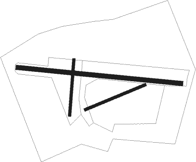
Runway info
Runway 07 / 25  | ||
| length | 174m (571ft) | |
| bearing | 80° / 260° | |
| width | 8m (26ft) | |
| surface | grass | |
| Runway 10 / 28 | ||
| length | 173m (568ft) | |
| bearing | 96° / 276° | |
| width | 12m (39ft) | |
| surface | grass | |
| Runway 11 / 29 | ||
| length | 272m (892ft) | |
| bearing | 96° / 276° | |
| width | 12m (39ft) | |
| surface | concrete | |
| displ threshold | 0m (0ft) / 52m (171ft) | |
| Runway 03 / 21 | ||
| length | 150m (492ft) | |
| bearing | 16° / 196° | |
| width | 8m (26ft) | |
| surface | grass | |
Nearby beacons
| code | identifier | dist | bearing | frequency |
|---|---|---|---|---|
| EDN | EDINBURGH NDB | 18.5 | 268° | 341 |
| SAB | SAINT ABBS VOR/DME | 18.6 | 100° | 112.50 |
| LUK | LEUCHARS TACAN | 22.7 | 341° | 110.50 |
| UW | EDINBURGH NDB | 26.4 | 263° | 368 |
| DND | DUNDEE NDB | 30 | 320° | 394 |
| PTH | PERTH VOR | 33.9 | 305° | 110.40 |
| TLA | TALLA VOR/DME | 36.6 | 231° | 113.80 |
Disclaimer
The information on this website is not for real aviation. Use this data with the X-Plane flight simulator only! Data taken with kind consent from X-Plane 12 source code and data files. Content is subject to change without notice.