Kemble
Airport details
| Country | United Kingdom |
| State | England |
| Region | EG |
| Airspace | London Ctr |
| Municipality | Wiltshire |
| Elevation | 433ft (132m) |
| Timezone | GMT +0 |
| Coordinates | 51.66806, -2.05694 |
| Magnetic var | |
| Type | land |
| Available since | X-Plane v10.40 |
| ICAO code | EGBP |
| IATA code | GBA |
| FAA code | n/a |
Communication
| Kemble INFO | 118.900 |
Nearby Points of Interest:
Rodmarton Manor
-Trull House
-Daneway Banks SSSI
-Daneway House
-Charlton Park
-Cirencester Town railway station
-Cecily Hill Barracks
-St Saviour's Church, Tetbury
-Strawberry Banks
-Malmesbury Market Cross
-Juniper Hill, Edgeworth
-St Mary of the Angels Church, Brownshill
-Box Farm Meadows SSSI
-Wildmoorway Meadows
-Davenport House
-Nether Lypiatt Manor
-Minchinhampton Common
-Ampney Park
-Egypt Mill
-Elmlea Meadows
-Westonbirt House
-Kingscote and Horsley Woods
-Rodborough Common
-Rough Bank, Miserden
-Barnsley Warren
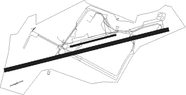
Runway info
Runway 08 / 26  | ||
| length | 2005m (6578ft) | |
| bearing | 84° / 264° | |
| width | 45m (148ft) | |
| surface | asphalt | |
| displ threshold | 170m (558ft) / 264m (866ft) | |
| Runway 08L / 26R | ||
| length | 559m (1834ft) | |
| bearing | 84° / 264° | |
| width | 19m (62ft) | |
| surface | grass | |
Nearby beacons
| code | identifier | dist | bearing | frequency |
|---|---|---|---|---|
| FFA | FAIRFORD TACAN | 9.6 | 87° | 113.40 |
| GST | GLOUCESTERSHIRE NDB | 14 | 334° | 331 |
| BZN | BRIZE NORTON TACAN | 17.5 | 80° | 111.90 |
| BZ | BRIZE NORTON NDB | 17.6 | 80° | 386 |
| OF | FILTON NDB | 21.8 | 255° | 325 |
| OX | OXFORD NDB | 29 | 77° | 367 |
| BRI | BRISTOL NDB | 30 | 247° | 414 |
| CPT | COMPTON VOR/DME | 32.9 | 102° | 114.35 |
| BDN | BOSCOMBE DOWN TACAN | 33.2 | 150° | 108.20 |
| BSO | BENSON TACAN | 35.8 | 93° | 110 |
| HON | HONILEY VOR/DME | 43.8 | 30° | 113.65 |
| VLN | YEOVILTON TACAN | 45.4 | 221° | 111 |
| SH | SHOBDON NDB | 46 | 305° | 426 |
| DTY | DAVENTRY VOR/DME | 46.5 | 62° | 116.40 |
| BHX | BIRMINGHAM NDB | 48.5 | 21° | 406 |
| YVL | DME | 49 | 219° | 109.05 |
| YVL | YEOVIL NDB | 49.2 | 220° | 343 |
| EAS | SOUTHAMPTON (EASTLEIGH) NDB | 50.2 | 135° | 391 |
| SAM | SOUTHAMPTON VOR/DME | 50.4 | 135° | 113.35 |
| WBA | WOLVERHAMPTON NDB | 51.4 | 346° | 356 |
| WOL | DME | 51.4 | 346° | 108.60 |
| BIA | BOURNEMOUTH NDB | 54 | 166° | 339 |
Instrument approach procedures
| runway | airway (heading) | route (dist, bearing) |
|---|---|---|
| RW26 | AXSOC (284°) | AXSOC 2500ft EDBIF (5mi, 345°) 2400ft |
| RW26 | BUSVE (242°) | BUSVE 2500ft EDBIF (5mi, 165°) 2400ft |
| RNAV | EDBIF 2400ft BP26F (4mi, 264°) 1800ft EGBP (5mi, 264°) 461ft BPM04 (7mi, 264°) BPM05 (5mi, 165°) AXSOC (15mi, 84°) 2500ft |
Disclaimer
The information on this website is not for real aviation. Use this data with the X-Plane flight simulator only! Data taken with kind consent from X-Plane 12 source code and data files. Content is subject to change without notice.