Strubby - Strubby Airfield
Airport details
| Country | United Kingdom |
| State | England |
| Region | EG |
| Airspace | London Ctr |
| Municipality | East Lindsey |
| Elevation | 43ft (13m) |
| Timezone | GMT +0 |
| Coordinates | 53.31083, 0.17200 |
| Magnetic var | |
| Type | land |
| Available since | X-Plane v10.40 |
| ICAO code | EGCG |
| IATA code | n/a |
| FAA code | n/a |
Communication
Nearby Points of Interest:
All Saints Church, Theddlethorpe
-Bowl barrow cemetery on Bully Hill
-Hanby Hall
-Louth railway station
-Town Hall
-Somersby Grange
-Gunby Hall
-Chapel at Raithby Hall
-Dobson's Windmill
-Lincolnshire Wolds
-Grim’s Mound
-Scrivelsby Court
-Revesby Abbey
-Spurn Point Low Light
-Council House
-Grimsby Ice Factory
-Grimsby Dock Tower
-Church of St Helen
-Dogdyke Engine
-St Michael's Church, Buslingthorpe
-St Lawrence's Church, Snarford
-Kingerby Castle
-Metheringham Windmill
-The Wash
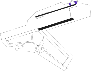
Runway info
Runway 08 / 26  | ||
| length | 814m (2671ft) | |
| bearing | 82° / 262° | |
| width | 17m (56ft) | |
| surface | asphalt | |
| displ threshold | 15m (49ft) / 168m (551ft) | |
| Runway 08R / 26L | ||
| length | 676m (2218ft) | |
| bearing | 82° / 262° | |
| width | 40m (131ft) | |
| surface | grass | |
Nearby beacons
| code | identifier | dist | bearing | frequency |
|---|---|---|---|---|
| CGY | CONINGSBY TACAN | 18 | 237° | 111.10 |
| KIM | HUMBERSIDE NDB | 24.5 | 297° | 365 |
| OTR | OTTRINGHAM VOR/DME | 25.2 | 325° | 113.90 |
| WAD | WADDINGTON TACAN | 26.5 | 258° | 117.10 |
| CWZ | CRANWELL TACAN | 29.1 | 247° | 117.40 |
| CWL | CRANWELL NDB | 29.2 | 247° | 423 |
| GAM | GAMSTON VOR/DME | 40.2 | 268° | 112.80 |
| MAM | MARHAM TACAN | 42.2 | 150° | 108.70 |
| FNY | DONCASTER SHEFFIELD NDB | 43.1 | 278° | 338 |
| WIT | WITTERING TACAN | 48.6 | 224° | 117.60 |
| LKH | LAKENHEATH TACAN | 56 | 157° | 110.20 |
| MLD | MILDENHALL TACAN | 58 | 162° | 115.90 |
| LE | LEICESTER NDB | 60.7 | 240° | 383 |
Disclaimer
The information on this website is not for real aviation. Use this data with the X-Plane flight simulator only! Data taken with kind consent from X-Plane 12 source code and data files. Content is subject to change without notice.