Helston - Rnas Culdrose
Airport details
| Country | United Kingdom |
| State | England |
| Region | EG |
| Airspace | London Ctr |
| Municipality | Cornwall |
| Elevation | 267ft (81m) |
| Timezone | GMT +0 |
| Coordinates | 50.07954, -5.24029 |
| Magnetic var | |
| Type | land |
| Available since | X-Plane v10.40 |
| ICAO code | EGDR |
| IATA code | n/a |
| FAA code | n/a |
Communication
| RNAS Culdrose Ground Control | 122.100 |
| RNAS Culdrose Tower | 123.300 |
| RNAS Culdrose Approach | 134.050 |
Approach frequencies
| ILS-cat-I | RW29 | 109.75 | 18.00mi |
| 3° GS | RW29 | 109.75 | 18.00mi |
Nearby Points of Interest:
Goonhilly Downs
-Wheal Trewavas
-Caerthillian to Kennack
-Cornwall and West Devon Mining Landscape
-Coverack to Porthoustock
-Acton Castle
-Glasney College
-Penberthy Croft mine
-Royal Cornwall Polytechnic Society
-West Cornwall Bryophytes Site of Special Scientific Interest
-Mining Exchange
-St Michael's Mount castle
-Marazion Marsh RSPB Reserve
-The Bucket of Blood
-Carnon Mine Engine House
-Godrevy Head to St Agnes
-Engine House Killifreth (Hawke's Shaft)
-Friends Meeting House, Come-to-Good
-South Pier
-Carricknath Point to Porthbean Beach
-Market Building, Penzance
-Morrab Library
-Public Buildings
-Tolverne Cottage
-Treneere Manor
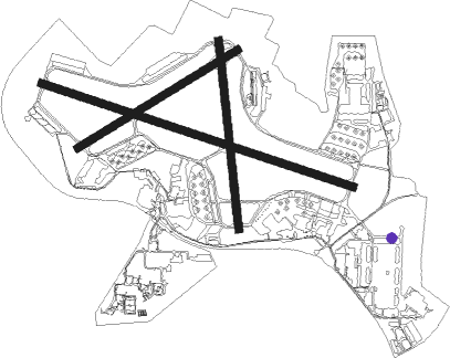
Runway info
Runway 12 / 30  | ||
| length | 1831m (6007ft) | |
| bearing | 105° / 285° | |
| width | 45m (148ft) | |
| surface | asphalt | |
| blast zone | 35m (115ft) / 43m (141ft) | |
| Runway 18 / 36 | ||
| length | 1056m (3465ft) | |
| bearing | 178° / 358° | |
| width | 43m (141ft) | |
| surface | asphalt | |
| Runway 07 / 25 | ||
| length | 1043m (3422ft) | |
| bearing | 72° / 252° | |
| width | 43m (141ft) | |
| surface | asphalt | |
Nearby beacons
| code | identifier | dist | bearing | frequency |
|---|---|---|---|---|
| CUL | CULDROSE NDB | 0.3 | 289° | 370 |
| LND | LANDS END VOR/DME | 15.6 | 278° | 114.20 |
| NQY | NEWQUAY NDB | 23.7 | 34° | 347 |
Disclaimer
The information on this website is not for real aviation. Use this data with the X-Plane flight simulator only! Data taken with kind consent from X-Plane 12 source code and data files. Content is subject to change without notice.