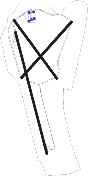
Llanbedr
Airport details
| Country | United Kingdom |
| State | Wales |
| Region | EG |
| Airspace | London Ctr |
| Municipality | Gwynedd |
| Elevation | 19ft (6m) |
| Timezone | GMT +0 |
| Coordinates | 52.80472, -4.12722 |
| Magnetic var | |
| Type | land |
| Available since | X-Plane v10.40 |
| ICAO code | EGFD |
| IATA code | n/a |
| FAA code | n/a |
Communication
| Llanbedr Tower | 118.925 |
Nearby Points of Interest:
Cors Y Gedol Hall
-Coleg Harlech
-Plas Mynach
-Morfa Harlech
-St John's Church
-The Cob
-Ystumllyn, Ffordd Porthmadog (portmadoc Road) (se Side)
-St Deiniol's Church
-Capel Peniel
-Plas Tan-yr-allt
-St Beuno's Church
-Llyn Gwernan
-St Brothen's Church
-Clenennau
-Neuadd Idris
-Plas Tan y Bwlch
-Dolgellau and Barmouth Hospital
-Nannau
-Betws Bach
-Ystumcegid
-Penarth-fawr
-Hafod Garegog
-Peniarth
-Pont Aberglaslyn
-Salem Chapel
Runway info
Nearby beacons
| code | identifier | dist | bearing | frequency |
|---|---|---|---|---|
| VYL | VALLEY TACAN | 30.6 | 317° | 108.40 |
| WPL | WELSHPOOL NDB | 36.9 | 100° | 323 |
| WAL | WALLASEY VOR/DME | 50.2 | 59° | 114.10 |
| STU | STRUMBLE VOR/DME | 59 | 228° | 113.10 |
| HAV | HAVERFORDWEST NDB | 66 | 221° | 328 |
| HDW | DME | 66.1 | 221° | 116.75 |
Disclaimer
The information on this website is not for real aviation. Use this data with the X-Plane flight simulator only! Data taken with kind consent from X-Plane 12 source code and data files. Content is subject to change without notice.

