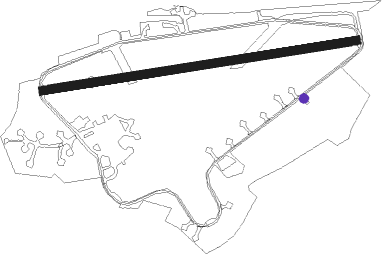
Lasham
Airport details
| Country | United Kingdom |
| State | England |
| Region | EG |
| Airspace | London Ctr |
| Municipality | East Hampshire |
| Elevation | 618ft (188m) |
| Timezone | GMT +0 |
| Coordinates | 51.18566, -1.02596 |
| Magnetic var | |
| Type | land |
| Available since | X-Plane v10.40 |
| ICAO code | EGHL |
| IATA code | QLA |
| FAA code | n/a |
Communication
| Lasham Lasham Radio | 126.650 |
| Lasham Farnborough Radar | 125.250 |
Nearby Points of Interest:
Town Hall
-Chawton House
-Old Church of St Mary the Virgin, Preston Candover
-Hillfort on King John's Hill
-Rotherfield Park
-Plestor House
-Old Arlesford House
-Blackmoor War Memorial
-Farnham Pottery
-West Green House
-Multi-period site in Micheldever Wood
-Headley Grange
-Woolmer Forest
-St Mary's Church, Itchen Stoke
-The Church of St John the Evangelist, Hale
-Bramshill House
-Moor Park
-Heckfield Place
-Pamber Forest and Silchester Common
-Prince Consort's Library
-Aldershot Town Hall
-Calleva Atrebatum
-Old Union Poor House (Workhouse)
-Smith-Dorrien House
-Aldershot Observatory
Nearby beacons
| code | identifier | dist | bearing | frequency |
|---|---|---|---|---|
| ODH | ODIHAM TACAN | 4 | 59° | 109.60 |
| BLC | DME | 10.7 | 53° | 116.20 |
| BLK | BLACKBUSHE NDB | 10.7 | 53° | 328 |
| WOD | WOODLEY NDB | 16.9 | 29° | 352 |
| MID | MIDHURST VOR/DME | 17 | 108° | 114 |
| SAM | SOUTHAMPTON VOR/DME | 18.3 | 234° | 113.35 |
| EAS | SOUTHAMPTON (EASTLEIGH) NDB | 18.6 | 235° | 391 |
| CPT | COMPTON VOR/DME | 19.7 | 328° | 114.35 |
| GWC | GOODWOOD VOR/DME | 22.2 | 141° | 114.75 |
| OCK | OCKHAM VOR/DME | 22.9 | 78° | 115.30 |
| BUR | BURNHAM NDB | 23.9 | 46° | 421 |
| EPM | EPSOM NDB | 25.8 | 78° | 316 |
| BSO | BENSON TACAN | 25.9 | 350° | 110 |
| BDN | BOSCOMBE DOWN TACAN | 27.4 | 267° | 108.20 |
| LON | LONDON VOR/DME | 27.7 | 62° | 113.60 |
| CHT | CHILTERN NDB | 32.4 | 49° | 277 |
| SHM | SHOREHAM NDB | 34.7 | 116° | 332 |
| SRH | DME-ILS | 34.7 | 116° | 109.95 |
| HEN | HENTON NDB | 35.5 | 22° | 433 |
| BNN | BOVINGDON VOR/DME | 37 | 41° | 113.75 |
| BIA | BOURNEMOUTH NDB | 39.4 | 243° | 339 |
| BZ | BRIZE NORTON NDB | 40.1 | 314° | 386 |
| BZN | BRIZE NORTON TACAN | 40.1 | 314° | 111.90 |
| WCO | WESTCOTT NDB | 40.1 | 5° | 335 |
| OX | OXFORD NDB | 40.4 | 335° | 367 |
| BIG | BIGGIN VOR/DME | 40.8 | 82° | 115.10 |
| FFA | FAIRFORD TACAN | 41.4 | 303° | 113.40 |
| MAY | MAYFIELD VOR/DME | 44.2 | 98° | 117.90 |
| LCY | LONDON CITY NDB | 45.2 | 74° | 322 |
| BPK | BROOKMANS PARK VOR/DME | 48.2 | 58° | 117.50 |
| SFD | SEAFORD VOR/DME | 50.3 | 110° | 117 |
| LUT | LUTON NDB | 51.4 | 47° | 345 |
| LAM | LAMBOURNE VOR/DME | 52 | 69° | 115.60 |
| CIT | CRANFIELD NDB | 59.3 | 26° | 850 |
| DTY | DAVENTRY VOR/DME | 59.8 | 355° | 116.40 |
| DET | DETLING VOR/DME | 61.4 | 86° | 117.30 |
| BKY | BARKWAY VOR/DME | 63 | 54° | 116.25 |
| HLS | DME | 63.1 | 91° | 115.95 |
| LSH | HEADCORN (LASHENDEN) NDB | 63.1 | 91° | 340 |
| SND | SOUTHEND NDB | 68.8 | 77° | 362 |
| LYD | LYDD VOR/DME | 72.7 | 96° | 114.05 |
Disclaimer
The information on this website is not for real aviation. Use this data with the X-Plane flight simulator only! Data taken with kind consent from X-Plane 12 source code and data files. Content is subject to change without notice.