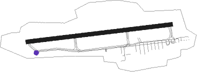
Saint Peter Port - Guernsey
Airport details
| Country | Guernsey |
| State | Guernsey |
| Region | EG |
| Airspace | Brest Ctr |
| Municipality | St Saviour |
| Elevation | 333ft (101m) |
| Timezone | GMT +0 |
| Coordinates | 49.43493, -2.60280 |
| Magnetic var | |
| Type | land |
| Available since | X-Plane v10.40 |
| ICAO code | EGJB |
| IATA code | GCI |
| FAA code | n/a |
Communication
| Guernsey Guernsey Ground | 121.800 |
| Guernsey Guernsey Tower | 119.950 |
| Guernsey Guernsey Approach | 128.650 |
Approach frequencies
| ILS-cat-I | RW27 | 108.1 | 18.00mi |
| ILS-cat-I | RW09 | 108.1 | 18.00mi |
| 3° GS | RW27 | 108.1 | 18.00mi |
| 3° GS | RW09 | 108.1 | 18.00mi |
Nearby beacons
| code | identifier | dist | bearing | frequency |
|---|---|---|---|---|
| GUR | GUERNSEY VOR/DME | 0.1 | 335° | 109.40 |
| JW | JERSEY NDB | 20.3 | 121° | 329 |
| ALD | ALDERNEY NDB | 22.7 | 56° | 383 |
| JSY | JERSEY VOR/DME | 25.2 | 111° | 112.20 |
| LN | LANNION NDB | 51.1 | 225° | 345 |
| SB | SAINT BRIEUC NDB | 52.5 | 192° | 353 |
| DIN | DINARD PLEURTUIT SAINT MA VOR/DME | 54.9 | 148° | 114.30 |
| BHD | BERRY HEAD VOR/DME | 67.3 | 317° | 112.05 |
Departure and arrival routes
| Transition altitude | 5000ft |
| SID end points | distance | outbound heading | |
|---|---|---|---|
| RW09 | |||
| ORTA3E | 41mi | 47° | |
| ORIS1F | 45mi | 53° | |
| GULD1E | 27mi | 94° | |
| LUSI1E | 34mi | 105° | |
| ORVA1E | 39mi | 117° | |
| DIN2E | 55mi | 148° | |
| LERA1F | 26mi | 155° | |
| SKER3E | 41mi | 315° | |
| RW27 | |||
| ORTA3W | 41mi | 47° | |
| ORIS1X | 45mi | 53° | |
| GULD1W | 27mi | 94° | |
| LUSI1W | 34mi | 105° | |
| ORVA1W | 39mi | 117° | |
| DIN2W | 55mi | 148° | |
| LERA1X | 26mi | 155° | |
| SKER3W | 41mi | 315° | |
| STAR starting points | distance | inbound heading | |
|---|---|---|---|
| ALL | |||
| SKER1G | 40.5 | 135° | |
| BIGN1G | 35.0 | 159° | |
| ALD1G | 22.7 | 236° | |
| BEVA1G | 42.0 | 292° | |
| DIN1G | 54.9 | 328° | |
| RW09 | |||
| LELN1V | 38.1 | 222° | |
| ORTA1V | 41.0 | 227° | |
| RW27 | |||
| LELN1B | 38.1 | 222° | |
| ORTA1B | 41.0 | 227° | |
Instrument approach procedures
| runway | airway (heading) | route (dist, bearing) |
|---|---|---|
| RW09 | ABDUS (71°) | ABDUS 2000ft REMLO (5mi, 356°) 2000ft |
| RW09 | RUTOK (106°) | RUTOK 2000ft REMLO (5mi, 176°) 2000ft |
| RNAV | REMLO 2000ft JB09F (5mi, 88°) 2000ft EGJB (6mi, 88°) 352ft JBM01 (5mi, 88°) JBM02 (3mi, 176°) JBM03 (3mi, 268°) GUR (4mi, 318°) 3000ft GUR (turn) | |
| RW27 | AMIBA (286°) | AMIBA 2000ft JB27I (5mi, 357°) 2000ft |
| RW27 | OTMIS (251°) | OTMIS 2000ft JB27I (5mi, 177°) 2000ft |
| RW27 | PELOM (269°) | PELOM 2000ft JB27I (5mi, 269°) 2000ft |
| RNAV | JB27I 2000ft JB27F (5mi, 269°) 2000ft EGJB (5mi, 268°) 386ft JBM04 (6mi, 268°) JBM05 (4mi, 356°) JBM06 (3mi, 88°) GUR (4mi, 134°) 3000ft GUR (turn) |
Holding patterns
| STAR name | hold at | type | turn | heading* | altitude | leg | speed limit |
|---|---|---|---|---|---|---|---|
| ALD1G | ALD | FIX | left | 259 (79)° | > 2000ft | 1.0min timed | ICAO rules |
| ALD1G | GUR | NDB | left | 268 (88)° | > 2000ft | 1.0min timed | ICAO rules |
| BEVA1G | GUR | NDB | left | 268 (88)° | > 2000ft | 1.0min timed | ICAO rules |
| BIGN1G | GUR | NDB | left | 268 (88)° | > 2000ft | 1.0min timed | ICAO rules |
| DIN1G | GUR | NDB | left | 268 (88)° | > 2000ft | 1.0min timed | ICAO rules |
| LELN1B | GUR | NDB | left | 268 (88)° | > 2000ft | 1.0min timed | ICAO rules |
| LELN1V | GUR | NDB | left | 268 (88)° | > 2000ft | 1.0min timed | ICAO rules |
| ORTA1B | GUR | NDB | left | 268 (88)° | > 2000ft | 1.0min timed | ICAO rules |
| ORTA1V | GUR | NDB | left | 268 (88)° | > 2000ft | 1.0min timed | ICAO rules |
| SKER1G | GUR | NDB | left | 268 (88)° | > 2000ft | 1.0min timed | ICAO rules |
| *) magnetic outbound (inbound) holding course | |||||||
Disclaimer
The information on this website is not for real aviation. Use this data with the X-Plane flight simulator only! Data taken with kind consent from X-Plane 12 source code and data files. Content is subject to change without notice.
