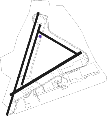
Brighton - Shoreham
Airport details
| Country | United Kingdom |
| State | England |
| Region | EG |
| Airspace | London Ctr |
| Municipality | Adur |
| Elevation | 3ft (1m) |
| Timezone | GMT +0 |
| Coordinates | 50.83501, -0.29039 |
| Magnetic var | |
| Type | land |
| Available since | X-Plane v10.40 |
| ICAO code | EGKA |
| IATA code | ESH |
| FAA code | n/a |
Communication
| Shoreham Shoreham Information | 130.980 |
| Shoreham Shoreham Tower | 123.155 |
| Shoreham Shoreham Tower | 125.405 |
| Shoreham Shoreham Apporach | 123.155 |
Runway info
Nearby beacons
| code | identifier | dist | bearing | frequency |
|---|---|---|---|---|
| SHM | SHOREHAM NDB | 0.1 | 276° | 332 |
| SRH | DME-ILS | 0.1 | 289° | 109.95 |
| SFD | SEAFORD VOR/DME | 16.2 | 100° | 117 |
| GWC | GOODWOOD VOR/DME | 17.7 | 272° | 114.75 |
| MID | MIDHURST VOR/DME | 18.2 | 303° | 114 |
| MAY | MAYFIELD VOR/DME | 18.8 | 66° | 117.90 |
| OCK | OCKHAM VOR/DME | 28.8 | 342° | 115.30 |
| EPM | EPSOM NDB | 29.2 | 350° | 316 |
| BIG | BIGGIN VOR/DME | 32.2 | 33° | 115.10 |
| ODH | ODIHAM TACAN | 34.4 | 301° | 109.60 |
| BLC | DME | 36 | 311° | 116.20 |
| BLK | BLACKBUSHE NDB | 36 | 311° | 328 |
| LON | LONDON VOR/DME | 39.7 | 345° | 113.60 |
| HLS | DME | 40.4 | 71° | 115.95 |
| LSH | HEADCORN (LASHENDEN) NDB | 40.4 | 71° | 340 |
| LCY | LONDON CITY NDB | 42.3 | 28° | 322 |
| WOD | WOODLEY NDB | 43.2 | 316° | 352 |
| BUR | BURNHAM NDB | 43.5 | 331° | 421 |
| DET | DETLING VOR/DME | 43.7 | 62° | 117.30 |
| LYD | LYDD VOR/DME | 45.3 | 82° | 114.05 |
| LZD | LYDD NDB | 47.1 | 84° | 397 |
| CHT | CHILTERN NDB | 48.1 | 344° | 277 |
| LAM | LAMBOURNE VOR/DME | 51.4 | 29° | 115.60 |
| CPT | COMPTON VOR/DME | 52.7 | 305° | 114.35 |
| BNN | BOVINGDON VOR/DME | 54.3 | 344° | 113.75 |
| BPK | BROOKMANS PARK VOR/DME | 55.3 | 11° | 117.50 |
| BSO | BENSON TACAN | 55.8 | 314° | 110 |
| SND | SOUTHEND NDB | 58 | 53° | 362 |
| HEN | HENTON NDB | 58.6 | 332° | 433 |
Instrument approach procedures
| runway | airway (heading) | route (dist, bearing) |
|---|---|---|
| RW02 | ADPOD (60°) | ADPOD 2200ft RIPIL (3mi, 104°) 2200ft |
| RW02 | GODOT (358°) | GODOT 2200ft RIPIL (3mi, 284°) 2200ft |
| RNAV | RIPIL 2200ft KA02F (3mi, 32°) 1500ft MA02 (3mi, 32°) 386ft (3052mi, 180°) 1500ft SHM (3053mi, 360°) 2200ft SHM (turn) | |
| RW20 | BITLI (172°) | BITLI 2200ft ADURI (3mi, 92°) 2200ft |
| RW20 | NITEN (236°) | NITEN 2200ft ADURI (3mi, 283°) 2200ft |
| RNAV | ADURI 2200ft KA20F (3mi, 212°) 2200ft EGKA (5mi, 208°) 47ft (3053mi, 180°) 1500ft SHM (3053mi, 360°) 2200ft SHM (turn) |
Disclaimer
The information on this website is not for real aviation. Use this data with the X-Plane flight simulator only! Data taken with kind consent from X-Plane 12 source code and data files. Content is subject to change without notice.

