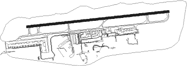
Nottingham - East Midlands
Airport details
| Country | United Kingdom |
| State | England |
| Region | EG |
| Airspace | London Ctr |
| Municipality | North West Leicestershire |
| Elevation | 306ft (93m) |
| Timezone | GMT +0 |
| Coordinates | 52.83111, -1.32778 |
| Magnetic var | |
| Type | land |
| Available since | X-Plane v10.40 |
| ICAO code | EGNX |
| IATA code | EMA |
| FAA code | n/a |
Communication
| East Midlands East Midlands Information | 122.680 |
| East Midlands East Midlands Ground | 121.905 |
| East Midlands East Midlands Tower | 124.005 |
| East Midlands East Midlands Radar | 134.180 |
| East Midlands East Midlands Radar | 126.180 |
Approach frequencies
| ILS-cat-III | RW27 | 109.35 | 18.00mi |
| ILS-cat-I | RW09 | 109.35 | 18.00mi |
| 3° GS | RW27 | 109.35 | 18.00mi |
| 3° GS | RW09 | 109.35 | 18.00mi |
Nearby Points of Interest:
Lockington Hall
-Donington Hall
-Shardlow Hall, Derbyshire
-Aston Hall, Aston-on-Trent
-Kingston Hall, Nottinghamshire
-The Bulwarks (earthworks)
-Thrumpton Hall
-Grace Dieu Manor
-Swarkestone Bridge
-Staunton Harold Hall
-Mount St Bernard Abbey
-Hough Windmill
-Three Horseshoes
-Loughborough Town Hall
-Coleorton Hall
-Heath Wood barrow cemetery
-The Homestead
-Cotes Mill
-Foremarke Hall
-Frances Longden Almshouses
-The Grange
-Locko Park
-Prestwold Hall
-Beaumanor Hall
-Bunny Hall
Nearby beacons
| code | identifier | dist | bearing | frequency |
|---|---|---|---|---|
| EMW | EAST MIDLANDS NDB | 4.5 | 269° | 393 |
| EME | EAST MIDLANDS NDB | 4.8 | 89° | 353 |
| TNL | TATENHILL NDB | 15.9 | 268° | 327 |
| LE | LEICESTER NDB | 17.1 | 128° | 383 |
| TNT | TRENT VOR/DME | 18.2 | 303° | 115.70 |
| BHX | BIRMINGHAM NDB | 27.4 | 228° | 406 |
| GAM | GAMSTON VOR/DME | 30.3 | 40° | 112.80 |
| HON | HONILEY VOR/DME | 31 | 215° | 113.65 |
| CWL | CRANWELL NDB | 32.5 | 77° | 423 |
| CWZ | CRANWELL TACAN | 32.7 | 77° | 117.40 |
| WIT | WITTERING TACAN | 33 | 105° | 117.60 |
| WAD | WADDINGTON TACAN | 35.2 | 67° | 117.10 |
| WBA | WOLVERHAMPTON NDB | 38.9 | 251° | 356 |
| WOL | DME | 38.9 | 251° | 108.60 |
| DTY | DAVENTRY VOR/DME | 39.8 | 162° | 116.40 |
| FNY | DONCASTER SHEFFIELD NDB | 40.4 | 27° | 338 |
| MCT | MANCHESTER VOR/DME | 46.1 | 299° | 113.55 |
| CIT | CRANFIELD NDB | 50.6 | 132° | 850 |
| KIM | HUMBERSIDE NDB | 56.7 | 53° | 365 |
| SBL | SHERBURN-IN-ELMET NDB | 57.7 | 7° | 323 |
| OX | OXFORD NDB | 59.9 | 180° | 367 |
| WCO | WESTCOTT NDB | 60.2 | 160° | 335 |
| POL | POLE HILL VOR/DME | 61.4 | 320° | 112.10 |
| GST | GLOUCESTERSHIRE NDB | 64.2 | 222° | 331 |
| MAM | MARHAM TACAN | 69.5 | 96° | 108.70 |
| MLD | MILDENHALL TACAN | 71.9 | 104° | 115.90 |
| LKH | LAKENHEATH TACAN | 72.9 | 103° | 110.20 |
Departure and arrival routes
| Transition altitude | 6000ft |
| SID end points | distance | outbound heading | |
|---|---|---|---|
| RW09 | |||
| DTY4P | 40mi | 162° | |
| TNT3P | 18mi | 303° | |
| POL2P | 61mi | 320° | |
| RW27 | |||
| DTY3N | 40mi | 162° | |
| TNT2N | 18mi | 303° | |
| STAR starting points | distance | inbound heading | |
|---|---|---|---|
| ALL | |||
| AMPI1E | 70.8 | 101° | |
| WAL1E | 73.3 | 107° | |
| ROKU1B | 64.6 | 123° | |
| ROKU1F | 61.4 | 140° | |
| ROKU1G | 46.4 | 141° | |
| ROKU1K | 84.5 | 149° | |
| HEME1E | 70.0 | 318° | |
| DTY1E | 39.8 | 342° | |
Holding patterns
| STAR name | hold at | type | turn | heading* | altitude | leg | speed limit |
|---|---|---|---|---|---|---|---|
| AMPI1E | ROKUP | VHF | right | 113 (293)° | 8000ft - 14000ft | DME 6.0mi | 220 |
| DTY1E | PIGOT | VHF | left | 5 (185)° | 8000ft - 12000ft | DME 5.5mi | 220 |
| HEME1E | PIGOT | VHF | left | 5 (185)° | 8000ft - 12000ft | DME 5.5mi | 220 |
| ROKU1B | ROKUP | VHF | right | 113 (293)° | 8000ft - 14000ft | DME 6.0mi | 220 |
| ROKU1F | ROKUP | VHF | right | 113 (293)° | 8000ft - 14000ft | DME 6.0mi | 220 |
| ROKU1G | ROKUP | VHF | right | 113 (293)° | 8000ft - 14000ft | DME 6.0mi | 220 |
| ROKU1K | ROKUP | VHF | right | 113 (293)° | 8000ft - 14000ft | DME 6.0mi | 220 |
| WAL1E | ROKUP | VHF | right | 113 (293)° | 8000ft - 14000ft | DME 6.0mi | 220 |
| *) magnetic outbound (inbound) holding course | |||||||
Disclaimer
The information on this website is not for real aviation. Use this data with the X-Plane flight simulator only! Data taken with kind consent from X-Plane 12 source code and data files. Content is subject to change without notice.