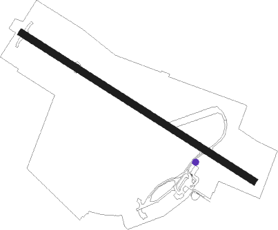
Wick
Airport details
| Country | United Kingdom |
| State | Scotland |
| Region | EG |
| Airspace | Scottish Ctr |
| Municipality | Caithness |
| Elevation | 125ft (38m) |
| Timezone | GMT +0 |
| Coordinates | 58.45876, -3.09296 |
| Magnetic var | |
| Type | land |
| Available since | X-Plane v10.40 |
| ICAO code | EGPC |
| IATA code | WIC |
| FAA code | n/a |
Communication
| Wick Wick Tower | 119.700 |
| Wick Wick Approach | 119.700 |
Nearby Points of Interest:
Wick, Dempster Street, Wick Central Church
-Whitegate Broch
-Keiss Castle
-Loch Watten
-Stone Lud
-Forse Castle
-Halkirk, Old Parish Church
-River Thurso
-Thurso, Wilson Lane, Old St Peter's Church And Burial-ground
-Flow Country
-Cnoc Freiceadain Long Cairns
-St Mary's Chapel
-Crosskirk Broch
-Berriedale, Parish Church
-Hackness Martello Tower and Battery
Nearby beacons
| code | identifier | dist | bearing | frequency |
|---|---|---|---|---|
| WIK | WICK VOR/DME | 0.2 | 270° | 113.60 |
| WCK | WICK NDB | 1.1 | 112° | 344 |
| KW | KIRKWALL NDB | 30.6 | 21° | 395 |
| KWL | KIRKWALL VOR/DME | 30.7 | 22° | 108.60 |
| LSM | LOSSIEMOUTH TACAN | 45.5 | 197° | 111.30 |
| INS | INVERNESS VOR/DME | 62.7 | 226° | 109.20 |
| IVR | INVERNESS NDB | 62.8 | 226° | 328 |
Instrument approach procedures
| runway | airway (heading) | route (dist, bearing) |
|---|---|---|
| RW13 | ABUVO (98°) | ABUVO 2600ft PC13I (5mi, 71°) 1800ft |
| RW13 | NISVO (130°) | NISVO 2400ft PC13I (5mi, 210°) 1800ft |
| RW13 | OGASU (111°) | OGASU 2200ft PC13I (5mi, 111°) 1800ft |
| RNAV | PC13I 1800ft PC13F (5mi, 111°) 1800ft EGPC (5mi, 111°) 164ft PCM01 (3mi, 112°) PCM01 (turn) 2000ft WCK (2mi, 291°) WCK (turn) 2000ft | |
| RW31 | ETVAR (276°) | ETVAR 1800ft PC31I (5mi, 235°) 1800ft |
| RW31 | OLNIT (325°) | OLNIT 2600ft PC31I (6mi, 55°) 1800ft |
| RW31 | ULMOD (292°) | ULMOD 1800ft PC31I (5mi, 292°) 1800ft |
| RNAV | PC31I 1800ft PC31F (4mi, 292°) 1800ft EGPC (5mi, 292°) 164ft PCM02 (3mi, 292°) PCM02 (turn) 2000ft WCK (4mi, 112°) WCK (turn) 2000ft |
Disclaimer
The information on this website is not for real aviation. Use this data with the X-Plane flight simulator only! Data taken with kind consent from X-Plane 12 source code and data files. Content is subject to change without notice.
