Edinburgh
Airport details
| Country | United Kingdom |
| State | Scotland |
| Region | EG |
| Airspace | Scottish Ctr |
| Municipality | City of Edinburgh |
| Elevation | 131ft (40m) |
| Timezone | GMT +0 |
| Coordinates | 55.94926, -3.34441 |
| Magnetic var | |
| Type | land |
| Available since | X-Plane v10.40 |
| ICAO code | EGPH |
| IATA code | EDI |
| FAA code | n/a |
Communication
| Edinburgh Edinburgh Information | 131.355 |
| Edinburgh Edinburgh Ground | 121.755 |
| Edinburgh Edinburgh Tower | 118.705 |
| Edinburgh Edinburgh Approach | 121.205 |
| Edinburgh Scottish Control | 124.825 |
Approach frequencies
| ILS-cat-III | RW24 | 108.9 | 18.00mi |
| ILS-cat-III | RW06 | 108.9 | 18.00mi |
| 3° GS | RW24 | 108.9 | 18.00mi |
| 3° GS | RW06 | 108.9 | 18.00mi |
Nearby Points of Interest:
Craigiehall
-Huly Hill, cairn & stone circle SW of Newbridge roundabout
-Tynecastle High School
-Dalmeny Kirk
-Cramond Roman Fort
-Almond Valley Viaduct
-Priory Church, South Queensferry
-Ravelston Garden
-Murrayfield Ice Rink
-Woodhall House, Edinburgh
-Edinburgh Corn Exchange
-Merchiston Castle School
-North Queensferry, Pilot Boat Slipway
-North Queensferry, Town Pier
-Craiglockhart Hydropathic
-Caroline Park
-Redford Barracks
-St Mary's Music School
-Craig House, Edinburgh
-The Grange Club
-Edinburgh, Gilmore Place, Viewforth Church
-Dreghorn Barracks
-Royal Edinburgh Hospital
-Bute House
-Boroughmuir High School
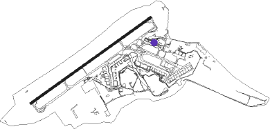
Runway info
| Runway 06 / 24 | ||
| length | 2550m (8366ft) | |
| bearing | 71° / 251° | |
| width | 44m (144ft) | |
| surface | asphalt | |
| displ threshold | 211m (692ft) / 208m (682ft) | |
| blast zone | 62m (203ft) / 61m (200ft) | |
Nearby beacons
| code | identifier | dist | bearing | frequency |
|---|---|---|---|---|
| EDN | EDINBURGH NDB | 2.6 | 64° | 341 |
| UW | EDINBURGH NDB | 5.9 | 254° | 368 |
| TLA | TALLA VOR/DME | 27 | 181° | 113.80 |
| PTH | PERTH VOR | 29.6 | 357° | 110.40 |
| LUK | LEUCHARS TACAN | 30 | 49° | 110.50 |
| DND | DUNDEE NDB | 31.3 | 24° | 394 |
| GLO | LOWTHER DME | 36.1 | 215° | 109.65 |
Departure and arrival routes
| Transition altitude | 6000ft |
| SID end points | distance | outbound heading | |
|---|---|---|---|
| RW06 | |||
| TLA6D | 27mi | 181° | |
| GOSA1D | 30mi | 259° | |
| GRIC4D | 19mi | 306° | |
| RW24 | |||
| TLA6C | 27mi | 181° | |
| GOSA1C | 30mi | 259° | |
| GRIC3C | 19mi | 306° | |
| STAR starting points | distance | inbound heading | |
|---|---|---|---|
| ALL | |||
| TUNS1E | 74.5 | 63° | |
| GIRV1E | 69.8 | 64° | |
| PTH1G | 29.6 | 177° | |
| AGPE1E | 68.6 | 301° | |
| INPI1E | 66.2 | 337° | |
Holding patterns
| STAR name | hold at | type | turn | heading* | altitude | leg | speed limit |
|---|---|---|---|---|---|---|---|
| AGPE1E | TARTN | VHF | left | 195 (15)° | 7000ft - 14000ft | DME 3.5mi | 230 |
| GIRV1E | TARTN | VHF | left | 195 (15)° | 7000ft - 14000ft | DME 3.5mi | 230 |
| INPI1E | TARTN | VHF | left | 195 (15)° | 7000ft - 14000ft | DME 3.5mi | 230 |
| PTH1G | STIRA | VHF | right | 54 (234)° | 7000ft - 14000ft | DME 4.0mi | 230 |
| TUNS1E | TARTN | VHF | left | 195 (15)° | 7000ft - 14000ft | DME 3.5mi | 230 |
| *) magnetic outbound (inbound) holding course | |||||||
Disclaimer
The information on this website is not for real aviation. Use this data with the X-Plane flight simulator only! Data taken with kind consent from X-Plane 12 source code and data files. Content is subject to change without notice.