Lossiemouth - Raf Lossiemouth
Airport details
| Country | United Kingdom |
| State | Scotland |
| Region | EG |
| Airspace | Scottish Ctr |
| Municipality | Moray |
| Elevation | 41ft (12m) |
| Timezone | GMT +0 |
| Coordinates | 57.70502, -3.33914 |
| Magnetic var | |
| Type | land |
| Available since | X-Plane v10.40 |
| ICAO code | EGQS |
| IATA code | LMO |
| FAA code | n/a |
Communication
| RAF Lossiemouth Lossiemouth Tower | 118.900 |
| RAF Lossiemouth Lossiemouth Approach | 123.300 |
| RAF Lossiemouth Lossiemouth Departure | 119.575 |
Approach frequencies
| ILS-cat-I | RW23 | 111.55 | 18.00mi |
| 3° GS | RW23 | 111.55 | 18.00mi |
Nearby Points of Interest:
Gordonstoun
-St Peter's Kirk, Duffus
-Sculptor’s Cave
-Elgin Museum
-Braco's Banking House
-Dr Gray's Hospital
-Coxton Tower
-Birnie Symbol Stone
-Milton Brodie House
-River Spey
-Tugnet, Fishing Station
-Tugnet Ice House
-Fochabers Bridge
-Bellie, Old Parish Church, Burial Ground, Gordon Tomb
-Fochabers, The Square, Bellie Parish Church
-St Ninian's Church, Tynet
-Kincorth House And Garden Walls
-Moy House
-Findhorn Viaduct
-Arndilly House
-Findochty Castle
-Aberlour House
-Victoria Bridge, Aberlour
-Kininvie House
-Old Bridge Of Keith, River Islay, Regent Street, Keith
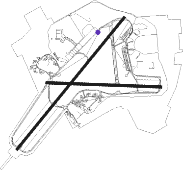
Runway info
Runway 10 / 28  | ||
| length | 1852m (6076ft) | |
| bearing | 93° / 273° | |
| width | 46m (151ft) | |
| surface | asphalt | |
| displ threshold | 101m (331ft) / 0m (0ft) | |
| blast zone | 155m (509ft) / 26m (85ft) | |
| Runway 05 / 23 | ||
| length | 2758m (9049ft) | |
| bearing | 61° / 241° | |
| width | 45m (148ft) | |
| surface | asphalt | |
| displ threshold | 0m (0ft) / 84m (276ft) | |
| blast zone | 34m (112ft) / 25m (82ft) | |
Nearby beacons
| code | identifier | dist | bearing | frequency |
|---|---|---|---|---|
| LSM | LOSSIEMOUTH TACAN | 0.4 | 65° | 111.30 |
| INS | INVERNESS VOR/DME | 24.5 | 257° | 109.20 |
| IVR | INVERNESS NDB | 24.7 | 257° | 328 |
| WCK | WICK NDB | 45.3 | 20° | 344 |
| WIK | WICK VOR/DME | 45.9 | 18° | 113.60 |
Departure and arrival routes
| Transition altitude | 3000ft |
| SID end points | distance | outbound heading | |
|---|---|---|---|
| RW05 | |||
| MID05A | 25mi | 61° | |
| RW10 | |||
| MID10A | 25mi | 93° | |
Disclaimer
The information on this website is not for real aviation. Use this data with the X-Plane flight simulator only! Data taken with kind consent from X-Plane 12 source code and data files. Content is subject to change without notice.