Dunsfold
Airport details
| Country | United Kingdom |
| State | England |
| Region | EG |
| Airspace | London Ctr |
| Municipality | Waverley |
| Elevation | 168ft (51m) |
| Timezone | GMT +0 |
| Coordinates | 51.12075, -0.53558 |
| Magnetic var | |
| Type | land |
| Available since | X-Plane v10.40 |
| ICAO code | EGTD |
| IATA code | n/a |
| FAA code | n/a |
Communication
| Dunsfold Tower frequency | 119.100 |
Nearby Points of Interest:
Lodge To Baynards Park
-Tigbourne Court
-Orchards
-Munstead Wood
-Hurt Wood Mill
-Busbridge War Memorial
-Chinthurst Hill Close House Gatehouse
-Godalming Congregational Church
-Surrey Hills AONB
-Godalming Friends Meeting House
-Salvation Army Hall, Godalming
-Chilworth Manor
-Albury Park
-Billingshurst Unitarian Chapel
-Church Hill House
-Abinger Common War Memorial
-Goddards
-Farnham Road Hospital
-Rodboro Buildings
-Broome Hall
-Undershaw
-Greyfriars
-Wanborough Manor
-Pitshill
-Town Hall
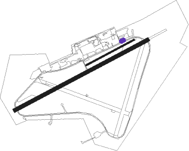
Runway info
Runway 07 / 25  | ||
| length | 1878m (6161ft) | |
| bearing | 75° / 255° | |
| width | 46m (151ft) | |
| surface | asphalt | |
| displ threshold | 158m (518ft) / 44m (144ft) | |
| Runway 6 / 24 | ||
| length | 672m (2205ft) | |
| bearing | 75° / 255° | |
| width | 20m (66ft) | |
| surface | grass | |
| displ threshold | 34m (112ft) / 23m (75ft) | |
Nearby beacons
| code | identifier | dist | bearing | frequency |
|---|---|---|---|---|
| MID | MIDHURST VOR/DME | 5.2 | 233° | 114 |
| OCK | OCKHAM VOR/DME | 11.5 | 26° | 115.30 |
| EPM | EPSOM NDB | 13.4 | 39° | 316 |
| BLC | DME | 16.8 | 303° | 116.20 |
| BLK | BLACKBUSHE NDB | 16.8 | 303° | 328 |
| ODH | ODIHAM TACAN | 16.9 | 285° | 109.60 |
| GWC | GOODWOOD VOR/DME | 18 | 220° | 114.75 |
| SHM | SHOREHAM NDB | 19.3 | 140° | 332 |
| SRH | DME-ILS | 19.3 | 140° | 109.95 |
| LON | LONDON VOR/DME | 22.1 | 11° | 113.60 |
| WOD | WOODLEY NDB | 23.7 | 314° | 352 |
| BUR | BURNHAM NDB | 24.5 | 340° | 421 |
| BIG | BIGGIN VOR/DME | 24.8 | 70° | 115.10 |
| MAY | MAYFIELD VOR/DME | 25.3 | 99° | 117.90 |
| CHT | CHILTERN NDB | 30.1 | 2° | 277 |
| SAM | SOUTHAMPTON VOR/DME | 32.1 | 258° | 113.35 |
| LCY | LONDON CITY NDB | 32.3 | 58° | 322 |
| EAS | SOUTHAMPTON (EASTLEIGH) NDB | 32.5 | 259° | 391 |
| SFD | SEAFORD VOR/DME | 32.9 | 119° | 117 |
| CPT | COMPTON VOR/DME | 33.9 | 298° | 114.35 |
| BNN | BOVINGDON VOR/DME | 36.3 | 359° | 113.75 |
| BSO | BENSON TACAN | 36.4 | 311° | 110 |
| HEN | HENTON NDB | 39.5 | 338° | 433 |
| LAM | LAMBOURNE VOR/DME | 40.7 | 53° | 115.60 |
| BPK | BROOKMANS PARK VOR/DME | 41 | 34° | 117.50 |
| DET | DETLING VOR/DME | 44 | 81° | 117.30 |
| HLS | DME | 44.7 | 88° | 115.95 |
| LSH | HEADCORN (LASHENDEN) NDB | 44.7 | 88° | 340 |
| WCO | WESTCOTT NDB | 46.7 | 330° | 335 |
| LUT | LUTON NDB | 47.6 | 20° | 345 |
| OX | OXFORD NDB | 51.9 | 312° | 367 |
| LYD | LYDD VOR/DME | 53.8 | 95° | 114.05 |
| SND | SOUTHEND NDB | 53.8 | 70° | 362 |
| LZD | LYDD NDB | 56.5 | 96° | 397 |
| BKY | BARKWAY VOR/DME | 56.7 | 35° | 116.25 |
| DVR | DOVER VOR/DME | 71.4 | 89° | 114.95 |
Disclaimer
The information on this website is not for real aviation. Use this data with the X-Plane flight simulator only! Data taken with kind consent from X-Plane 12 source code and data files. Content is subject to change without notice.