Oxford - Oxford Kidlington
Airport details
| Country | United Kingdom |
| State | England |
| Region | EG |
| Airspace | London Ctr |
| Municipality | Cherwell District |
| Elevation | 270ft (82m) |
| Timezone | GMT +0 |
| Coordinates | 51.83694, -1.32000 |
| Magnetic var | |
| Type | land |
| Available since | X-Plane v10.40 |
| ICAO code | EGTK |
| IATA code | OXF |
| FAA code | n/a |
Communication
| Oxford Kidlington Oxford Information | 136.230 |
| Oxford Kidlington Oxford Ground | 121.955 |
| Oxford Kidlington Oxford Tower | 133.430 |
| Oxford Kidlington Oxford Approach | 125.090 |
| Oxford Kidlington Oxford Radar | 125.090 |
Approach frequencies
| ILS-cat-I | RW19 | 108.35 | 18.00mi |
| 3° GS | RW19 | 108.35 | 18.00mi |
Nearby Points of Interest:
Kidlington railway station
-The Bell Inn, Long Hanborough
-Swinford Toll Bridge
-Eynsham Hall
-Rousham House
-66, Banbury Road
-Belsyre Court
-Kiddington Hall
-Radcliffe Observatory
-Radcliffe Infirmary
-Middleton Park, Oxfordshire
-Rewley Road Swing Bridge
-Lamb & Flag
-Pusey House, Oxford
-Upplands runinskrifter 104
-Weston Library
-Buildings of Nuffield College, Oxford
-Indian Institute
-Holywell Manor, Oxford
-County Hall
-Osney Abbey
-Codrington Library
-Oxford Town Hall
-Blue Boar Quadrangle
-Radcliffe Quadrangle
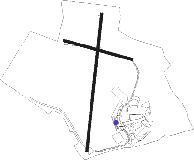
Runway info
Runway 01 / 19  | ||
| length | 1506m (4941ft) | |
| bearing | 17° / 197° | |
| width | 30m (98ft) | |
| surface | asphalt | |
| displ threshold | 123m (404ft) / 66m (217ft) | |
| blast zone | 50m (164ft) / 0m (0ft) | |
| Runway 11 / 29 | ||
| length | 758m (2487ft) | |
| bearing | 103° / 283° | |
| width | 28m (92ft) | |
| surface | asphalt | |
Nearby beacons
| code | identifier | dist | bearing | frequency |
|---|---|---|---|---|
| OX | OXFORD NDB | 0.2 | 224° | 367 |
| BZ | BRIZE NORTON NDB | 11.7 | 253° | 386 |
| BZN | BRIZE NORTON TACAN | 11.8 | 253° | 111.90 |
| WCO | WESTCOTT NDB | 13.3 | 87° | 335 |
| BSO | BENSON TACAN | 15.6 | 135° | 110 |
| FFA | FAIRFORD TACAN | 20 | 252° | 113.40 |
| HEN | HENTON NDB | 20.2 | 98° | 433 |
| CPT | COMPTON VOR/DME | 21 | 164° | 114.35 |
| DTY | DAVENTRY VOR/DME | 21.9 | 31° | 116.40 |
| WOD | WOODLEY NDB | 28.3 | 131° | 352 |
| BNN | BOVINGDON VOR/DME | 29.3 | 98° | 113.75 |
| BUR | BURNHAM NDB | 30.6 | 116° | 421 |
| GST | GLOUCESTERSHIRE NDB | 31.6 | 274° | 331 |
| CHT | CHILTERN NDB | 32.4 | 105° | 277 |
| CIT | CRANFIELD NDB | 33.2 | 69° | 850 |
| HON | HONILEY VOR/DME | 33.6 | 327° | 113.65 |
| BLC | DME | 35.5 | 137° | 116.20 |
| BLK | BLACKBUSHE NDB | 35.5 | 137° | 328 |
| LON | LONDON VOR/DME | 38.1 | 112° | 113.60 |
| ODH | ODIHAM TACAN | 38.8 | 148° | 109.60 |
| BHX | BIRMINGHAM NDB | 40.3 | 325° | 406 |
| BDN | BOSCOMBE DOWN TACAN | 44.3 | 212° | 108.20 |
| OCK | OCKHAM VOR/DME | 45.6 | 121° | 115.30 |
| EPM | EPSOM NDB | 47 | 119° | 316 |
| LE | LEICESTER NDB | 47.3 | 20° | 383 |
| EAS | SOUTHAMPTON (EASTLEIGH) NDB | 52.9 | 182° | 391 |
| SAM | SOUTHAMPTON VOR/DME | 52.9 | 182° | 113.35 |
| WBA | WOLVERHAMPTON NDB | 53.5 | 306° | 356 |
| WOL | DME | 53.5 | 306° | 108.60 |
| MID | MIDHURST VOR/DME | 53.7 | 138° | 114 |
| WIT | WITTERING TACAN | 55.2 | 47° | 117.60 |
| EMW | EAST MIDLANDS NDB | 59.7 | 352° | 393 |
| EME | EAST MIDLANDS NDB | 59.9 | 7° | 353 |
| TNL | TATENHILL NDB | 60.9 | 335° | 327 |
| GWC | GOODWOOD VOR/DME | 62.6 | 150° | 114.75 |
| MLD | MILDENHALL TACAN | 73.8 | 74° | 115.90 |
Disclaimer
The information on this website is not for real aviation. Use this data with the X-Plane flight simulator only! Data taken with kind consent from X-Plane 12 source code and data files. Content is subject to change without notice.