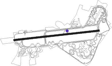
Fairford - Raf Fairford
Airport details
| Country | United Kingdom |
| State | England |
| Region | EG |
| Airspace | London Ctr |
| Municipality | Cotswold District |
| Elevation | 285ft (87m) |
| Timezone | GMT +0 |
| Coordinates | 51.68352, -1.79001 |
| Magnetic var | |
| Type | land |
| Available since | X-Plane v10.40 |
| ICAO code | EGVA |
| IATA code | FFD |
| FAA code | n/a |
Communication
| RAF Fairford Brize Director | 124.275 |
| RAF Fairford Fairford Tower | 124.800 |
| RAF Fairford Brize Radar | 122.100 |
| RAF Fairford Brize Radar | 127.250 |
| RAF Fairford Brize Radar | 119.000 |
Approach frequencies
| ILS-cat-I | RW27 | 111.1 | 18.00mi |
| ILS-cat-I | RW09 | 111.1 | 18.00mi |
| 2.8° GS | RW27 | 111.1 | 18.00mi |
| 2.7° GS | RW09 | 111.1 | 18.00mi |
Nearby Points of Interest:
The Round House
-Hannington Hall
-Jenner's School
-Halfpenny Bridge
-Convent Of St Clotilde
-Elmlea Meadows
-St. John's Bridge, Lechlade
-Wildmoorway Meadows
-Ampney Park
-Barnsley Park
-Winson Meadows
-Barnsley Warren
-Cirencester Town railway station
-The Spectrum Building (formerly The Renault Distribution Centre)
-Cecily Hill Barracks
-Beckett Hall
-Swindon Town Hall
-Radcot Bridge
-Westwell War Memorial
-Corn Exchange And Town Hall
-The Crumpled Horn
-Coate Water Diving Platform
-Barrington Park
-Sherborne House, Gloucestershire
-Bampton Castle, Oxfordshire
Nearby beacons
| code | identifier | dist | bearing | frequency |
|---|---|---|---|---|
| FFA | FAIRFORD TACAN | 0.3 | 256° | 113.40 |
| BZN | BRIZE NORTON TACAN | 7.9 | 71° | 111.90 |
| BZ | BRIZE NORTON NDB | 8 | 71° | 386 |
| GST | GLOUCESTERSHIRE NDB | 18.8 | 299° | 331 |
| OX | OXFORD NDB | 19.5 | 72° | 367 |
| CPT | COMPTON VOR/DME | 24.2 | 109° | 114.35 |
| BSO | BENSON TACAN | 26 | 96° | 110 |
| OF | FILTON NDB | 31.4 | 259° | 325 |
| BDN | BOSCOMBE DOWN TACAN | 32.1 | 176° | 108.20 |
| WCO | WESTCOTT NDB | 32.3 | 78° | 335 |
| WOD | WOODLEY NDB | 36.7 | 104° | 352 |
| HEN | HENTON NDB | 37.4 | 86° | 433 |
| DTY | DAVENTRY VOR/DME | 38.9 | 54° | 116.40 |
| BRI | BRISTOL NDB | 39.1 | 252° | 414 |
| HON | HONILEY VOR/DME | 40.6 | 11° | 113.65 |
| BLC | DME | 41.4 | 111° | 116.20 |
| BLK | BLACKBUSHE NDB | 41.4 | 111° | 328 |
| ODH | ODIHAM TACAN | 41.5 | 118° | 109.60 |
| BHX | BIRMINGHAM NDB | 46.3 | 3° | 406 |
| EAS | SOUTHAMPTON (EASTLEIGH) NDB | 46.6 | 149° | 391 |
| SAM | SOUTHAMPTON VOR/DME | 46.8 | 149° | 113.35 |
| VLN | YEOVILTON TACAN | 51.7 | 231° | 111 |
| WBA | WOLVERHAMPTON NDB | 52.9 | 330° | 356 |
| WOL | DME | 52.9 | 330° | 108.60 |
| BIA | BOURNEMOUTH NDB | 54.4 | 183° | 339 |
| YVL | DME | 55.1 | 229° | 109.05 |
| YVL | YEOVIL NDB | 55.3 | 230° | 343 |
| LE | LEICESTER NDB | 62 | 39° | 383 |
Departure and arrival routes
| Transition altitude | 3000ft |
| SID end points | distance | outbound heading | |
|---|---|---|---|
| RW09 | |||
| GIBM1A | 20mi | 40° | |
| MAXO1A | 20mi | 314° | |
| RW27 | |||
| MAXO1B | 20mi | 314° | |
Disclaimer
The information on this website is not for real aviation. Use this data with the X-Plane flight simulator only! Data taken with kind consent from X-Plane 12 source code and data files. Content is subject to change without notice.