Middle Wallop - Aac Middle Wallop
Airport details
| Country | United Kingdom |
| State | England |
| Region | EG |
| Airspace | London Ctr |
| Municipality | Test Valley |
| Elevation | 293ft (89m) |
| Timezone | GMT +0 |
| Coordinates | 51.14850, -1.56186 |
| Magnetic var | |
| Type | land |
| Available since | X-Plane v10.30 |
| ICAO code | EGVP |
| IATA code | n/a |
| FAA code | n/a |
Communication
| AAC Middle Wallop Middle Wallop Tower | 118.600 |
| AAC Middle Wallop Middle Wallop Approach | 123.300 |
Nearby Points of Interest:
Amport House
-Bury Hill
-Stockbridge War Memorial
-Marshcourt
-Andover Guildhall
-Wilbury House
-Horsebridge railway station
-Kings Somborne War Memorial
-Redenham Park
-Rookley House
-All Saints Church, Idmiston
-St Mary's Church, Ashley
-St Mary's Church, South Tidworth
-Tedworth House
-Biddesden House
-Amesbury Abbey
-Tidbury Ring
-Merdon Castle
-Lake House
-Fosbury Camp
-Frowds Almshouses
-Brunton House
-Sadler's Mill
-Salisbury War Memorial And Railings
-The Guildhall
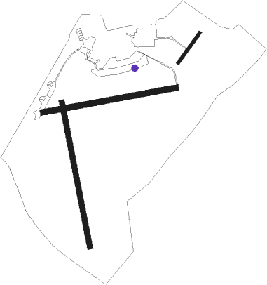
Runway info
Runway 08 / 26  | ||
| length | 1097m (3599ft) | |
| bearing | 86° / 266° | |
| width | 45m (148ft) | |
| surface | grass | |
| displ threshold | 82m (269ft) / 0m (0ft) | |
| Runway 04 / 22 | ||
| length | 295m (968ft) | |
| bearing | 54° / 234° | |
| width | 26m (85ft) | |
| surface | asphalt | |
| Runway 17 / 35 | ||
| length | 1187m (3894ft) | |
| bearing | 170° / 350° | |
| width | 45m (148ft) | |
| surface | grass | |
Nearby beacons
| code | identifier | dist | bearing | frequency |
|---|---|---|---|---|
| BDN | BOSCOMBE DOWN TACAN | 7.1 | 270° | 108.20 |
| EAS | SOUTHAMPTON (EASTLEIGH) NDB | 13.9 | 133° | 391 |
| SAM | SOUTHAMPTON VOR/DME | 14.2 | 132° | 113.35 |
| ODH | ODIHAM TACAN | 23.6 | 82° | 109.60 |
| CPT | COMPTON VOR/DME | 24.2 | 45° | 114.35 |
| BIA | BOURNEMOUTH NDB | 24.6 | 217° | 339 |
| BLC | DME | 28.9 | 76° | 116.20 |
| BLK | BLACKBUSHE NDB | 28.9 | 76° | 328 |
| WOD | WOODLEY NDB | 31.4 | 66° | 352 |
| BSO | BENSON TACAN | 32.9 | 45° | 110 |
| FFA | FAIRFORD TACAN | 33.2 | 336° | 113.40 |
| GWC | GOODWOOD VOR/DME | 35.1 | 110° | 114.75 |
| MID | MIDHURST VOR/DME | 35.7 | 96° | 114 |
| BZN | BRIZE NORTON TACAN | 36 | 356° | 111.90 |
| BZ | BRIZE NORTON NDB | 36.1 | 356° | 386 |
| BUR | BURNHAM NDB | 39.9 | 67° | 421 |
| OX | OXFORD NDB | 42 | 19° | 367 |
| HEN | HENTON NDB | 46.7 | 52° | 433 |
| WCO | WESTCOTT NDB | 47.8 | 40° | 335 |
| GST | GLOUCESTERSHIRE NDB | 50 | 321° | 331 |
Instrument approach procedures
| runway | airway (heading) | route (dist, bearing) |
|---|---|---|
| RW26-Y | VP26A (255°) | VP26A 2300ft VP26I (3mi, 171°) 2000ft |
| RNAV | VP26I 2000ft VP26F (4mi, 266°) 2000ft EGVP (5mi, 267°) 319ft VPM02 (1mi, 263°) 1300ft VPM03 (7mi, 70°) VP26A (4mi, 86°) 2300ft VP26A (turn) 2300ft | |
| RW26-Z | VP26A (255°) | VP26A 2300ft VP26I (3mi, 171°) 2000ft |
| RNAV | VP26I 2000ft VP26F (4mi, 266°) 2000ft EGVP (5mi, 267°) 319ft (3073mi, 178°) 1000ft VPM03 (3076mi, 358°) VP26A (4mi, 86°) VP26A (turn) 2300ft | |
| RW35 | VP35A (29°) | VP35A 2300ft VP35I (4mi, 86°) 2000ft |
| RNAV | VP35I 2000ft VP35F (3mi, 350°) 2000ft EGVP (6mi, 356°) 310ft VPM01 (1mi, 317°) 1300ft VPM03 (6mi, 74°) VP26A (4mi, 86°) 2300ft VP26A (turn) 2300ft |
Disclaimer
The information on this website is not for real aviation. Use this data with the X-Plane flight simulator only! Data taken with kind consent from X-Plane 12 source code and data files. Content is subject to change without notice.