Weert - Budel
Airport details
| Country | Netherlands |
| State | North Brabant |
| Region | EH |
| Airspace | Amsterdam Ctr |
| Municipality | Budel |
| Elevation | 110ft (34m) |
| Timezone | GMT +1 |
| Coordinates | 51.25444, 5.60083 |
| Magnetic var | |
| Type | land |
| Available since | X-Plane v10.40 |
| ICAO code | EHBD |
| IATA code | n/a |
| FAA code | n/a |
Communication
| Budel Budel Radio | 122.155 |
Nearby Points of Interest:
Sint-Odakapel
-De Lichtenberg
-Sint-Antoniuskapel
-Kasteel Beverbeek
-Beverbeekhoeve
-Sint-Jozefkerk
-Muntgebouw
-Abdij Maria Hart
-Nijenborgh Castle
-Minderbroedersklooster
-Achel Abbey
-Braosheuf
-Hydroelectric power plant Roeven
-Sint-Lambertuskerk
-cemetery chapel Nederweert
-Sint-Michielscollege
-Michielshuis
-Onze-Lieve-Vrouw van Altijddurende Bijstandkapel
-Onze-Lieve-Vrouw Onbevlekt Ontvangenkerk
-statue of Sacred Heart of Jesus Christ
-Huize Robijnenhof
-Galdermansmolen
-Keyartmolen
-Dommelse Watermolen
-Sint Lambertuskerk
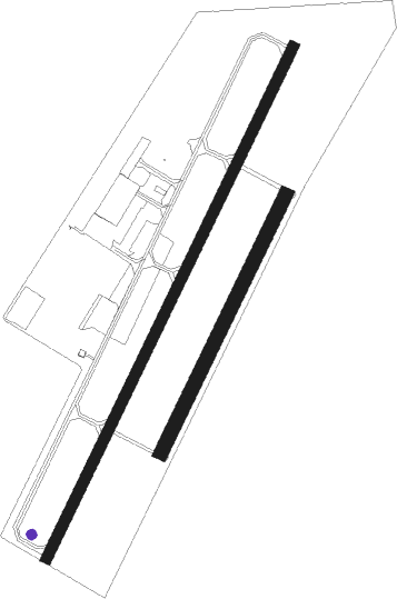
Runway info
Runway 03 / 21  | ||
| length | 1192m (3911ft) | |
| bearing | 43° / 223° | |
| width | 23m (75ft) | |
| surface | asphalt | |
| displ threshold | 50m (164ft) / 135m (443ft) | |
| Runway 03R / 21L | ||
| length | 602m (1975ft) | |
| bearing | 43° / 223° | |
| width | 30m (98ft) | |
| surface | grass | |
Nearby beacons
| code | identifier | dist | bearing | frequency |
|---|---|---|---|---|
| BBL | KLEINE BROGEL TACAN | 7.3 | 238° | 109.60 |
| EHV | EINDHOVEN TACAN | 14.3 | 311° | 117.20 |
| NW | MAASTRICHT NDB | 17.5 | 130° | 373 |
| MAS | MAASTRICHT VOR/DME | 21.7 | 128° | 108.60 |
| GIX | GEILENKIRCHEN TACAN | 24.2 | 123° | 108.10 |
| VKL | VOLKEL TACAN | 24.4 | 15° | 108.30 |
| FLO | FLORA VOR/DME | 28.7 | 231° | 112.05 |
| NID | DME | 28.9 | 57° | 115.50 |
| BUN | BRUNO VOR/DME | 29.6 | 260° | 110.60 |
| LAA | NIEDERRHEIN NDB | 29.8 | 59° | 352 |
| LMA | LIMA NDB | 30.6 | 82° | 311 |
| GZR | GILZE-RIJEN TACAN | 31.2 | 295° | 116.40 |
| ONL | LIEGE NDB | 33.2 | 185° | 290 |
| MHV | MOENCHENGLADBACH VOR | 33.4 | 91° | 109.80 |
| MHD | DME | 33.5 | 91° | 112.50 |
| LGE | LIEGE VOR/DME | 36.3 | 192° | 115.45 |
| LNO | OLNO VOR/DME | 40.3 | 171° | 112.80 |
| OB | BRUSSELS NDB | 42.2 | 251° | 293 |
| BBE | BEAUVECHAIN TACAN | 43.3 | 239° | 116 |
| HTB | BEAUVECHAIN NDB | 43.4 | 239° | 381 |
| SPI | SPRIMONT VOR/DME | 44.4 | 178° | 113.10 |
| HUL | HULDENBERG VOR/DME | 47.2 | 242° | 117.55 |
| SLV | SPA NDB | 48.1 | 158° | 386 |
| DLN | DEELEN TACAN | 49.2 | 19° | 112.20 |
| FRT | DME | 54.6 | 312° | 117.15 |
Departure and arrival routes
| Transition altitude | 3000ft |
| SID end points | distance | outbound heading | |
|---|---|---|---|
| RW03 | |||
| TENL2G | 64mi | 33° | |
| DIBI3G | 31mi | 82° | |
| OSGO2G | 13mi | 103° | |
| LNO4G | 40mi | 171° | |
| WOOD3G | 47mi | 277° | |
| ABNE2G | 97mi | 284° | |
| PESE2G | 46mi | 289° | |
| TULI3G | 93mi | 303° | |
| INKE3G | 46mi | 304° | |
| RW21 | |||
| TENL2H | 64mi | 33° | |
| DIBI3H | 31mi | 82° | |
| OSGO2H | 13mi | 103° | |
| LNO4H | 40mi | 171° | |
| WOOD3H | 47mi | 277° | |
| ABNE2H | 97mi | 284° | |
| PESE2H | 46mi | 289° | |
| TULI3H | 93mi | 303° | |
| INKE3H | 46mi | 304° | |
| STAR starting points | distance | inbound heading | |
|---|---|---|---|
| ALL | |||
| DENU2U | 73.0 | 89° | |
| HELE6U | 65.0 | 89° | |
| COA5U | 84.5 | 92° | |
| REDF4U | 126.8 | 105° | |
| LAMS4U | 131.0 | 120° | |
| MOLI4U | 132.7 | 122° | |
| INKE3U | 45.7 | 124° | |
| TOPA4U | 149.1 | 136° | |
| LOPI3U | 44.2 | 145° | |
| TENL3U | 64.2 | 213° | |
| RUME2U | 24.4 | 218° | |
| LMA2U | 30.6 | 262° | |
| LNO3U | 40.3 | 351° | |
Instrument approach procedures
| runway | airway (heading) | route (dist, bearing) |
|---|---|---|
| RW21 | BUDIP (245°) | BUDIP 3000ft BD373 (5mi, 276°) 2000ft |
| RNAV | BD373 2000ft BD374 (4mi, 223°) 2000ft EHBD (6mi, 223°) 161ft EHBD (turn) 700ft BD375 (2mi, 286°) 700ft BD376 (6mi, 42°) 1200ft BD377 (9mi, 90°) 2000ft BUDIP (1mi, 348°) BUDIP (turn) 2000ft |
Disclaimer
The information on this website is not for real aviation. Use this data with the X-Plane flight simulator only! Data taken with kind consent from X-Plane 12 source code and data files. Content is subject to change without notice.