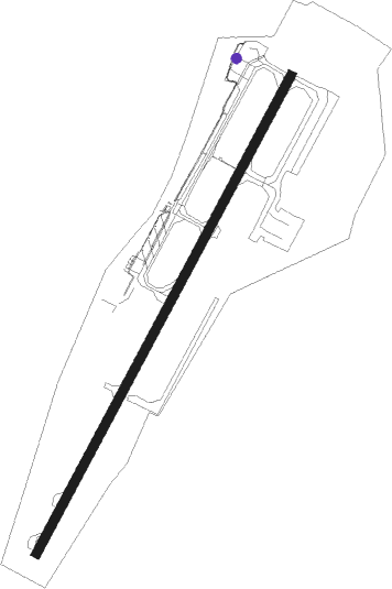
Maastricht Aachen
Airport details
| Country | Netherlands |
| State | Limburg |
| Region | EH |
| Airspace | Amsterdam Ctr |
| Municipality | Maastricht-Airport |
| Elevation | 375ft (114m) |
| Timezone | GMT +1 |
| Coordinates | 50.91583, 5.77694 |
| Magnetic var | |
| Type | land |
| Available since | X-Plane v10.40 |
| ICAO code | EHBK |
| IATA code | MST |
| FAA code | n/a |
Communication
| Maastricht Aachen ATIS | 124.580 |
| Maastricht Aachen Beek Delivery | 121.825 |
| Maastricht Aachen Beek Tower | 119.475 |
| Maastricht Aachen Beek Approach | 123.980 |
Approach frequencies
| ILS-cat-III | RW21 | 111.55 | 18.00mi |
| ILS-cat-I | RW03 | 111.55 | 18.00mi |
| 3° GS | RW21 | 111.55 | 18.00mi |
| 3° GS | RW03 | 111.55 | 18.00mi |
Nearby beacons
| code | identifier | dist | bearing | frequency |
|---|---|---|---|---|
| NW | MAASTRICHT NDB | 7.3 | 44° | 373 |
| MAS | MAASTRICHT VOR/DME | 7.7 | 73° | 108.60 |
| GIX | GEILENKIRCHEN TACAN | 10.5 | 80° | 108.10 |
| ONL | LIEGE NDB | 15.5 | 227° | 290 |
| BBL | KLEINE BROGEL TACAN | 19.1 | 309° | 109.60 |
| LGE | LIEGE VOR/DME | 19.5 | 229° | 115.45 |
| LNO | OLNO VOR/DME | 19.9 | 191° | 112.80 |
| FLO | FLORA VOR/DME | 24.4 | 267° | 112.05 |
| SPI | SPRIMONT VOR/DME | 24.7 | 201° | 113.10 |
| SLV | SPA NDB | 26.7 | 163° | 386 |
| MHD | DME | 33 | 66° | 112.50 |
| NVO | NOERVENICH VORTAC | 33 | 96° | 116.20 |
| MHV | MOENCHENGLADBACH VOR | 33.1 | 66° | 109.80 |
| WNN | DME | 34.1 | 95° | 109.85 |
| EHV | EINDHOVEN TACAN | 35.3 | 323° | 117.20 |
| LMA | LIMA NDB | 35.9 | 54° | 311 |
| BUN | BRUNO VOR/DME | 37.3 | 282° | 110.60 |
| DY | DUESSELDORF NDB | 38.2 | 70° | 284 |
| DUS | DUESSELDORF VOR/DME | 42.9 | 69° | 115.15 |
| NID | DME | 43.3 | 28° | 115.50 |
| LAA | NIEDERRHEIN NDB | 43.7 | 30° | 352 |
| VKL | VOLKEL TACAN | 44.4 | 355° | 108.30 |
| GZR | GILZE-RIJEN TACAN | 50.3 | 308° | 116.40 |
| SPA | SPANGDAHLEM TACAN | 66.3 | 135° | 109.50 |
Departure and arrival routes
| Transition altitude | 3000ft |
| SID end points | distance | outbound heading | |
|---|---|---|---|
| RW03 | |||
| TENL1A | 82mi | 20° | |
| OSGO1A | 17mi | 27° | |
| NETE1A | 31mi | 50° | |
| NVO2A | 33mi | 96° | |
| LNO3A | 20mi | 191° | |
| PESE3A | 63mi | 299° | |
| RW21 | |||
| TENL1B | 82mi | 20° | |
| OSGO1B | 17mi | 27° | |
| NETE1B | 31mi | 50° | |
| NVO2B | 33mi | 96° | |
| LNO2B | 20mi | 191° | |
| PESE3B | 63mi | 299° | |
| STAR starting points | distance | inbound heading | |
|---|---|---|---|
| ALL | |||
| LNO1M | 19.9 | 11° | |
| RUME2M | 42.5 | 189° | |
| NETE1M | 30.9 | 230° | |
| MODR1M | 13.3 | 252° | |
| NVO2M | 33.0 | 276° | |
Holding patterns
| STAR name | hold at | type | turn | heading* | altitude | leg | speed limit |
|---|---|---|---|---|---|---|---|
| LNO1M | NW | FIX | right | 31 (211)° | > 3000ft | 1.0min timed | 220 |
| MODR1M | NW | FIX | right | 31 (211)° | > 3000ft | 1.0min timed | 220 |
| NETE1M | NW | FIX | right | 31 (211)° | > 3000ft | 1.0min timed | 220 |
| NVO2M | NW | FIX | right | 31 (211)° | > 3000ft | 1.0min timed | 220 |
| OSGO1M | NW | FIX | right | 31 (211)° | > 3000ft | 1.0min timed | 220 |
| RUME2M | NW | FIX | right | 31 (211)° | > 3000ft | 1.0min timed | 220 |
| *) magnetic outbound (inbound) holding course | |||||||
Disclaimer
The information on this website is not for real aviation. Use this data with the X-Plane flight simulator only! Data taken with kind consent from X-Plane 12 source code and data files. Content is subject to change without notice.
