Lemelerveld - Aero Club Salland
Airport details
| Country | Netherlands |
| State | Overijssel |
| Region | |
| Airspace | Amsterdam Ctr |
| Municipality | Lemelerveld |
| Elevation | 16ft (5m) |
| Timezone | GMT +1 |
| Coordinates | 52.46802, 6.32447 |
| Magnetic var | |
| Type | land |
| Available since | X-Plane v10.30 |
| ICAO code | EHDS |
| IATA code | n/a |
| FAA code | n/a |
Communication
Nearby Points of Interest:
Den Aalshorst
-Lourdesgrot
-'t Witte Huis
-Kasteel Eerde, Ommen
-De Colckhof
-watertoren Raalte
-Plaskerk
-Boerderij Strunk
-Molen op de Elshof
-Het Nieuwe Verlaat
-Familiegraf van de heren van Windesheim (Zwolle)
-Windesheim manor
-Sprengenberg, Haarle
-Openlucht zwembad, Zwolle
-De Jonge Gerrit
-De Gelder
-Marechausseekazerne
-Thomas à Kempisstraat 38, Zwolle
-watertoren Daarle
-Oude Watertoren
-Diezerstraat 93, Zwolle
-Koestraat 33, Zwolle
-De Witte Leeuw
-Huize Den Doorn
-Stadhuis, Zwolle
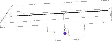
Runway info
| Runway 09 / 27 | ||
| length | 1122m (3681ft) | |
| bearing | 91° / 271° | |
| width | 5m (16ft) | |
| surface | gravel | |
Nearby beacons
| code | identifier | dist | bearing | frequency |
|---|---|---|---|---|
| RKN | DME | 25.7 | 127° | 116.80 |
| DLN | DEELEN TACAN | 29.7 | 228° | 112.20 |
| FRO | DME | 29.8 | 269° | 111.40 |
| EEL | EELDE (GRONINGEN) VOR/DME | 43.6 | 26° | 112.40 |
| LWD | LEEUWARDEN TACAN | 49.9 | 323° | 114.70 |
| LAA | NIEDERRHEIN NDB | 52.3 | 190° | 352 |
| NID | DME | 52.5 | 192° | 115.50 |
| VKL | VOLKEL TACAN | 53.8 | 217° | 108.30 |
| BOT | BOTTROP NDB | 58.9 | 142° | 406 |
Disclaimer
The information on this website is not for real aviation. Use this data with the X-Plane flight simulator only! Data taken with kind consent from X-Plane 12 source code and data files. Content is subject to change without notice.