Athboy
Airport details
| Country | Ireland |
| State | County Meath |
| Region | EI |
| Airspace | Shannon Ctr |
| Municipality | The Municipal District of Kells |
| Elevation | 229ft (70m) |
| Timezone | GMT +0 |
| Coordinates | 53.63778, -6.87861 |
| Magnetic var | |
| Type | land |
| Available since | X-Plane v10.40 |
| ICAO code | EIMH |
| IATA code | n/a |
| FAA code | n/a |
Communication
| Athboy Athboy Radio | 118.550 |
Nearby Points of Interest:
St. Columb's House
-Hill of Tara
-Loughcrew
-Balrath Cross
-Taghmon Church
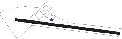
Runway info
| Runway 11 / 29 | ||
| length | 665m (2182ft) | |
| bearing | 97° / 277° | |
| width | 18m (59ft) | |
| surface | grass | |
| displ threshold | 109m (358ft) / 0m (0ft) | |
Nearby beacons
| code | identifier | dist | bearing | frequency |
|---|---|---|---|---|
| MCM | DME | 16.3 | 355° | 114.40 |
| OE | DUBLIN NDB | 20.3 | 115° | 316 |
| DUB | DUBLIN VOR/DME | 22 | 104° | 114.90 |
| GMN | DME | 22.9 | 89° | 112.90 |
| GMN | GORMANSTON NDB | 23.2 | 89° | 334 |
| DAP | COLLINSTOWN VOR/DME | 24.2 | 110° | 111.20 |
| BAL | BALDONNEL VOR/DME | 25.4 | 128° | 115.80 |
| OP | DUBLIN NDB | 29.6 | 107° | 397 |
| KLY | KILLINEY NDB | 35.3 | 115° | 378 |
| WTP | DME | 41.3 | 233° | 116.30 |
| GTG | DME | 53.9 | 137° | 114.15 |
Disclaimer
The information on this website is not for real aviation. Use this data with the X-Plane flight simulator only! Data taken with kind consent from X-Plane 12 source code and data files. Content is subject to change without notice.