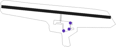
Sligo
Airport details
| Country | Ireland |
| State | County Sligo |
| Region | EI |
| Airspace | Shannon Ctr |
| Municipality | Sligo Municipal Borough District |
| Elevation | 20ft (6m) |
| Timezone | GMT +0 |
| Coordinates | 54.27911, -8.59784 |
| Magnetic var | |
| Type | land |
| Available since | X-Plane v10.40 |
| ICAO code | EISG |
| IATA code | SXL |
| FAA code | n/a |
Communication
| Sligo Sligo Tower | 122.100 |
Nearby beacons
| code | identifier | dist | bearing | frequency |
|---|---|---|---|---|
| SLG | SLIGO NDB | 0 | 260° | 384 |
| OK | CONNAUGHT NDB | 21.6 | 196° | 398 |
| CON | CONNAUGHT VOR/DME | 23.6 | 211° | 117.40 |
| KNK | CONNAUGHT NDB | 25.8 | 222° | 364 |
| CFN | DONEGAL NDB | 46.8 | 19° | 361 |
Instrument approach procedures
| runway | airway (heading) | route (dist, bearing) |
|---|---|---|
| RW10-Y | SG201 (81°) | SG201 3000ft LAZBE (5mi, 17°) 3000ft |
| RW10-Y | SG202 (96°) | SG202 3000ft LAZBE (5mi, 96°) 3000ft |
| RW10-Y | SG203 (114°) | SG203 3000ft LAZBE (5mi, 197°) 3000ft |
| RNAV | LAZBE 3000ft BAFBI (4mi, 96°) 1830ft SG210 (6mi, 96°) 61ft LAZBE (10mi, 276°) 3000ft LAZBE (turn) 3000ft | |
| RW10-Z | SG201 (81°) | SG201 3000ft LAZBE (5mi, 17°) 3000ft |
| RW10-Z | SG202 (96°) | SG202 3000ft LAZBE (5mi, 96°) 3000ft |
| RW10-Z | SG203 (114°) | SG203 3000ft LAZBE (5mi, 197°) 3000ft |
| RNAV | LAZBE 3000ft BAFBI (4mi, 96°) 1800ft SG205 (4mi, 96°) 506ft LAZBE (8mi, 276°) 3000ft LAZBE (turn) 3000ft | |
| RW28 | SG206 (261°) | SG206 3700ft OFCER (5mi, 198°) 3000ft |
| RW28 | SG207 (276°) | SG207 3700ft OFCER (5mi, 276°) 3000ft |
| RW28 | SG208 (293°) | SG208 3000ft OFCER (5mi, 16°) 3000ft |
| RNAV | OFCER 3000ft OGDUM (5mi, 276°) 1800ft EISG (6mi, 276°) 62ft SG209 (5mi, 277°) OFCER (15mi, 96°) 3000ft OFCER (turn) 3000ft |
Disclaimer
The information on this website is not for real aviation. Use this data with the X-Plane flight simulator only! Data taken with kind consent from X-Plane 12 source code and data files. Content is subject to change without notice.
