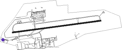
Billund
Airport details
| Country | Denmark |
| State | Region of Southern Denmark |
| Region | EK |
| Airspace | Copenhagen Ctr |
| Municipality | Billund Municipality |
| Elevation | 247ft (75m) |
| Timezone | GMT +1 |
| Coordinates | 55.73758, 9.16940 |
| Magnetic var | |
| Type | land |
| Available since | X-Plane v10.40 |
| ICAO code | EKBI |
| IATA code | BLL |
| FAA code | n/a |
Communication
| Billund ATIS | 118.775 |
| Billund Tower | 119.000 |
| Billund Approach | 127.575 |
Approach frequencies
| ILS-cat-III | RW09 | 109.75 | 18.00mi |
| ILS-cat-III | RW27 | 110.7 | 18.00mi |
| 3° GS | RW09 | 109.75 | 18.00mi |
| 3° GS | RW27 | 110.7 | 18.00mi |
Nearby beacons
| code | identifier | dist | bearing | frequency |
|---|---|---|---|---|
| KD | KOLDING NDB | 18.5 | 151° | 357 |
| VAM | DME | 18.8 | 151° | 110.05 |
| EJ | ESBJERG NDB | 19.8 | 247° | 400 |
| ESE | DME | 24.4 | 251° | 116.60 |
| HP | ESBJERG NDB | 29 | 253° | 376 |
| VJ | STAUNING NDB | 29.2 | 289° | 328 |
| SKR | VOJENS/SKRYDSTRUP VORTAC | 30.5 | 175° | 110.40 |
| VO | VOJENS/SKRYDSTRUP NDB | 31 | 169° | 321 |
| LME | DME | 31.4 | 287° | 115.35 |
| AU | STAUNING NDB | 32.4 | 287° | 346 |
| KAR | KARUP TACAN | 34 | 344° | 110 |
| RAM | DME | 55.3 | 307° | 111.85 |
| WES | DME-ILS | 57.1 | 225° | 111.50 |
| ALS | ALSIE VOR | 57.3 | 135° | 114.70 |
| SLT | WESTERLAND/SYLT NDB | 58.9 | 221° | 387 |
Departure and arrival routes
| Transition altitude | 3000ft |
| SID end points | distance | outbound heading | |
|---|---|---|---|
| RW09 | |||
| INTE2B | 30mi | 26° | |
| ABIN6B | 31mi | 74° | |
| GOKI4B | 18mi | 88° | |
| RIDS7B | 29mi | 100° | |
| ALS6B | 57mi | 135° | |
| MIKR5B | 39mi | 252° | |
| BAMP5B | 31mi | 277° | |
| RERP2B | 55mi | 307° | |
| RW27 | |||
| INTE2A | 30mi | 26° | |
| ABIN6A | 31mi | 74° | |
| RIDS6A | 29mi | 100° | |
| ALS6A | 57mi | 135° | |
| MIKR5A | 39mi | 252° | |
| ASKO4A | 19mi | 267° | |
| BAMP5A | 31mi | 277° | |
| RERP2A | 55mi | 307° | |
Instrument approach procedures
| runway | airway (heading) | route (dist, bearing) |
|---|---|---|
| RW09 | ADABO (89°) | ADABO 3000ft GELBA (4mi, 88°) 3000ft |
| RW09 | EPARA (100°) | EPARA 3000ft GELBA (6mi, 142°) 3000ft |
| RW09 | GIVNA (76°) | GIVNA 3000ft GELBA (6mi, 28°) 3000ft |
| RNAV | GELBA 3000ft OSLAS (5mi, 88°) 2000ft EKBI (7mi, 89°) 265ft (3377mi, 189°) 2000ft (turn) 2000ft | |
| RW27 | BEVRA (268°) | BEVRA 3000ft LOKSA (4mi, 268°) 3000ft |
| RW27 | ODNEV (255°) | ODNEV 3000ft LOKSA (6mi, 209°) 3000ft |
| RW27 | UVINA (280°) | UVINA 3000ft LOKSA (6mi, 323°) 3000ft |
| RNAV | LOKSA 3000ft ELRIT (6mi, 268°) 2000ft EKBI (6mi, 267°) 293ft (3377mi, 189°) 2000ft (turn) 2000ft |
Disclaimer
The information on this website is not for real aviation. Use this data with the X-Plane flight simulator only! Data taken with kind consent from X-Plane 12 source code and data files. Content is subject to change without notice.
