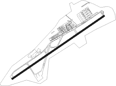
Luxembourg
Airport details
| Country | Luxembourg |
| State | Luxembourg |
| Region | EL |
| Airspace | Brussels Ctr |
| Municipality | Sandweiler |
| Elevation | 1231ft (375m) |
| Timezone | GMT +1 |
| Coordinates | 49.62325, 6.20433 |
| Magnetic var | |
| Type | land |
| Available since | X-Plane v10.40 |
| ICAO code | ELLX |
| IATA code | LUX |
| FAA code | n/a |
Communication
| Luxembourg ATIS | 134.755 |
| Luxembourg Tower | 118.105 |
| Luxembourg Approach | 118.905 |
| Luxembourg Departure | 118.905 |
Approach frequencies
| ILS-cat-III | RW24 | 110.7 | 18.00mi |
| ILS-cat-I | RW06 | 109.9 | 18.00mi |
| 3° GS | RW06 | 109.9 | 18.00mi |
| 3° GS | RW24 | 110.7 | 18.00mi |
Nearby Points of Interest:
Cemetery chapel Hostert (Niederanven)
-Hospice Saint-Jean
-Former Clinique Saint-François in Luxembourg City
-Codex Mariendalensis
-Villa Louvigny
-Wintrange Castle
-St. Lukas und St. Arnold
-Palace of Nell
-St. Quirinus
-House Warsberg
-Nécropole mérovingienne d'Audun-le-Tiche
-Schloss Ayl
-Mariä Heimsuchung
-Burghaus (Igel)
-St. Nikolaus
-St. Johannes der Täufer (Kastel-Staadt)
-Villa rustica of Bollendorf
-Château du Hof
-Mine de fer Bassompierre
-Synagogue of Thionville
-1, Avenue Albert 1er
-Autel de la Patrie
-Domaine de Clémarais, Aubange
-pont des Alliés
-église Saint-Pierre de Veymerange
Nearby beacons
| code | identifier | dist | bearing | frequency |
|---|---|---|---|---|
| LW | LUXEMBOURG NDB | 1.3 | 250° | 404 |
| LE | LUXEMBOURG NDB | 1.9 | 69° | 318 |
| LUX | LUXEMBOURG VOR/DME | 1.9 | 69° | 112.25 |
| ELU | LUXEMBOURG NDB | 6.7 | 69° | 368 |
| WLU | LUXEMBOURG NDB | 6.7 | 250° | 346 |
| DIK | DIEKIRCH NDB | 14.5 | 343° | 307 |
| MTZ | METZ NDB | 20.8 | 179° | 354 |
| SPA | SPANGDAHLEM TACAN | 28.6 | 54° | 109.50 |
| ETN | ETAIN NDB | 31.4 | 233° | 410 |
| LOU | LORRAINE NDB | 37.6 | 174° | 388 |
| GTQ | GROSTENQUIN VOR/DME | 43.1 | 141° | 111.25 |
| SAD | DME | 43.3 | 114° | 116.75 |
| BUE | BUECHEL TACAN | 47.2 | 57° | 117.10 |
| SLV | SPA NDB | 52.5 | 341° | 386 |
| SPI | SPRIMONT VOR/DME | 58 | 327° | 113.10 |
| LNO | OLNO VOR/DME | 60.8 | 333° | 112.80 |
| PHG | PHALSBOURG NDB | 64.5 | 131° | 424 |
Departure and arrival routes
| Transition altitude | 4500ft |
| SID end points | distance | outbound heading | |
|---|---|---|---|
| RW06 | |||
| ASMO4U, ASMO4T | 17mi | 14° | |
| EXCO2U, EXCO3T | 11mi | 101° | |
| GTQ2U, GTQ2T | 43mi | 141° | |
| MMD1T | 44mi | 258° | |
| RAPO7T | 39mi | 268° | |
| DIK5T | 15mi | 343° | |
| RW24 | |||
| ASMO4Z | 17mi | 14° | |
| EXCO2Y, EXCO2X | 11mi | 101° | |
| GTQ1X, GTQ1Y | 43mi | 141° | |
| MMD1X | 44mi | 258° | |
| RAPO7X | 39mi | 268° | |
| DIK5X | 15mi | 343° | |
| STAR starting points | distance | inbound heading | |
|---|---|---|---|
| ALL | |||
| MMD1V, MMD1W, MMD5K, MMD5M | 44.3 | 78° | |
| REMB1D, REMB3K, REMB3M | 79.7 | 129° | |
| LNO6M, LNO5K, LNO1D | 60.8 | 153° | |
| ARCK1D | 40.6 | 174° | |
| BITB1E, BITB1P, BITB1D | 25.6 | 225° | |
| BETE3K, BETE3M | 14.4 | 229° | |
| OLIV1P, OLIV1G, OLIV1E | 55.2 | 264° | |
| MAPI1S | 34.2 | 282° | |
| AKEL4K, AKEL4M | 18.4 | 315° | |
| GTQ1S, GTQ1D | 43.1 | 321° | |
| GIVO1S, GIVO1D | 58.3 | 349° | |
Instrument approach procedures
| runway | airway (heading) | route (dist, bearing) |
|---|---|---|
| RW06 | AKE2D (7°) | AKELU LX871 (3mi, 312°) BREDI (8mi, 312°) LX062 (11mi, 257°) 4700ft LX06I (5mi, 319°) 3000ft |
| RW06 | DIK2D (7°) | DIK LX861 (4mi, 222°) 4000ft LX063 (14mi, 222°) LX06I (5mi, 135°) 3000ft |
| RW06 | DIK2Q (7°) | DIK LX861 (4mi, 222°) 4000ft LX063 (14mi, 222°) LX065 (4mi, 266°) LX068 (6mi, 171°) LX069 (4mi, 86°) LX06I (3mi, 70°) 3000ft |
| RW06 | EXC2D (7°) | EXCOS LX062 (18mi, 256°) 4700ft LX06I (5mi, 319°) 3000ft |
| RW06 | IRT2D (7°) | IRTON LX066 (8mi, 81°) LX06I (9mi, 101°) 3000ft |
| RW06 | KOM2D (7°) | KOMOB LX862 (20mi, 110°) LX863 (11mi, 169°) 4000ft LX063 (12mi, 169°) LX06I (5mi, 135°) 3000ft |
| RW06 | OXC2D (7°) | OXCAM LX870 (3mi, 251°) LX101 (10mi, 251°) LX102 (6mi, 250°) LX063 (8mi, 247°) LX06I (5mi, 135°) 3000ft |
| RW06 | OXC2Q (7°) | OXCAM LX870 (3mi, 251°) LX101 (10mi, 251°) LX102 (6mi, 250°) LX063 (8mi, 247°) LX065 (4mi, 266°) LX068 (6mi, 171°) LX069 (4mi, 86°) LX06I (3mi, 70°) 3000ft |
| RW06 | RIT2D (7°) | RITAX LX862 (6mi, 169°) LX863 (11mi, 169°) 4000ft LX063 (12mi, 169°) LX06I (5mi, 135°) 3000ft |
| RW06 | VAV2D (7°) | VAVOT LX067 (8mi, 86°) LX069 (5mi, 86°) LX06I (3mi, 70°) 3000ft |
| RNAV | LX06I 3000ft LX06F (4mi, 70°) 3000ft ELLX (6mi, 70°) 1214ft ELU (7mi, 69°) 3000ft LX872 (10mi, 314°) 4000ft DIK (4mi, 297°) 4000ft | |
| RW24 | DIK2C (7°) | DIK LX864 (4mi, 106°) 4000ft LX242 (7mi, 106°) LX24I (5mi, 139°) 3000ft |
| RW24 | EXC2C (7°) | EXCOS LX243 (5mi, 32°) 4000ft LX24I (5mi, 319°) 3000ft |
| RW24 | IRT2N (7°) | IRTON LX066 (8mi, 81°) LX242 (28mi, 72°) LX24I (5mi, 139°) 3000ft |
| RW24 | IRT2S (7°) | IRTON LX867 (9mi, 100°) LX062 (11mi, 100°) BREDI (11mi, 77°) LX243 (11mi, 62°) 4000ft LX24I (5mi, 319°) 3000ft |
| RW24 | OXC2C (7°) | OXCAM LX24I (7mi, 205°) 3000ft |
| RW24 | PON2C (7°) | PONIG LX24I (5mi, 249°) 3000ft |
| RW24 | VAV2N (7°) | VAVOT LX066 (9mi, 61°) LX242 (28mi, 72°) LX24I (5mi, 139°) 3000ft |
| RW24 | VAV2S (7°) | VAVOT LX869 (9mi, 93°) LX062 (10mi, 93°) BREDI (11mi, 77°) LX243 (11mi, 62°) 4000ft LX24I (5mi, 319°) 3000ft |
| RNAV | LX24I 3000ft LX24F (4mi, 250°) 3000ft ELLX (7mi, 249°) 1263ft WLU (7mi, 250°) 3000ft LX878 (14mi, 9°) 4000ft DIK (4mi, 33°) 4000ft |
Holding patterns
| STAR name | hold at | type | turn | heading* | altitude | leg | speed limit |
|---|---|---|---|---|---|---|---|
| AKEL4K | DIK | NDB | right | 301 (121)° | 4000ft - 10000ft | 1.0min timed | 220 |
| AKEL4M | WLU | FIX | left | 248 (68)° | 3000ft - 7000ft | 1.0min timed | 220 |
| ARCK1D | DIK | NDB | right | 301 (121)° | 4000ft - 10000ft | 1.0min timed | 220 |
| BETE3K | DIK | NDB | right | 301 (121)° | 4000ft - 10000ft | 1.0min timed | 220 |
| BETE3M | WLU | FIX | left | 248 (68)° | 3000ft - 7000ft | 1.0min timed | 220 |
| BITB1D | DIK | NDB | right | 301 (121)° | 4000ft - 10000ft | 1.0min timed | 220 |
| EXCO1K | DIK | NDB | right | 301 (121)° | 4000ft - 10000ft | 1.0min timed | 220 |
| EXCO1M | WLU | FIX | left | 248 (68)° | 3000ft - 7000ft | 1.0min timed | 220 |
| GIVO1D | DIK | NDB | right | 301 (121)° | 4000ft - 10000ft | 1.0min timed | 220 |
| GIVO1S | EXCOS | VHF | left | 223 (43)° | 6000ft - 9000ft | DME 5.0mi | 230 |
| GTQ1D | DIK | NDB | right | 301 (121)° | 4000ft - 10000ft | 1.0min timed | 220 |
| GTQ1S | EXCOS | VHF | left | 223 (43)° | 6000ft - 9000ft | DME 5.0mi | 230 |
| LNO1D | DIK | NDB | right | 301 (121)° | 4000ft - 10000ft | 1.0min timed | 220 |
| LNO5K | DIK | NDB | right | 301 (121)° | 4000ft - 10000ft | 1.0min timed | 220 |
| LNO6M | WLU | FIX | left | 248 (68)° | 3000ft - 7000ft | 1.0min timed | 220 |
| MAPI1S | EXCOS | VHF | left | 223 (43)° | 6000ft - 9000ft | DME 5.0mi | 230 |
| MMD5K | DIK | NDB | right | 301 (121)° | 4000ft - 10000ft | 1.0min timed | 220 |
| MMD5M | WLU | FIX | left | 248 (68)° | 3000ft - 7000ft | 1.0min timed | 220 |
| REMB1D | DIK | NDB | right | 301 (121)° | 4000ft - 10000ft | 1.0min timed | 220 |
| REMB3K | DIK | NDB | right | 301 (121)° | 4000ft - 10000ft | 1.0min timed | 220 |
| REMB3M | WLU | FIX | left | 248 (68)° | 3000ft - 7000ft | 1.0min timed | 220 |
| *) magnetic outbound (inbound) holding course | |||||||
Disclaimer
The information on this website is not for real aviation. Use this data with the X-Plane flight simulator only! Data taken with kind consent from X-Plane 12 source code and data files. Content is subject to change without notice.