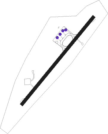
Båtsfjord - Batsfjord
Airport details
| Country | Norway |
| State | Finnmark |
| Region | EN |
| Airspace | Polaris Ctr |
| Municipality | Båtsfjord |
| Elevation | 490ft (149m) |
| Timezone | GMT +1 |
| Coordinates | 70.60028, 29.69250 |
| Magnetic var | |
| Type | land |
| Available since | X-Plane v10.40 |
| ICAO code | ENBS |
| IATA code | BJF |
| FAA code | n/a |
Communication
| Batsfjord AFIS | 123.400 |
Approach frequencies
| LOC | RW21 | 111.1 | 18.00mi |
Nearby beacons
| code | identifier | dist | bearing | frequency |
|---|---|---|---|---|
| BX | BATSFJORD NDB | 0.5 | 71° | 348 |
| BV | BERLEVAG NDB | 20.6 | 293° | 399 |
| VD | VADSO NDB | 32.3 | 160° | 342 |
| KIK | KIRKENES VOR/DME | 52.7 | 169° | 112 |
Instrument approach procedures
| runway | airway (heading) | route (dist, bearing) |
|---|---|---|
| RW03 | BITBO (55°) | BITBO 4000ft MIKDU (5mi, 305°) 4000ft |
| RW03 | ERNIX (80°) | ERNIX 4000ft MIKDU (5mi, 98°) 4000ft |
| RNAV | MIKDU 4000ft BS410 (4mi, 71°) 4000ft ENBS (9mi, 71°) 530ft BS420 (8mi, 71°) MIKDU (20mi, 251°) MIKDU (turn) 4000ft | |
| RW21 | LUNUX (225°) | LUNUX 4000ft NAMAP (5mi, 108°) 3000ft |
| RW21 | OLADU (263°) | OLADU 4000ft NAMAP (5mi, 288°) 3000ft |
| RNAV | NAMAP 3000ft GODIT (4mi, 251°) 3000ft ENBS (6mi, 251°) 539ft BS502 (6mi, 251°) LUNUX (17mi, 57°) LUNUX (turn) 4000ft |
Disclaimer
The information on this website is not for real aviation. Use this data with the X-Plane flight simulator only! Data taken with kind consent from X-Plane 12 source code and data files. Content is subject to change without notice.
