Airports for X-Plane offers a convenient way to explore airports and their related communication information for the X-Plane flight simulator. It only uses data from the X-Plane flight simulator itself, and is therefore more reliable than the data that comes from real aviation websites. You can search for airports by using the ICAO code, or browse for airports per country and state. The information displayed is categorized by airport details, runway information, airport communication, approach frequencies (ILS and Glidepath details), details of nearby beacons, SIDs, STARs and approach procedures.

embassy plane airport airport check-in flight newark aircraft station downtown airports airliner stopover helicopters arrival terminal nation aircraft carrier airport authority seaplane frankfurt airport

Tønsberg - Jarlsberg

Airport details

CountryNorway
StateVestfold
RegionEN
AirspacePolaris Ctr
MunicipalityTønsberg
Elevation87ft (27m)
TimezoneGMT +1
Coordinates59.29805, 10.37000
Magnetic var
Typeland
Available sinceX-Plane v10.40
ICAO codeENJB
IATA coden/a
FAA coden/a

Communication

No airport communication available for ENJB
Nearby Points of Interest:
Jarlsberg Manor
-
Tønsberg Fortress
-
Mariakirken i Tønsberg
-
St. Olav's Abbey, Tønsberg
-
Svend Foyns arbeiderboliger
-
Skjærsnes
-
Nøtterøy prestegård
-
Torgersøy fyrstasjon
-
Stokke Parsonage
-
Borre prestegård
-
Karljohansvern
-
Falkensten
-
Kalkovnene på Karljohansvern
-
Holtane Tjøme
-
Holtekjæråsen
-
Midtåsen
-
Gräberfeld von Elgesem
-
Torderød Gård
-
Dilling Station
-
Holmestrand politistasjon
-
Fattighuset i Holmestrand
-
Tollboden
-
Klostergata 13
-
Klostergata 23
-
Klostergata 20

Runway info

Runway 18 / 36
 length800m (2625ft)
 bearing174° / 354°
 width18m (59ft)
 surfaceasphalt

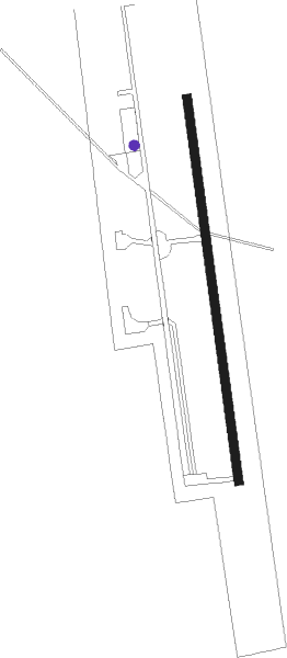
Airport layout - parking location Ramp-2


Parking locations

Nearby beacons

codeidentifierdistbearingfrequency
TORTORP VOR/DME8.4221°113.85
RYGRYGGE TACAN14.181°113.50
YGENGE NDB14.781°396
RGTUNE (MOSS) NDB19.588°381
SIGSIGDAL VOR/DME48.5314°117.70
GRMGARDERMOEN VOR/DME57.738°115.95

Disclaimer

The information on this website is not for real aviation. Use this data with the X-Plane flight simulator only! Data taken with kind consent from X-Plane 12 source code and data files. Content is subject to change without notice.