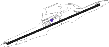
Kristiansund N - Kristiansund Kvernberget
Airport details
| Country | Norway |
| State | Møre og Romsdal |
| Region | EN |
| Airspace | Polaris Ctr |
| Municipality | Kristiansund |
| Elevation | 205ft (62m) |
| Timezone | GMT +1 |
| Coordinates | 63.11195, 7.82611 |
| Magnetic var | |
| Type | land |
| Available since | X-Plane v10.40 |
| ICAO code | ENKB |
| IATA code | KSU |
| FAA code | n/a |
Communication
| Kristiansund Kvernberget ATIS | 135.075 |
| Kristiansund Kvernberget Tower | 118.300 |
| Kristiansund Kvernberget Approach | 119.350 |
Approach frequencies
| ILS-cat-I | RW07 | 110.1 | 18.00mi |
| 3° GS | RW07 | 110.1 | 18.00mi |
Nearby beacons
| code | identifier | dist | bearing | frequency |
|---|---|---|---|---|
| KVB | KVERNBERGET (KRISTIANSUND VOR/DME | 0.5 | 292° | 113.80 |
| BRS | BREMSNES NDB | 5.1 | 261° | 371 |
| TAT | TAUTRA (MOLDE) NDB | 36 | 245° | 393 |
Departure and arrival routes
| Transition altitude | 7000ft |
| Transition level | 70ft |
| SID end points | distance | outbound heading | |
|---|---|---|---|
| RW07 | |||
| NELS2G | 49mi | 90° | |
| BAMV1G | 29mi | 142° | |
| GIGI2G | 56mi | 206° | |
| TUTO2G | 94mi | 245° | |
| RW25 | |||
| NELS2H | 49mi | 90° | |
| BAMV2H | 29mi | 142° | |
| GIGI1H | 56mi | 206° | |
| TUTO1H | 94mi | 245° | |
| STAR starting points | distance | inbound heading | |
|---|---|---|---|
| RW07 | |||
| OBIT2S | 67.8 | 24° | |
| TUMI2S | 98.6 | 54° | |
| DEKE2S | 35.8 | 262° | |
| VEPU2S | 56.6 | 330° | |
| RW25 | |||
| OBIT3T | 67.8 | 24° | |
| TUMI3T | 98.6 | 54° | |
| DEKE2T | 35.8 | 262° | |
| VEPU3T | 56.6 | 330° | |
Instrument approach procedures
| runway | airway (heading) | route (dist, bearing) |
|---|---|---|
| RW07-Z | IPITE (81°) | IPITE 4500ft IBUVI (3mi, 81°) 3600ft |
| RW07-Z | LUGEK (69°) | LUGEK 4500ft IBUVI (5mi, 323°) 3600ft |
| RW07-Z | ODVUD (91°) | ODVUD 4000ft IBUVI (5mi, 143°) 3600ft |
| RNAV | IBUVI 3600ft BATGI (6mi, 81°) 2000ft ENKB (6mi, 81°) 230ft KB515 (2mi, 81°) (3808mi, 187°) APTAT (3817mi, 7°) APTAT (turn) 5000ft | |
| RW25 | DODUN (272°) | DODUN 4500ft GUDVA (5mi, 305°) 4300ft |
| RW25 | INKEV (255°) | INKEV 4500ft GUDVA (5mi, 194°) 4300ft |
| RNAV | GUDVA 4300ft UPKEP (4mi, 264°) 3500ft KB780 (9mi, 264°) 234ft KB422 (11mi, 264°) APTAT (15mi, 40°) APTAT (turn) 5000ft |
Holding patterns
| STAR name | hold at | type | turn | heading* | altitude | leg | speed limit |
|---|---|---|---|---|---|---|---|
| DEKE2S | DEKEB | VHF | left | 70 (250)° | > 7000ft | 1.0min timed | ICAO rules |
| DEKE2T | DEKEB | VHF | left | 70 (250)° | > 7000ft | 1.0min timed | ICAO rules |
| OBIT2S | OBITI | VHF | left | 130 (310)° | > 14000ft | 1.0min timed | ICAO rules |
| OBIT3T | OBITI | VHF | left | 130 (310)° | > 14000ft | 1.0min timed | ICAO rules |
| TUMI2S | TUMIM | VHF | right | 191 (11)° | > 14000ft | 1.0min timed | ICAO rules |
| TUMI3T | TUMIM | VHF | right | 191 (11)° | > 14000ft | 1.0min timed | ICAO rules |
| VEPU2S | VEPUL | VHF | right | 127 (307)° | > 14000ft | 1.0min timed | ICAO rules |
| VEPU3T | VEPUL | VHF | right | 127 (307)° | > 14000ft | 1.0min timed | ICAO rules |
| *) magnetic outbound (inbound) holding course | |||||||
Disclaimer
The information on this website is not for real aviation. Use this data with the X-Plane flight simulator only! Data taken with kind consent from X-Plane 12 source code and data files. Content is subject to change without notice.
