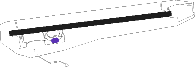
Vadsø
Airport details
| Country | Norway |
| State | Finnmark |
| Region | EN |
| Airspace | Polaris Ctr |
| Municipality | Vadsø |
| Elevation | 125ft (38m) |
| Timezone | GMT +1 |
| Coordinates | 70.06528, 29.84472 |
| Magnetic var | |
| Type | land |
| Available since | X-Plane v10.40 |
| ICAO code | ENVD |
| IATA code | VDS |
| FAA code | n/a |
Communication
| Vadsø AFIS | 118.400 |
Approach frequencies
| LOC | RW07 | 108.7 | 18.00mi |
Nearby beacons
| code | identifier | dist | bearing | frequency |
|---|---|---|---|---|
| VD | VADSO NDB | 0.7 | 89° | 342 |
| KIK | KIRKENES VOR/DME | 20.5 | 176° | 112 |
| BX | BATSFJORD NDB | 32.6 | 346° | 348 |
| BV | BERLEVAG NDB | 51 | 316° | 399 |
Instrument approach procedures
| runway | airway (heading) | route (dist, bearing) |
|---|---|---|
| RW07 | RUDUP (98°) | RUDUP 3000ft EPOPU (5mi, 129°) 3000ft |
| RW07 | ULSAK (80°) | ULSAK 3000ft EPOPU (5mi, 42°) 3000ft |
| RNAV | EPOPU 3000ft VD407 (4mi, 89°) 2000ft ENVD (5mi, 89°) 177ft (4372mi, 203°) 2000ft ULSAK (4362mi, 23°) 3000ft ULSAK (turn) 3000ft | |
| RW25 | AGDIR (280°) | AGDIR 3000ft TOKLA (5mi, 354°) 3000ft |
| RW25 | RULAX (258°) | RULAX 3000ft TOKLA (5mi, 174°) 3000ft |
| RNAV | TOKLA 3000ft VD506 (4mi, 269°) 2000ft ENVD (5mi, 269°) 137ft (4372mi, 203°) 2000ft AGDIR (4373mi, 23°) 3000ft AGDIR (turn) 3000ft | |
| RWNVA | KIK (356°) | KIK 3000ft VD512 (13mi, 356°) 3000ft |
| RNAV | VD512 3000ft VD513 (6mi, 356°) 620ft AGABO (12mi, 87°) 3000ft AGABO (turn) 3000ft |
Disclaimer
The information on this website is not for real aviation. Use this data with the X-Plane flight simulator only! Data taken with kind consent from X-Plane 12 source code and data files. Content is subject to change without notice.
