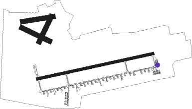
Bydgoszcz - Bydgoszcz Szwederowo
Airport details
| Country | Poland |
| State | Kuyavian-Pomeranian Voivodeship |
| Region | EP |
| Airspace | Warsaw Ctr |
| Municipality | Bydgoszcz |
| Elevation | 233ft (71m) |
| Timezone | GMT +1 |
| Coordinates | 53.09658, 17.95851 |
| Magnetic var | |
| Type | land |
| Available since | X-Plane v10.40 |
| ICAO code | EPBY |
| IATA code | BZG |
| FAA code | n/a |
Communication
| Bydgoszcz Szwederowo Bydgoszcz Tower | 131.000 |
Approach frequencies
| ILS-cat-I | RW26 | 109.1 | 18.00mi |
| 3° GS | RW26 | 109.1 | 18.00mi |
Runway info
Nearby beacons
| code | identifier | dist | bearing | frequency |
|---|---|---|---|---|
| BYZ | BYDGOSZCZ VOR/DME | 0.4 | 82° | 112.70 |
| NR | INOWROCLAW NDB | 21 | 124° | 262 |
| NRD | INOWROCLAW NDB | 21 | 122° | 444 |
| TIR | INOWROCLAW TACAN | 21 | 127° | 109.25 |
| GRU | GRUDZIADZ VOR/DME | 39 | 63° | 114.60 |
| NT | POWIDZ NDB | 43.3 | 186° | 303 |
| TPW | POWIDZ TACAN | 43.3 | 189° | 115.55 |
| NG | POWIDZ NDB | 43.6 | 185° | 322 |
| NK | KRZESINY (POZNAN) NDB | 58.2 | 231° | 489 |
| TKS | KRZESINY (POZNAN) TACAN | 58.3 | 232° | 111.50 |
Departure and arrival routes
| Transition altitude | 6500ft |
| SID end points | distance | outbound heading | |
|---|---|---|---|
| RW08 | |||
| GOBN1B, GOBN1A | 25mi | 63° | |
| INTU1A, INTU1B | 27mi | 85° | |
| LUXU1A, LUXU1B | 25mi | 271° | |
| RW26 | |||
| GOBN1H, GOBN1G | 25mi | 63° | |
| INTU1G, INTU1H | 27mi | 85° | |
| LUXU1G, LUXU1H | 25mi | 271° | |
| STAR starting points | distance | inbound heading | |
|---|---|---|---|
| ALL | |||
| LUXU1N, LUXU1S | 24.9 | 91° | |
| GOBN1S | 25.2 | 243° | |
| INTU1S | 26.9 | 265° | |
| RW08 | |||
| LUXU1P | 24.9 | 91° | |
| GOBN1P | 25.2 | 243° | |
| INTU1P | 26.9 | 265° | |
| RW26 | |||
| LUXU1T | 24.9 | 91° | |
| GOBN1T | 25.2 | 243° | |
| INTU1T | 26.9 | 265° | |
Instrument approach procedures
| runway | airway (heading) | route (dist, bearing) |
|---|---|---|
| RW08 | ABIBO (91°) | ABIBO 6000ft BY801 (7mi, 101°) 2800ft |
| RW08 | BY802 (65°) | BY802 2800ft BY801 (5mi, 347°) 2800ft |
| RW08 | BY804 (100°) | BY804 3000ft BY801 (4mi, 167°) 2800ft |
| RNAV | BY801 2800ft BY806 (4mi, 85°) 2000ft EPBY (5mi, 85°) 286ft BY814 (7mi, 86°) BY802 (16mi, 254°) 2800ft | |
| RW26 | BY627 (259°) | BY627 6000ft BY623 (6mi, 244°) 3000ft |
| RW26 | BY628 (250°) | BY628 5000ft BY623 (5mi, 167°) 3000ft |
| RW26 | BY636 (282°) | BY636 3000ft BY623 (6mi, 347°) 3000ft |
| RNAV | BY623 3000ft BY637 (4mi, 265°) 2300ft EPBY (8mi, 266°) 284ft BY633 (4mi, 264°) BY634 (6mi, 167°) BY636 (16mi, 85°) 3000ft |
Holding patterns
| STAR name | hold at | type | turn | heading* | altitude | leg | speed limit |
|---|---|---|---|---|---|---|---|
| GOBN1P | GOBNI | VHF | right | 29 (209)° | 1.0min timed | 230 | |
| GOBN1T | GOBNI | VHF | right | 29 (209)° | 1.0min timed | 230 | |
| INTU1P | INTUN | VHF | left | 89 (269)° | 1.0min timed | 230 | |
| INTU1T | INTUN | VHF | left | 89 (269)° | 1.0min timed | 230 | |
| LUXU1P | LUXUD | VHF | left | 274 (94)° | 1.0min timed | 230 | |
| LUXU1T | LUXUD | VHF | left | 274 (94)° | 1.0min timed | 230 | |
| *) magnetic outbound (inbound) holding course | |||||||
Disclaimer
The information on this website is not for real aviation. Use this data with the X-Plane flight simulator only! Data taken with kind consent from X-Plane 12 source code and data files. Content is subject to change without notice.

