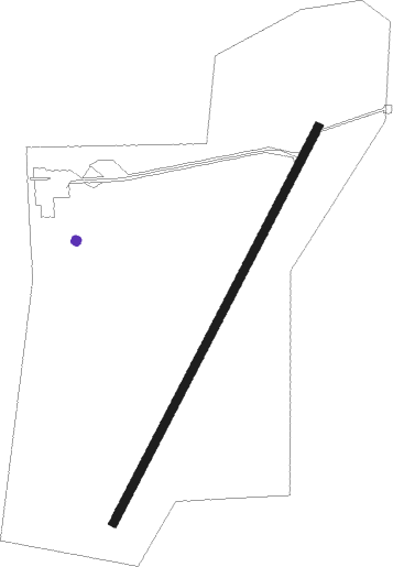
Airports for X-Plane offers a convenient way to explore airports and their related communication information for the X-Plane flight simulator. It only uses data from the X-Plane flight simulator itself, and is therefore more reliable than the data that comes from real aviation websites. You can search for airports by using the ICAO code, or browse for airports per country and state. The information displayed is categorized by airport details, runway information, airport communication, approach frequencies (ILS and Glidepath details), details of nearby beacons, SIDs, STARs and approach procedures.

airport apron gravel newark train road automated airport weather station drome landing area concrete hospital aviation air terminal rail taxiway airdrome heliport air safety flown aerodromes airspace

Piotrków Trybunalski - Piotrkow Trybunalski

Airport details

CountryPoland
StateŁódź Voivodeship
RegionEP
AirspaceWarsaw Ctr
MunicipalityPiotrków Trybunalski
Elevation669ft (204m)
TimezoneGMT +1
Coordinates51.38250, 19.68861
Magnetic var
Typeland
Available sinceX-Plane v10.40
ICAO codeEPPT
IATA coden/a
FAA coden/a

Communication

No airport communication available for EPPT
Nearby Points of Interest:
Piotrków Trybunalski Wąskotorowy train station
-
10 Trybunalski Market Square in Piotrków Trybunalski
-
8 Farna Street in Piotrków Trybunalski
-
6 Sieradzka Street in Piotrków Trybunalski
-
6 Grodzka Street in Piotrków Trybunalski
-
3 Farna Street in Piotrków Trybunalski
-
kamienica przy Placu Czarnieckiego 10
-
dom przy ul. Słowackiego 1
-
6 Rwańska Street in Piotrków Trybunalski
-
5 Słowackiego Street in Piotrków Trybunalski
-
Dominican nuns convent in Piotrków Trybunalski
-
Piarist monastery in Piotrków Trybunalski
-
Former girls' school in Piotrków Trybunalski
-
Villa Wanda in Piotrków Trybunalski
-
Kaplica grobowa T. Andriejewej
-
Orthodox cemetery in Piotrków Trybunalski
-
Burghard family chapel in Piotrków Trybunalski
-
Jüttner family chapel in Piotrków Trybunalski
-
Saint Florian church in Sulejów
-
Saint Ignatius of Loyola church in Suchcice
-
Kościół św. Marcina w Tomaszowie Mazowieckim (stary)
-
Kościół św. Jadwigi Śląskiej w Kodrębie
-
Radomsko Town Hall
-
Saint Lambertus church in Radomsko
-
Benedykt Górski's manor

Runway info

Runway 03R / 21L
 length954m (3130ft)
 bearing45° / 225°
 width18m (59ft)
 surfaceconcrete

Airport layout - parking location 1


Parking locations

Nearby beacons

codeidentifierdistbearingfrequency
TTMTOMASZOW MAZOWIECKI TACAN19.563°110.70
NPTOMASZOW MAZOWIECKI NDB2066°437
NPRTOMASZOW MAZOWIECKI NDB20.869°488
TASLASK TACAN21.5288°108.55
LOZWIACZYN DOLNY VOR/DME23.7351°112.40
NWTLECZYCA NDB40.6323°385
NWLECZYCA NDB41.6320°520
TLYLECZYCA TACAN42.3319°110.10
KRNDME4453°117.80
JEDDME49143°115.60
KAXKATOWICE VOR/DME58.9214°114.80
WARZABOROWEK VOR/DME63.748°114.90

Disclaimer

The information on this website is not for real aviation. Use this data with the X-Plane flight simulator only! Data taken with kind consent from X-Plane 12 source code and data files. Content is subject to change without notice.