Krepa K/slupska
Airport details
| Country | Poland |
| State | Pomeranian Voivodeship |
| Region | EP |
| Airspace | Warsaw Ctr |
| Municipality | Krępa Słupska |
| Elevation | 251ft (77m) |
| Timezone | GMT +1 |
| Coordinates | 54.40843, 17.09562 |
| Magnetic var | |
| Type | land |
| Available since | X-Plane v10.40 |
| ICAO code | EPSK |
| IATA code | OSP |
| FAA code | n/a |
Communication
| Krepa k/Slupska Krepa Radio | 118.250 |
Nearby Points of Interest:
Evangelical-Augsburg church in Słupsk
-Poczta w Słupsku
-11 Zwycięstwa Square in Słupsk
-Słupsk Town Hall
-4 Old Market Square in Słupsk
-Słupsk New Town Hall
-Księżna Anna
-Pałac
-Manor in Barnowo
-Salvator church in Ustka
-City office in Sławno
-Brama Koszalińska
-Krąg Castle
-Old Saint Catherine church in Bytów
-Saint Stanislaus Kostka church in Wałdowo
-Manor in Cecenowo
-Our Lady of the Rosary church in Sierakowo Sławieńskie
-Saint Nicholas church in Parchowo
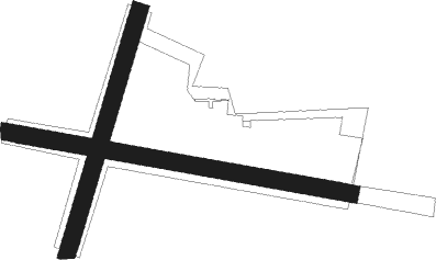
Runway info
Runway 10 / 28  | ||
| length | 1028m (3373ft) | |
| bearing | 99° / 279° | |
| width | 50m (164ft) | |
| surface | grass | |
| displ threshold | 210m (689ft) / 0m (0ft) | |
| Runway 02 / 20 | ||
| length | 743m (2438ft) | |
| bearing | 33° / 213° | |
| width | 50m (164ft) | |
| surface | grass | |
Nearby beacons
| code | identifier | dist | bearing | frequency |
|---|---|---|---|---|
| TZE | DME | 11.9 | 186° | 113.80 |
| TCW | CEWICE TACAN | 23.3 | 89° | 113.95 |
| SA | DARLOWO NDB | 24.4 | 272° | 474 |
| M | CEWICE NDB | 24.5 | 89° | 423 |
| DAR | DARLOWO VOR/DME | 24.7 | 270° | 114.20 |
| S | DARLOWO NDB | 25.4 | 270° | 436 |
| TDA | DARLOWO TACAN | 25.7 | 270° | 116.85 |
| WIC | DME | 25.9 | 65° | 108 |
| ML | CEWICE NDB | 26 | 89° | 311 |
| CZA | DME | 60.9 | 221° | 117 |
Disclaimer
The information on this website is not for real aviation. Use this data with the X-Plane flight simulator only! Data taken with kind consent from X-Plane 12 source code and data files. Content is subject to change without notice.