Airports for X-Plane offers a convenient way to explore airports and their related communication information for the X-Plane flight simulator. It only uses data from the X-Plane flight simulator itself, and is therefore more reliable than the data that comes from real aviation websites. You can search for airports by using the ICAO code, or browse for airports per country and state. The information displayed is categorized by airport details, runway information, airport communication, approach frequencies (ILS and Glidepath details), details of nearby beacons, SIDs, STARs and approach procedures.

stol landing airline military airports train station airport check-in plane aerodrome public transport stolport ferry heliport propeller plane air safety helicopters stopover arrival bus near

Hässleholm - Hässleholm Bokeberg

Airport details

CountrySweden
StateSkåne län
RegionES
AirspaceSweden Ctr
MunicipalityHässleholms kommun
Elevation104ft (32m)
TimezoneGMT +1
Coordinates56.13361, 13.87889
Magnetic var
Typeland
Available sinceX-Plane v10.40
ICAO codeESFA
IATA coden/a
FAA coden/a

Communication

Hässleholm Bokeberg Hässleholm RDO123.600
Nearby Points of Interest:
Ignaberga socken
-
Vinslövs socken
-
Stainabjär
-
Sörby socken
-
Stoby socken
-
Gumlösa socken
-
Norra Sandby socken
-
Nävlinge socken
-
Norra Strö socken
-
Vankiva socken
-
Hällristningarna i Frännarp
-
Finja socken
-
Önnestads socken
-
Brönnestads socken
-
Kviinge socken
-
Gryts socken
-
Norra Mellby socken
-
Knislinge socken
-
Färlövs socken
-
Färlövstenen
-
Djurröds socken
-
Torsebro krutbruk
-
Ballingstorpsgården
-
Mala stenar
-
Matteröds socken

Runway info

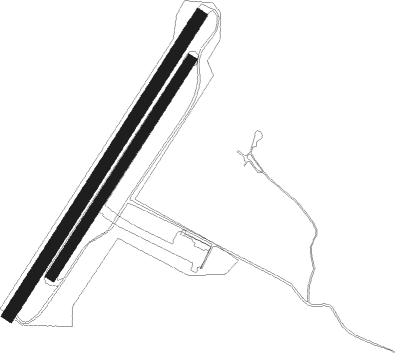
Runway 04L / 22R  
 length1156m (3793ft)
 bearing54° / 234°
 width40m (131ft)
 surfacedry lakebed
Runway 04 / 22  
 length832m (2730ft)
 bearing54° / 234°
 width35m (115ft)
 surfacegrass

Airport layout


Nearby beacons

codeidentifierdistbearingfrequency
OEMKRISTIANSTAD NDB11.4123°363
KDKRISTIANSTAD NDB17.1143°375
LJULJUNGBYHED VOR/DME22.8266°113.40
AHANGELHOLM NDB33.6278°417
SUPSTURUP (MALMO) VOR/DME39.7220°113
VXVAXJO NDB51.249°329
JXVAXJO NDB59.346°349

Disclaimer

The information on this website is not for real aviation. Use this data with the X-Plane flight simulator only! Data taken with kind consent from X-Plane 12 source code and data files. Content is subject to change without notice.