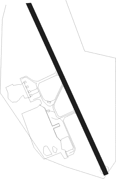
Sundsvall/ Härnösand - Sundsvall Timra
Airport details
| Country | Sweden |
| State | Västernorrlands län |
| Region | ES |
| Airspace | Sweden Ctr |
| Municipality | Timrå District |
| Elevation | 16ft (5m) |
| Timezone | GMT +1 |
| Coordinates | 62.52945, 17.44278 |
| Magnetic var | |
| Type | land |
| Available since | X-Plane v10.40 |
| ICAO code | ESNN |
| IATA code | SDL |
| FAA code | n/a |
Communication
| Sundsvall Timra ATIS | 127.400 |
| Sundsvall Timra Tower | 129.550 |
| Sundsvall Timra Tower | 118.100 |
Approach frequencies
| ILS-cat-I | RW16 | 108.7 | 18.00mi |
| ILS-cat-I | RW34 | 110.3 | 18.00mi |
| 3.2° GS | RW16 | 108.7 | 18.00mi |
| 3° GS | RW34 | 110.3 | 18.00mi |
Nearby beacons
| code | identifier | dist | bearing | frequency |
|---|---|---|---|---|
| SUN | SUNDSVALL VOR/DME | 0.1 | 100° | 113.10 |
| LUE | LUNDE NDB | 23.5 | 48° | 427 |
| KG | KRAMFORS-SOLLEFTEA NDB | 36.5 | 27° | 326 |
Departure and arrival routes
| Transition altitude | 5000ft |
| SID end points | distance | outbound heading | |
|---|---|---|---|
| RW16 | |||
| GAJP1G | 33mi | 50° | |
| FOXS1B, FOXS1G | 39mi | 141° | |
| DEGE1G | 31mi | 236° | |
| SINU1G | 24mi | 258° | |
| RW34 | |||
| GAJP1H | 33mi | 50° | |
| FOXS1H, FOXS1L | 39mi | 141° | |
| DEGE1H | 31mi | 236° | |
| SINU1H | 24mi | 258° | |
| STAR starting points | distance | inbound heading | |
|---|---|---|---|
| RW16 | |||
| DEGE1S | 31.2 | 56° | |
| SINU1S | 24.1 | 78° | |
| GAJP1S | 32.5 | 230° | |
| ZIPC1E, ZIPC1S | 39.9 | 344° | |
| RW34 | |||
| DEGE1T | 31.2 | 56° | |
| SINU1T | 24.1 | 78° | |
| GAJP1T | 32.5 | 230° | |
| ZIPC1F, ZIPC1T | 39.9 | 344° | |
Instrument approach procedures
| runway | airway (heading) | route (dist, bearing) |
|---|---|---|
| RW16 | NN850 (119°) | NN850 3200ft NEKPO (5mi, 80°) 3000ft |
| RW16 | NN853 (142°) | NN853 3300ft NEKPO (4mi, 142°) 3000ft |
| RW16 | NN854 (180°) | NN854 3200ft NEKPO (5mi, 261°) 3000ft |
| RNAV | NEKPO 3000ft NN851 (5mi, 142°) 3000ft ESNN (9mi, 142°) 67ft IXIBI (13mi, 142°) IXIBI (turn) 2500ft | |
| RW34 | NN551 (322°) | NN551 3200ft IXIBI (4mi, 322°) 2500ft |
| RW34 | NN553 (299°) | NN553 3200ft IXIBI (5mi, 261°) 2500ft |
| RW34 | NN700 (2°) | NN700 3200ft IXIBI (5mi, 80°) 2500ft |
| RNAV | IXIBI 2500ft NN552 (5mi, 322°) 2500ft ESNN (8mi, 322°) 63ft NEKPO (14mi, 322°) NEKPO (turn) 3100ft |
Disclaimer
The information on this website is not for real aviation. Use this data with the X-Plane flight simulator only! Data taken with kind consent from X-Plane 12 source code and data files. Content is subject to change without notice.

