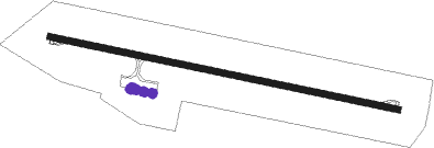
Skellefteå - Skelleftea
Airport details
| Country | Sweden |
| State | Västerbottens län |
| Region | ES |
| Airspace | Sweden Ctr |
| Municipality | Skellefteå kommun |
| Elevation | 145ft (44m) |
| Timezone | GMT +1 |
| Coordinates | 64.62473, 21.07694 |
| Magnetic var | |
| Type | land |
| Available since | X-Plane v10.40 |
| ICAO code | ESNS |
| IATA code | SFT |
| FAA code | n/a |
Communication
| Skelleftea Tower | 122.050 |
Approach frequencies
| ILS-cat-I | RW28 | 109.5 | 18.00mi |
| 3° GS | RW28 | 109.5 | 18.00mi |
Nearby beacons
| code | identifier | dist | bearing | frequency |
|---|---|---|---|---|
| SKA | SKELLEFTEA VOR/DME | 0.1 | 51° | 113.40 |
| UME | UMEA VOR/DME | 54.3 | 223° | 114.10 |
| WU | UMEA NDB | 56.8 | 216° | 329 |
| OL | KALLAX (LULEA) NDB | 63 | 43° | 377 |
Instrument approach procedures
| runway | airway (heading) | route (dist, bearing) |
|---|---|---|
| RW10 | BALEX (108°) | BALEX 2800ft NS850 (5mi, 214°) 2500ft |
| RW10 | ENOVI (88°) | ENOVI 2900ft NS850 (5mi, 33°) 2500ft |
| RW10 | ULGOT (97°) | ULGOT 2900ft NS850 (3mi, 97°) 2500ft |
| RNAV | NS850 2500ft NS851 (5mi, 97°) 2500ft ESNS (8mi, 97°) 208ft NS550 (6mi, 97°) VENDA (8mi, 257°) 2500ft VENDA (turn) 2500ft | |
| RW28 | GATVI (268°) | GATVI 2800ft LUVIX (5mi, 215°) 2500ft |
| RW28 | INDAK (277°) | INDAK 2500ft LUVIX (3mi, 277°) 2500ft |
| RW28 | MOKMO (288°) | MOKMO 2800ft LUVIX (5mi, 35°) 2500ft |
| RNAV | LUVIX 2500ft NS571 (5mi, 277°) 2500ft ESNS (8mi, 277°) 172ft NS870 (6mi, 277°) VENDA (8mi, 126°) 2500ft VENDA (turn) 2500ft |
Disclaimer
The information on this website is not for real aviation. Use this data with the X-Plane flight simulator only! Data taken with kind consent from X-Plane 12 source code and data files. Content is subject to change without notice.
