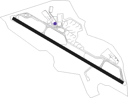
Stockholm - Bromma
Airport details
| Country | Sweden |
| State | Stockholms län |
| Region | ES |
| Airspace | Sweden Ctr |
| Municipality | Stockholm |
| Elevation | 44ft (13m) |
| Timezone | GMT +1 |
| Coordinates | 59.35444, 17.94222 |
| Magnetic var | |
| Type | land |
| Available since | X-Plane v10.40 |
| ICAO code | ESSB |
| IATA code | BMA |
| FAA code | n/a |
Communication
| Bromma ATIS | 122.455 |
| Bromma Ground Control | 121.605 |
| Bromma Tower | 118.105 |
| Bromma Approach | 120.150 |
| Bromma Approach | 123.300 |
Approach frequencies
| ILS-cat-I | RW12 | 110.3 | 18.00mi |
| ILS-cat-I | RW30 | 109.7 | 18.00mi |
| 3.5° GS | RW12 | 110.3 | 18.00mi |
| 3.5° GS | RW30 | 109.7 | 18.00mi |
Nearby Points of Interest:
Stockholm Bromma Airport
-Mariehällskyrkan
-Uppland Runic Inscription 56
-Uppland Runic Inscription 78
-Upplands runinskrifter 58
-Uppland Runic Inscription 80
-runestone U 81
-Constantia
-Västerleds församlingshus
-Kvarteret Fyrväpplingen
-Råstahällen
-Bromma-Teatern
-Uppland Runic Inscription 77
-Solna Town
-Solna stadshus
-Kaskad
-Swedish Institute for Communicable Disease Control
-Fornlämningar i Smedslätten
-Råcksta begravningsplats
-Kvarteret Tomten
-Tomteboda
-Tranan
-Villa Erskine
-Stenvärdshuset
-Hertigarnas stall
Nearby beacons
| code | identifier | dist | bearing | frequency |
|---|---|---|---|---|
| TEB | TEBBY VOR/DME | 13.2 | 56° | 117.10 |
| ASW | (STOCKHOLM) DME | 14.4 | 332° | 113.75 |
| COR | CORNER NDB | 15.1 | 259° | 388 |
| ASE | (STOCKHOLM) DME | 16.9 | 3° | 114.45 |
| ARL | ARLANDA (STOCKHOLM) VOR/DME | 17.9 | 355° | 116 |
| WA | ARLANDA (STOCKHOLM) NDB | 18.1 | 355° | 348 |
| ANE | (STOCKHOLM) DME | 20.7 | 19° | 113.30 |
| LNA | LENA NDB | 20.9 | 288° | 330 |
| ANW | (STOCKHOLM) DME | 21.7 | 346° | 112.05 |
| TRS | TROSA VOR/DME | 28.4 | 227° | 114.30 |
| ERK | ERKEN NDB | 34.6 | 36° | 383 |
| UP | UPPSALA NDB | 38.2 | 339° | 366 |
| PEO | SKAVSTA (STOCKHOLM) NDB | 43.5 | 238° | 398 |
| HMR | HAMMAR VOR/DME | 57.1 | 26° | 112.60 |
Departure and arrival routes
| Transition altitude | 5000ft |
| SID end points | distance | outbound heading | |
|---|---|---|---|
| RW12 | |||
| RESN5W | 61mi | 5° | |
| TOVR5W | 35mi | 64° | |
| TRS4W | 28mi | 227° | |
| NOSL4W | 27mi | 248° | |
| PETE1W | 30mi | 261° | |
| TINK4W | 51mi | 265° | |
| RW30 | |||
| RESN4Z | 61mi | 5° | |
| TRS4Z | 28mi | 227° | |
| NOSL4Z | 27mi | 248° | |
| PETE1Z | 30mi | 261° | |
| TINK4Z | 51mi | 265° | |
| STAR starting points | distance | inbound heading | |
|---|---|---|---|
| RW12 | |||
| TRS1U | 28.4 | 47° | |
| TINK8U | 51.2 | 85° | |
| HMR9U | 57.1 | 206° | |
| XILA7U | 39.1 | 255° | |
| RW30 | |||
| TRS7Y | 28.4 | 47° | |
| TINK7Y | 51.2 | 85° | |
| HMR9Y | 57.1 | 206° | |
| XILA8Y | 39.1 | 255° | |
Holding patterns
| STAR name | hold at | type | turn | heading* | altitude | leg | speed limit |
|---|---|---|---|---|---|---|---|
| ARS8U | ARS | NDB | right | 54 (234)° | > 9000ft | 1.0min timed | 230 |
| ARS8Y | ARS | NDB | right | 54 (234)° | > 9000ft | 1.0min timed | 230 |
| HMR9U | HMR | NDB | left | 11 (191)° | > 10000ft | 1.5min timed | 230 |
| HMR9Y | HMR | NDB | left | 11 (191)° | > 10000ft | 1.5min timed | 230 |
| TINK7Y | TINKA | VHF | right | 264 (84)° | > 10000ft | 1.5min timed | 230 |
| TINK8U | TINKA | VHF | right | 264 (84)° | > 10000ft | 1.5min timed | 230 |
| TRS1U | TRS | NDB | right | 213 (33)° | > 5000ft | 1.5min timed | 230 |
| TRS7Y | TRS | NDB | right | 213 (33)° | > 5000ft | 1.5min timed | 230 |
| XILA7U | XILAN | VHF | left | 68 (248)° | 10000ft - 24500ft | 1.5min timed | 230 |
| XILA8Y | XILAN | VHF | left | 68 (248)° | 10000ft - 24500ft | 1.5min timed | 230 |
| *) magnetic outbound (inbound) holding course | |||||||
Disclaimer
The information on this website is not for real aviation. Use this data with the X-Plane flight simulator only! Data taken with kind consent from X-Plane 12 source code and data files. Content is subject to change without notice.