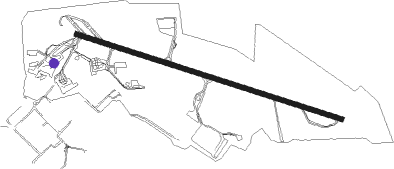
Linköping - Linkoping Saab
Airport details
| Country | Sweden |
| State | Östergötlands län |
| Region | ES |
| Airspace | Sweden Ctr |
| Municipality | Linköping |
| Elevation | 170ft (52m) |
| Timezone | GMT +1 |
| Coordinates | 58.40639, 15.67972 |
| Magnetic var | |
| Type | land |
| Available since | X-Plane v10.40 |
| ICAO code | ESSL |
| IATA code | LPI |
| FAA code | n/a |
Communication
| Linkoping Saab Tower | 128.700 |
| Linkoping Saab Tower | 118.800 |
| Linkoping Saab Tower | 123.400 |
| Linkoping Saab Tower | 133.100 |
| Linkoping Saab Ostgota control | 132.950 |
| Linkoping Saab Ostgota control | 135.850 |
Approach frequencies
| ILS-cat-I | RW11 | 108.7 | 18.00mi |
| ILS-cat-I | RW29 | 108.1 | 18.00mi |
| 3.2° GS | RW11 | 108.7 | 18.00mi |
| 2.8° GS | RW29 | 108.1 | 18.00mi |
Nearby Points of Interest:
Linköpings stad
-Östergötlands runinskrifter Fv1958;255
-Östergötlands runinskrifter 113
-Östergötlands runinskrifter Fv1958;252
-Kvarteret Abboten 1
-Klostret, Linköping
-Östergötlands runinskrifter SvK200;87
-Biskopsgården, Linköping
-Gymnastikhuset, Linköping
-Konsistoriehuset
-Hunnebergsgatan
-Lärarhögskolan i Linköping
-Onkel Adamsgården
-Östergötlands runinskrifter 12
-Östergötlands runinskrifter 11
-Vårdsbergs socken
-Landeryds socken
-Östergötlands runinskrifter 111
-Rystads socken
-Östergötlands runinskrifter ATA5503/61
-Östergötlands runinskrifter 128
-Lambohovs säteri
-Östergötlands runinskrifter 115
-Östergötlands runinskrifter 116
-Slaka 69:1
Nearby beacons
| code | identifier | dist | bearing | frequency |
|---|---|---|---|---|
| OL | SAAB (LINKOPING) NDB | 4.2 | 102° | 415 |
| SC | SAAB (LINKOPING) NDB | 4.3 | 282° | 300 |
| VSN | VASSEN VOR/DME | 6.2 | 164° | 115.25 |
| LCF | MALMEN (LINKOPING) NDB | 8.2 | 247° | 285 |
| ON | NORRKOPING NDB | 24.4 | 76° | 324 |
| RB | OREBRO NDB | 48.5 | 317° | 375 |
| EN | OREBRO NDB | 56.4 | 325° | 400 |
Instrument approach procedures
| runway | airway (heading) | route (dist, bearing) |
|---|---|---|
| RW11 | SL840 (89°) | SL840 2100ft SL910 (5mi, 37°) 2100ft |
| RW11 | SL920 (102°) | SL920 2600ft SL910 (5mi, 102°) 2100ft |
| RW11 | SL930 (119°) | SL930 2100ft SL910 (5mi, 218°) 2100ft |
| RNAV | SL910 2100ft SL900 (5mi, 102°) 2100ft ESSL (6mi, 102°) 193ft SL600 (6mi, 102°) VSN (6mi, 249°) 2500ft VSN (turn) 2500ft | |
| RW29 | SL540 (269°) | SL540 2100ft SL601 (5mi, 218°) 2100ft |
| RW29 | SL602 (298°) | SL602 2100ft SL601 (5mi, 38°) 2100ft |
| RW29 | SL603 (282°) | SL603 2100ft SL601 (5mi, 282°) 2100ft |
| RNAV | SL601 2100ft SL600 (5mi, 282°) 2100ft ESSL (6mi, 282°) 223ft SL900 (6mi, 282°) VSN (11mi, 124°) 2500ft VSN (turn) 2500ft |
Disclaimer
The information on this website is not for real aviation. Use this data with the X-Plane flight simulator only! Data taken with kind consent from X-Plane 12 source code and data files. Content is subject to change without notice.