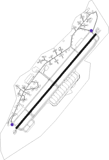
Trier - Spangdahlem Ab
Airport details
| Country | Germany |
| State | Rhineland-Palatinate |
| Region | ED |
| Airspace | Langen Ctr |
| Municipality | Spangdahlem |
| Elevation | 1196ft (365m) |
| Timezone | GMT +1 |
| Coordinates | 49.98540, 6.70219 |
| Magnetic var | |
| Type | land |
| Available since | X-Plane v10.40 |
| ICAO code | ETAD |
| IATA code | SPM |
| FAA code | n/a |
Communication
| Spangdahlem AB Spangdahlem Tower | 122.200 |
| Spangdahlem AB Spangdahlem GCA | 129.475 |
| Spangdahlem AB Langen Radar | 125.600 |
Approach frequencies
| ILS-cat-II | RW23 | 108.1 | 18.00mi |
| ILS-cat-I | RW05 | 109.15 | 18.00mi |
| 3° GS | RW23 | 108.1 | 18.00mi |
| 3° GS | RW05 | 109.15 | 18.00mi |
Nearby beacons
| code | identifier | dist | bearing | frequency |
|---|---|---|---|---|
| SPA | SPANGDAHLEM TACAN | 0.4 | 215° | 109.50 |
| BUE | BUECHEL TACAN | 18.3 | 62° | 117.10 |
| FHH | DME | 21.7 | 94° | 117.35 |
| HAN | HAHN NDB | 22.3 | 92° | 376 |
| ELU | LUXEMBOURG NDB | 22.7 | 229° | 368 |
| DIK | DIEKIRCH NDB | 23.3 | 258° | 307 |
| LE | LUXEMBOURG NDB | 27.1 | 233° | 318 |
| LUX | LUXEMBOURG VOR/DME | 27.2 | 233° | 112.25 |
| LW | LUXEMBOURG NDB | 30.3 | 235° | 404 |
| WLU | LUXEMBOURG NDB | 35.5 | 237° | 346 |
| SLV | SPA NDB | 42.3 | 302° | 386 |
| MTZ | METZ NDB | 46.7 | 215° | 354 |
| RMS | RAMSTEIN TACAN | 47.6 | 122° | 113.40 |
| SAD | DME | 49.1 | 152° | 116.75 |
| NVO | NOERVENICH VORTAC | 50.3 | 356° | 116.20 |
| SR | ENSHEIM (SAARBRUECKEN) NDB | 50.3 | 146° | 360 |
| WNN | DME | 51 | 358° | 109.85 |
| LNO | OLNO VOR/DME | 52.4 | 301° | 112.80 |
| ZWN | ZWEIBRUECKEN VOR/DME | 53.2 | 137° | 114.80 |
| LV | COLOGNE-BONN NDB | 53.3 | 33° | 327 |
| KBO | COLOGNE-BONN VOR/DME | 55.2 | 27° | 112.15 |
| LJ | COLOGNE-BONN NDB | 58.2 | 21° | 365 |
| LW | COLOGNE-BONN NDB | 58.7 | 31° | 300 |
| COL | COLA VOR/DME | 58.8 | 48° | 108.80 |
| GTQ | GROSTENQUIN VOR/DME | 59.9 | 179° | 111.25 |
| LOU | LORRAINE NDB | 61.6 | 204° | 388 |
| GIX | GEILENKIRCHEN TACAN | 63.8 | 326° | 108.10 |
| MAS | MAASTRICHT VOR/DME | 65.6 | 323° | 108.60 |
Departure and arrival routes
| Transition altitude | 5000ft |
| SID end points | distance | outbound heading | |
|---|---|---|---|
| RW05 | |||
| ROPU1H | 15mi | 32° | |
| GERK1H | 82mi | 119° | |
| PIRE1H | 64mi | 128° | |
| TOLE1H | 31mi | 146° | |
| NVO2H | 50mi | 356° | |
| GEBS2H | 34mi | 359° | |
| RW23 | |||
| GERK1X | 82mi | 119° | |
| PIRE1X | 64mi | 128° | |
| TOLE1X | 31mi | 146° | |
| NVO2X | 50mi | 356° | |
| GEBS2X | 34mi | 359° | |
Disclaimer
The information on this website is not for real aviation. Use this data with the X-Plane flight simulator only! Data taken with kind consent from X-Plane 12 source code and data files. Content is subject to change without notice.
