Ansbach - Ansbach-katterbach
Airport details
| Country | Germany |
| State | Bavaria |
| Region | ED |
| Airspace | Langen Ctr |
| Municipality | Ansbach |
| Elevation | 1533ft (467m) |
| Timezone | GMT +1 |
| Coordinates | 49.30817, 10.63867 |
| Magnetic var | |
| Type | land |
| Available since | X-Plane v10.40 |
| ICAO code | ETEB |
| IATA code | n/a |
| FAA code | n/a |
Communication
| Ansbach-Katterbach Ansbach Tower | 122.100 |
Nearby Points of Interest:
Rutzenmühle
-Residenz Ansbach
-Pfarrhaus Lichtenau (Mittelfranken)
-Rathaus Ansbach
-St. Jakob
-Pfarrhaus (Immeldorf)
-St. Georg (Immeldorf)
-Pfarrhaus
-Christuskirche
-Weißes Roß
-St. Peter
-Die Marter
-St. Laurentius (Elpersdorf bei Ansbach)
-St. Jobst
-Wasserburg Dietenhofen
-Evangelisch-lutherisches Pfarrhaus
-Fronveststraße 12 (Herrieden)
-Friedenshort (Neuendettelsau)
-Schloss Neuendettelsau
-Mesnerhaus (Neuendettelsau)
-Haus Lutherrose
-Gruppe von Steinkreuzen Wolframs-Eschenbach
-Steinkreuz in Weidenbach
-Hauptstraße 2
-2. Pfarrhaus (Merkendorf)
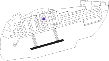
Runway info
| Runway 08 / 26 | ||
| length | 374m (1227ft) | |
| bearing | 83° / 263° | |
| width | 22m (72ft) | |
| surface | asphalt | |
| blast zone | 0m (0ft) / 27m (89ft) | |
Nearby beacons
| code | identifier | dist | bearing | frequency |
|---|---|---|---|---|
| ANS | ANSBACH NDB | 0.2 | 276° | 452 |
| ILM | ILLESHEIM NDB | 13.8 | 303° | 488 |
| DKB | DINKELSBUEHL VORTAC | 18.5 | 248° | 117.80 |
| NUB | NUERNBERG VOR/DME | 19.4 | 64° | 115.75 |
| NGD | DME | 20.7 | 66° | 113.10 |
| RTB | ROETHENBACH NDB | 26.1 | 74° | 415 |
| NSN | NIEDERSTETTEN NDB | 26.8 | 277° | 311 |
| NDD | DME-ILS | 27 | 277° | 108.70 |
| ERL | ERLANGEN VOR/DME | 28.8 | 56° | 114.90 |
| SHD | HALL DME | 35.6 | 257° | 108.05 |
| NEU | NEUBURG TACAN | 42.2 | 136° | 108.90 |
| WLD | WALDA VOR/DME | 47.8 | 146° | 112.80 |
| IGL | INGOLSTADT TACAN | 50.9 | 122° | 111.40 |
| AGB | AUGSBURG NDB | 54.3 | 162° | 318 |
| AUG | DME | 54.3 | 161° | 115.90 |
| BAY | BAYREUTH VOR | 56.2 | 56° | 110.60 |
| MIQ | MIKE NDB | 58.2 | 128° | 426 |
Disclaimer
The information on this website is not for real aviation. Use this data with the X-Plane flight simulator only! Data taken with kind consent from X-Plane 12 source code and data files. Content is subject to change without notice.