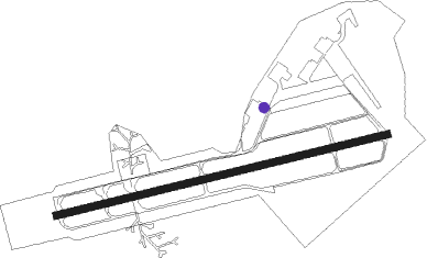
Celle Ab
Airport details
| Country | Germany |
| State | Lower Saxony |
| Region | ED |
| Airspace | Bremen Ctr |
| Municipality | Celle |
| Elevation | 113ft (34m) |
| Timezone | GMT +1 |
| Coordinates | 52.59323, 10.02693 |
| Magnetic var | |
| Type | land |
| Available since | X-Plane v10.40 |
| ICAO code | ETHC |
| IATA code | ZCN |
| FAA code | n/a |
Communication
| Celle AB Celle tower | 122.100 |
Nearby Points of Interest:
Wohnhausgruppe Waack
-Italienischer Garten
-Im Güldenen Winkel 8
-Seeckt-Kaserne
-Gut Rixförde
-St. Marienkirche
-St. Marien-Kirche (Wienhausen)
-Amtshof Eicklingen
-St. Marcus, Engensen
-Kirchfriedhof Kirchhorst
-Steller Straße 15
-Elisabeth Church from 1867 in Langenhagen
-Groß-Buchholzer-Kirchweg 66 (Hannover)
-Nikolaikirche
-Hof Burzlaff
-Kurhaus Friedenstal (Hannover)
-St. Georgs-Kirche
-Ostenholz church
-Alt-Bethesda
-Elisabethstraße 9/9a
-Lister Turm (Hannover)
-Walderseestraße 3
-Villa Effertz
-Jakobistraße 9
-Duellstein
Nearby beacons
| code | identifier | dist | bearing | frequency |
|---|---|---|---|---|
| CEL | CELLE NDB | 0.2 | 145° | 311 |
| HA | HANNOVER NDB | 11.2 | 240° | 320 |
| HAD | DME | 14.2 | 249° | 113.95 |
| HBD | DME | 15.7 | 249° | 116.90 |
| HW | HANNOVER NDB | 19 | 255° | 358 |
| FSB | FASSBERG NDB | 20.2 | 27° | 284 |
| DLE | LEINE VOR/DME | 21.2 | 203° | 115.20 |
| SAS | SARSTEDT VOR/DME | 21.2 | 203° | 114.45 |
| WUN | WUNSTORF TACAN | 23.3 | 257° | 114.85 |
| NIE | NIENBURG VOR | 23.9 | 273° | 116.50 |
| BRU | BRAUNSCHWEIG-WOLFSBURG NDB | 26.7 | 115° | 427 |
| HLZ | HEHLINGEN VOR/DME | 31.3 | 107° | 117.30 |
| BYC | BUECKEBURG NDB | 38.7 | 252° | 368 |
Departure and arrival routes
| Transition altitude | 5000ft |
| SID end points | distance | outbound heading | |
|---|---|---|---|
| RW08 | |||
| OBAT1D | 16mi | 74° | |
| AMAL1D | 15mi | 107° | |
| NIE1D | 24mi | 273° | |
| RW26 | |||
| OBAT1C | 16mi | 74° | |
| AMAL1C | 15mi | 107° | |
| NIE1C | 24mi | 273° | |
Instrument approach procedures
| runway | airway (heading) | route (dist, bearing) |
|---|---|---|
| RW08 | AMALI (287°) | AMALI 3000ft HC500 (9mi, 330°) 2000ft HC402 (15mi, 274°) 2000ft HC403 (8mi, 264°) 2000ft HC400 (4mi, 165°) 2000ft |
| RW08 | NIE (93°) | NIE 3000ft HC404 (7mi, 88°) 2000ft HC400 (8mi, 112°) 2000ft |
| RW08 | OBATU (254°) | OBATU 3000ft HC503 (4mi, 260°) 2000ft HC402 (14mi, 264°) 2000ft HC403 (8mi, 264°) 2000ft HC400 (4mi, 165°) 2000ft |
| RNAV | HC400 2000ft DEDOP (4mi, 84°) 2000ft ETHC (6mi, 84°) 174ft HC500 (11mi, 85°) OBATU (6mi, 47°) 3000ft | |
| RW26 | AMALI (287°) | AMALI 3000ft HC500 (9mi, 330°) 2000ft |
| RW26 | NIE (93°) | NIE 3000ft HC402 (20mi, 88°) 2000ft HC503 (14mi, 84°) 2000ft HC500 (4mi, 165°) 2000ft |
| RW26 | OBATU (254°) | OBATU 3000ft HC500 (6mi, 227°) 2000ft |
| RNAV | HC500 2000ft AMLIM (5mi, 264°) 2000ft ETHC (6mi, 265°) 178ft HC401 (3mi, 263°) HC502 (7mi, 60°) HC503 (8mi, 84°) OBATU (4mi, 80°) 3000ft |
Disclaimer
The information on this website is not for real aviation. Use this data with the X-Plane flight simulator only! Data taken with kind consent from X-Plane 12 source code and data files. Content is subject to change without notice.